Download presentation
Presentation is loading. Please wait.

1
The Piedmont What is the terrain like? What does the Piedmont have more of than the Coastal Plains or even the Mountain Region? Can you name some? What are the two rivers?

2
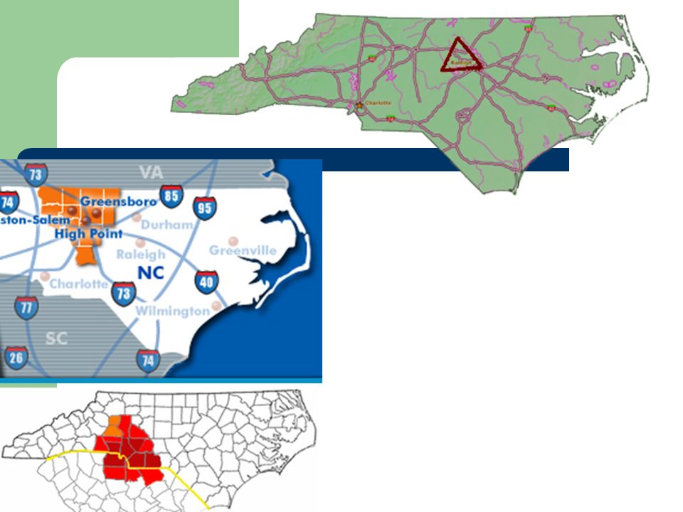
Where is the Piedmont?

3
The Piedmont Piedmont means “ the foot of the mountain”. In North Carolina this region stretches across nearly 300 miles of gently rolling land that runs from the Coastal Plain to the Mountains there are some areas of low mountains most notably the Uwharrie Mountains, the South Mountains and the Brushy mountains. Several Rivers drain the Piedmont, including the Lower Catawba River, Yadkin River, Cape Fear River, and Neuse River. The Eastern border of the Piedmont is determined by the Fall Line, the place where the Piedmont land drops to the lower land of the Coastal Plain. The fall line is easiest to see along a river or a stream because you will often see a small waterfall or large rocks in the water.

4
Landscape

5
Piedmont People and Economy
By the 16th century the Catawba Indians dominated the Piedmont. Europeans began settling in the region during the 1700s. The majority came from Pennsylvania and other northern colonies and reached the Piedmont along a trail call the Great Wagon Road. Piedmont rivers were to rocky to use for transportation and the area had few roads. Because there weren’t good ways to transport crops most settlers in the Piedmont had small farms for which they grew their own food. However, by the late 1700’s more people lived in the Piedmont than any other region in the state. Eventually this prompted law makers to move the capital to the Piedmont after the Revolutionary War.

7
Piedmont People and Economy Continued
After the Civil War, the Piedmont began to industrialize. Rivers and streams that were too shallow and rocky for boats proved ideal for water powered industry. Dams along the Piedmont’s rivers became a major source of hydroelectric power. The coming of the railroad solved the transportation problem. Textile, furniture, and tobacco factories grew up through the region. Today, the Piedmont is North Carolina’s most urbanized ad industrialized region. It is also the wealthiest. The state's largest cities are located in the Piedmont. The cities of the Triangle (Raleigh, Durham, Chapel Hill), the Triad (Greensboro, High Point, Winston Salem) and the Metrolina area around Charlotte are known as the Urban Crescent. The traditional industries of textiles, furniture, and tobacco have been joined by banking, trucking, pharmaceuticals, biotechnology, computer software and other industries.
, the Triad (Greensboro, High Point, Winston Salem) and the Metrolina area around Charlotte are known as the Urban Crescent. The traditional industries of textiles, furniture, and tobacco have been joined by banking, trucking, pharmaceuticals, biotechnology, computer software and other industries.")
9
Cotton Mills And The Piedmont

10
The Urban Life Of The Piedmont

12
A lot of Higher Education
North Carolina State University Duke University UNC-Chapel Hill UNC-Greensboro Wake Forest Elon University North Carolina A&T North Carolina Central Guildford College Wingate UNC-Charlotte Davidson College Winston Salem State Meredith College Peace College Louisburg College Shaw University

13
Museums and other sites

14
Cities in the Piedmont

Similar presentations


 on notebook paper.>")


>")


