Download presentation
Presentation is loading. Please wait.

1
Human Geography of Canada

2
CANADIAN HISTORY TIMELINE
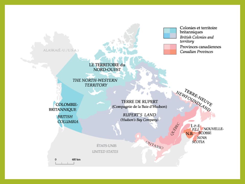
British split Canada into 2 provinces: Upper Canada-Protestant English (Ontario) and Lower Canada –Catholic French (Quebec) With control of Rupert’s Land, Canada went from Atlantic to Pacific France & England claimed parts of Canada Canada independent from Britain Leif Erikson discovered Newfoundland 1763 1791 1867 1871 1885 1931 1000 1497 16th-17th Centuries France surrenders territory to British after French & Indian War Cabot claimed Newfoundland for England British No. America Act –Dominion of Canada creating confederation of Ontario, Quebec, & 2 colonies-Nova Scotia & New Brunswick Canadian transcontinental railway completed
 and Lower Canada –Catholic French (Quebec) With control of Rupert’s Land, Canada went from Atlantic to Pacific. France & England claimed parts of Canada. Canada independent from Britain. Leif Erikson discovered Newfoundland th-17th. Centuries. France surrenders territory to British after French & Indian War. Cabot claimed Newfoundland for England. British No. America Act –Dominion of Canada creating confederation of Ontario, Quebec, & 2 colonies-Nova Scotia & New Brunswick. Canadian transcontinental railway completed.")
3
Migration in Canada Quebec (French colony) was indifferent to the American Revolution so many loyalists moved into Canada and set up the English territories of Nova Scotia and New Brunswick Canada expanded westward differently because the lands were already in British or French hands, so there was no need to move in or use Manifest Destiny to justify migration Canada’s population is primarily on both coasts and around the Great Lakes
 was indifferent to the American Revolution so many loyalists moved into Canada and set up the English territories of Nova Scotia and New Brunswick. Canada expanded westward differently because the lands were already in British or French hands, so there was no need to move in or use Manifest Destiny to justify migration. Canada’s population is primarily on both coasts and around the Great Lakes.")
4
Current Canadian Population Density

5
Quebec Conflict French settlers remained in Canada despite British taking control after winning the French & Indian War French settlers were Roman Catholic and serious ethnic disputes arose between them and the Protestant English settlers British government passed the British North America Act creating the Dominion of Canada which was a confederation (political union) of Ontario (Upper Canada) & Quebec (Lower Canada)
 of Ontario (Upper Canada) & Quebec (Lower Canada)")
7
Separatism in Canada French Canada (Quebec area) has always wanted to be separate from English Canada, at least culturally Quebec speaks French and the people are primarily Roman Catholic compared to the rest of Canada that speaks English and is primarily Protestant Canada has created two official languages

9
Multicultural Multiculturalism: Effort to promote and embrace diversity Both British and French people live in Canada In the late 1800s immigrants from other parts of Europe came to live in Canada’s vast open lands

10
Parliamentary Government
System in which legislative and executive functions are combined in a legislature called parliament Central federal government with smaller provincial and territorial governments Parliament: Appointed Senate and elected House of Commons Majority party’s leader in Parliament becomes Prime Minister

11
First Nations Canada’s Native American peoples

12
Economic Activities in Canada
Primary Industries: Farming in south central Canada, logging, mining (uranium, zinc, gold, silver), fishing along ocean coastlines, newsprint, oil (along U.S. border) Secondary Activities (Manufacturing Sector): 13% of Canadians have mfg jobs; accounts for 1/8 of the GDP. Automobiles, steel, household appliances, electronics, high-tech equipment, mining equipment. Mfg has small clusters in southwest & south central Canada but is mainly in the southeast near the St. Lawrence seaway.
, fishing along ocean coastlines, newsprint, oil (along U.S. border) Secondary Activities (Manufacturing Sector): 13% of Canadians have mfg jobs; accounts for 1/8 of the GDP. Automobiles, steel, household appliances, electronics, high-tech equipment, mining equipment. Mfg has small clusters in southwest & south central Canada but is mainly in the southeast near the St. Lawrence seaway.")
13
Economic Activities in Canada
Tertiary Activities (Service Industries): 70% of GDP; employ more Canadians than all other industries combined Finance, utilities, trade, transportation, tourism, communications, insurance, real estate, trade Service industries are found throughout southern Canada
: 70% of GDP; employ more Canadians than all other industries combined. Finance, utilities, trade, transportation, tourism, communications, insurance, real estate, trade. Service industries are found throughout southern Canada.")
14
Canada – Land of Many Cultures
There were diverse cultures from Canada’s earliest settlement when the Inuit and First Nations peoples came after the last Ice Age Then the English and French arrived, and later immigrants from Europe and Asia

15
Languages & Religion Officially Bilingual: English-speaking majority and French-speaking minority First Nation languages still survive Protestant and Roman Catholics are two largest religions with smaller groups of Muslims, Jews, and others

16
Population Settlement affected by the harsh physical environment and lack of transportation routes Port cities of Montreal, Toronto, & Vancouver are most densely settled 80% of Canadians live on 10% of the land along a 100- mile wide strip just north of the U.S. border Becoming more urban: 4/5 of people live in cities 75% of French Canadians live in Quebec; Inuit people live in northern territories

17
Sports and Recreation Skating, ice hockey, fishing, skiing, golf, hunting Canadian football league & professional ice hockey teams are popular Lacrosse was developed by native peoples of Canada Early European settlers in Canada developed ice hockey

19
The Arts Oral traditions of the First Nations
Realistic carvings of the Inuit made from ivory, whalebone, and soapstone Totem poles of First Nations on the West Coast Toronto-based artists called Group of Seven Stratford Festival in Ontario honoring Shakespeare

21
Canadian Subregions Four subregions: Atlantic Provinces, Core Provinces, Prairie Provinces, Pacific Province and Territories 10 total provinces and 3 territories Each has a unique population, economy, and resources Regional Canada map - Color the four subregions found on page 154 of the textbook.

23
Atlantic Provinces Prince Edward Island, New Brunswick, Nova Scotia, Newfoundland, Labrador 8% of Canada’s population and most of these live in coastal cities Rugged terrain and severe weather Logging is largest industry due to dense forests Fishing, mining, shipbuilding Hydroelectric power resources

24
Lunenberg, Nova Scotia Bay of Fundy beach in New Brunswick

25
Core Provinces Quebec and Ontario
Heartland of Canada: 3 out of 5 Canadians live here. Ontario largest population, Quebec largest land area. Most people live along Great Lakes and St. Lawrence River Center of political and economic life Ottawa (in Ontario) is capital of federal government 35% of agriculture, 41% of mining, 70% of manufacturing Toronto is banking and financial center Montreal is Canada’s 2nd largest city & center of life in Quebec
 is capital of federal government. 35% of agriculture, 41% of mining, 70% of manufacturing. Toronto is banking and financial center. Montreal is Canada’s 2nd largest city & center of life in Quebec.")
26
Chateau Frontenac Castle in Quebec

27
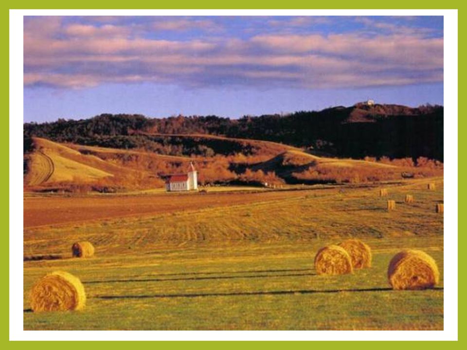
Prairie Provinces Manitoba, Saskatchewan, Alberta
Part of North America’s Great Plains – center of agriculture (50% of agriculture in Canada) Many minerals also; large coal, oil & natural gas deposits in Alberta Manitoba: Scots-Irish, Germans, Scandinavians, Ukrainians, Poles Saskatchewan: Asia and the Metis people Alberta: Europeans, Indian, Japanese, Lebanese, Vietnamese
 Many minerals also; large coal, oil & natural gas deposits in Alberta. Manitoba: Scots-Irish, Germans, Scandinavians, Ukrainians, Poles. Saskatchewan: Asia and the Metis people. Alberta: Europeans, Indian, Japanese, Lebanese, Vietnamese.")
29
Pacific Province British Columbia
Westernmost province, almost all in Rocky Mountain range ¾ is 3000 feet above sea level; ½ dense forests; 1/3 frozen tundra, snowfields, glaciers Victoria and Vancouver are largest cities in SW Logging, mining, hydroelectric power, largest port in Canada so lots of shipping

30
Emerald Lake, British Columbia

31
Northern Territories Yukon, Northwest, and Nunavut Territories
41% of the land mass of Canada, sparsely populated Yukon: North of British Columbia; 35,000 people Northwest Territories: East of Yukon, extends to the Arctic; population 43,000 Nunavut: Formed from eastern Northwest Territories in 1999; home to many Inuit people Mining, fishing, logging – widely scattered

32
Northern Lights, Northwest Territories

33
Nunavut, Inuit, Metis Nunavut was formed in 1999 to settle the land claims of the Inuit (formerly called Eskimo) peoples and give them a protected homeland Nunavut means “our land” Metis are people of mixed French and native heritage
 peoples and give them a protected homeland. Nunavut means our land Metis are people of mixed French and native heritage.")
34
Metis symbol and celebrities

Similar presentations