Download presentation
Presentation is loading. Please wait.

1
North Africa, Southwest Asia, and Central Asia Physical Geography Mr. Marston Dominion Christian High School Fall 2009

2
Chapter Objectives 1. Major landforms and natural resources 2. Climate and Vegetation

3
Maghreb and the Middle East Persia Gulf Gulf of Aden Arabian Sea Red Sea

4
Divisions 1. Maghreb: area of North Africa between the Atlas Mountains and the Mediterranean Sea. Maghreb means “western” in Arabic. The Countries have similar a.Climates b.Landforms c.Populations d.Economies e.history

5
Maghreb Union The joining together of the North African countries in 1989. To: Promote economic cooperation Economic integration Morocco Algeria Tunisia Libya Mauritania

6
Central Asia

7
Divisions II 2. Middle East a.Arabian Peninsula b.Iran and Turkey 3. Central Asia

8
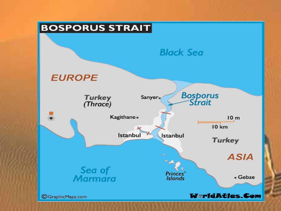
Key Geographic Points Bosporus Strait: separates Asia and Europe Dead Sea: forms Israeli-Jordanian border Caspian Sea: largest inland body of water on earth Aral Sea: once the 4 th largest inland sea, it is now drying up.

9
Bosporus Strait: separates Europe from Asia

11
Dead Sea: 1400 feet below sea level

12
Location of Dead Sea

13
Floating in the Dead Sea: Aaaaahhh. High Salt content contributes to buoyancy.

14
Caspian Sea: largest lake on earth. Oil and gas and sturgeon.

15
The shrinking Aral Sea

16
Aral Sea Shrinkage Shrinkage

17
Rivers

18
Nile River: Egypt. World’s longest river.

19
Nile River Delta

20
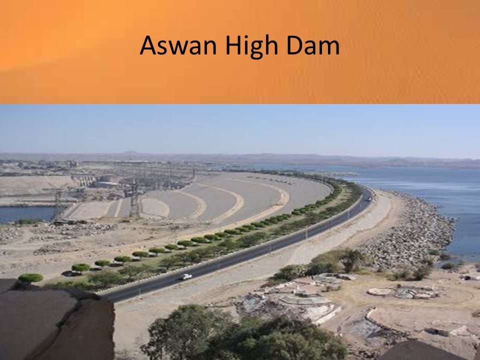
90% of Egypt’s people live in Nile River Delta They live on 3% of Egypt’s land Aswan High Dam a.Controls river flow b.Reduces flooding c.Alluvial soil: rich soil made up of sand and mud deposited by moving water.

21
Aswan High Dam

23
Mesopotamia: “The land between two rivers” Tigris and Euphrates Rivers in Iraq The two rivers join to form the Shatt al Arab, which empties into the Persian Gulf

24
Shatt al Arab

25
Wadis Wadis: streambeds that remain dry until a heavy rain and often become dangerous after a heavy rain.

26
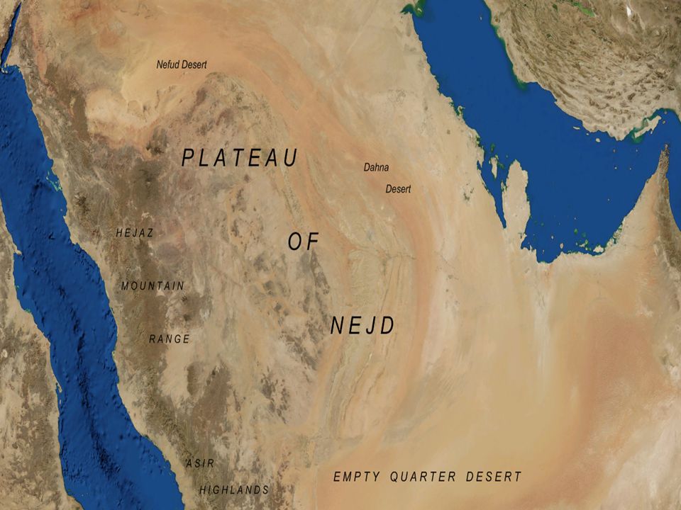
Plains, Plateaus, and Mountains Coastal plains: fertile plains along the Mediterranean Sea (Moroccan and Algerian coasts and along the Caspian Sea and Persian Gulf) Highlands: Atlas Mountains: 50% of Moroccan people engage in agriculture and produce, barley, oats, and wheat) Hejaz: mountain range on western coast of Arabian Peninsula Asir: area more agriculturally productive on Arabian peninsula because it gets more rainfall than the Hejaz
 Highlands: Atlas Mountains: 50% of Moroccan people engage in agriculture and produce, barley, oats, and wheat) Hejaz: mountain range on western coast of Arabian Peninsula Asir: area more agriculturally productive on Arabian peninsula because it gets more rainfall than the Hejaz")
28
Other mountain ranges Pontic (Turkey Taurus (Turkey) Caucasus Zagros: southern Iran
 Caucasus Zagros: southern Iran")
29
Caucasus Mountains

30
Russian Caucasus

31
Lowlands Kums: dune covered deserts of Turkmenistan and Uzbekistan. Garagum (black sand) Qizilqum (red sand)
 Qizilqum (red sand).")
33
Earthquakes African, Arabian, and Eurasian plates come together in the region. As they clash: a.Build mountains b.Shift landmasses c.Cause earthquakes Turkey: experiences regular earthquakes

34
Natural Resources Petroleum: 70% of world’s oil reserves Natural Gas: 33% of natural gas Other: Sulfate: (Paperboard, glass, detergents) Phosphates: used in fertilizers Chromium, gold, lead, manganese, and zinc Iron ore
 Phosphates: used in fertilizers Chromium, gold, lead, manganese, and zinc Iron ore")
35
Potential for diversification UAE: banking, information technology, and tourism. Libya: invested in infrastructure, agriculture, and fisheries.

36
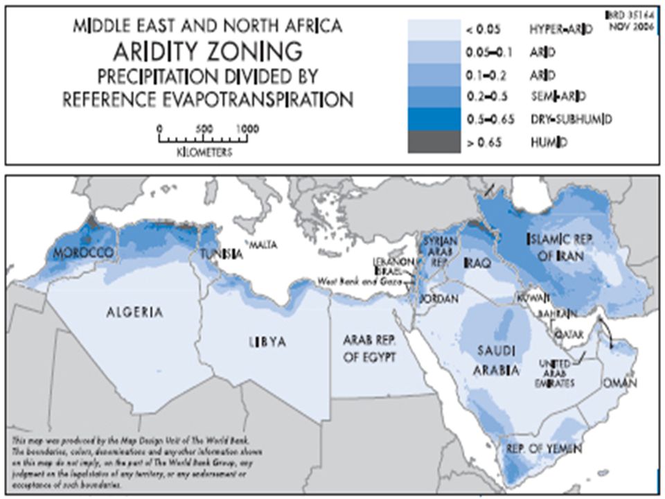
Climate and Vegetation Water scarcity defines the region’s climates Climates: Desert: predominates Steppe Mediterranean Highland

39
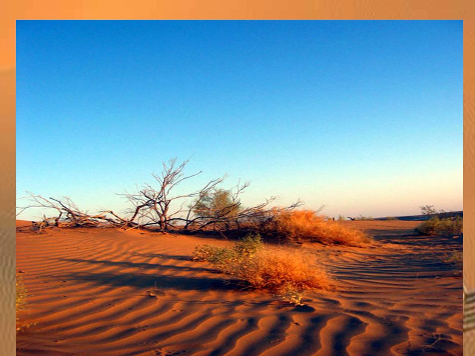
Sahara Largest desert in the world 3.5 million square miles Desert: average less than 10 inches of rain per year Sand covers less than 10% of the Sahara (barren rock, mountains, and desert pavement cover the most) Desert encompasses about 50% of the lands in North Africa, Southwest Asia, an Central Asia.
 Desert encompasses about 50% of the lands in North Africa, Southwest Asia, an Central Asia.")
40
Sahara

41
Sahara Desert

42
Weather Patterns in the Desert Central Asia/northern Sahara: cold winters with freezing temperatures Southern Sahara/Arabia: winters are milder Summers are long and hot. Ergs: Sand dune covered areas Regs: stony plains covered with rocky gravel called “desert pavement” Hamada: flat, sandstone plateau

43
Rub al Khali “Empty Quarter” Located on the Arabian Peninsula Some vegetation grows: cacti and drought resistant shrubs.

44
“Empty Quarter”

45
Oasis: a place where water can be found in a desert

46
Steppe Climate Second largest climate in the region of North Africa, Central Asia, and Southwest Asia Steppe borders the Sahara to the north and runs from Turkey to eastern Kazakhstan Precipitation averages less than 14 inches per year.

47
Steppes

48
Steppes in Kazakhstan

49
Pastoralism: the raising and grazing of livestock is a way of life for people in the steppes. Bedouin Pastoralists

50
Climatic Variations Mediterranean Climate zones: Cool, rainy winters alternate with hot, dry summers. Ideal for tourism Export citrus fruits, olives and grapes to Europe and North America

51
Rainfall Coastal and highland areas near mountain ranges receive the most rainfall as moist, warm air is driven off the sea by prevailing westerly winds Ex: North African coast Elburz Mountains in Georgia Cereals (food grains such as barley, oats and wheat) can be grown without irrigation if area gets more than 14 inches of rain per year.
 can be grown without irrigation if area gets more than 14 inches of rain per year.")
52
Desertification Grassy plains turn into desert, especially where small shrubs and trees are used for firewood.

53
desertification over time in Libya

54
Highland Climate Caucasus Mountains Wetter and colder than other climates in the region

Similar presentations