Download presentation
Presentation is loading. Please wait.

1
Development of GNSS Applications for Space Weather Monitoring in Indonesia
Budan Muslim1) , Joni Effendi2) , Farid 3) and Toni Harun3) 1)Observation Technology Division, Space Science Center National Institute of Aeronautics and Space Jl.Dr. Junjunan 133 Bandung Indonesia National Coordinating Agency for Surveys And Mapping Jl. Jakarat-Bogor KM 46 Cibinong National Land Agency Jl Kuningan Barat No. 1 Jakarta Selatan ASIA GEOSPATIAL FORUM , Jakarta, Oktober 2011
 , Joni Effendi2) , Farid 3) and Toni Harun3) 1)Observation Technology Division, Space Science Center. National Institute of Aeronautics and Space. Jl.Dr. Junjunan 133 Bandung Indonesia. National Coordinating Agency for Surveys And Mapping. Jl. Jakarat-Bogor KM 46 Cibinong. National Land Agency. Jl Kuningan Barat No. 1 Jakarta Selatan. ASIA GEOSPATIAL FORUM , Jakarta, Oktober")
2
OUTLINE Space weather Space Weather Effect on GNSS
Space weather monitoring by using GNSS Methodology Status of GNSS Applications for Space Weather Monitoring The Future Plan of Space weather monitoring using GNSS

3
Earth weather and space weather

4
SPACE WEATHER

5
2. Space Weather Effect on GNSS

6
Ionospheric Delay (regular error) and Irreqularity (disturbance error)
 and Irreqularity (disturbance error)")
8
3. Space weather monitoring by using GNSS

9
4. Methodology Code and phase data extracting from GPS RINEX
GPS code data combination GPS phase data combination TEC Computation

10
5. Status GNSS Applications for space weather monitoring in Indonesia
1. Near real time IGS (GPS) based TEC monitoring 2. IPGSN-based TEC computation
 based TEC monitoring 2. IPGSN-based TEC computation")
11
Near Real Time Ionospheric Monitoring Over Indonesia Using IGS GPS data
Buldan, 2011, in progress

12
Latest development of IPGSN-Based TEC Observations
Buldan et.al., 2011

13
Diagram Block of TEC computation System
BAKOSURTANAL Real Time IPGSN Data Raw GPS format GPS data extracter and combiner (automatic) bako2300P1P2.11c TEC calculator and data server (manual) Bako t (LAPTOP) Data management (automatic) bako o bako232a.11o LAN Internet LAPAN
 bako2300P1P2.11c. TEC calculator and data server (manual) Bako t. (LAPTOP) Data management. (automatic) bako o. bako232a.11o. LAN. Internet. LAPAN.")
14
TEC data

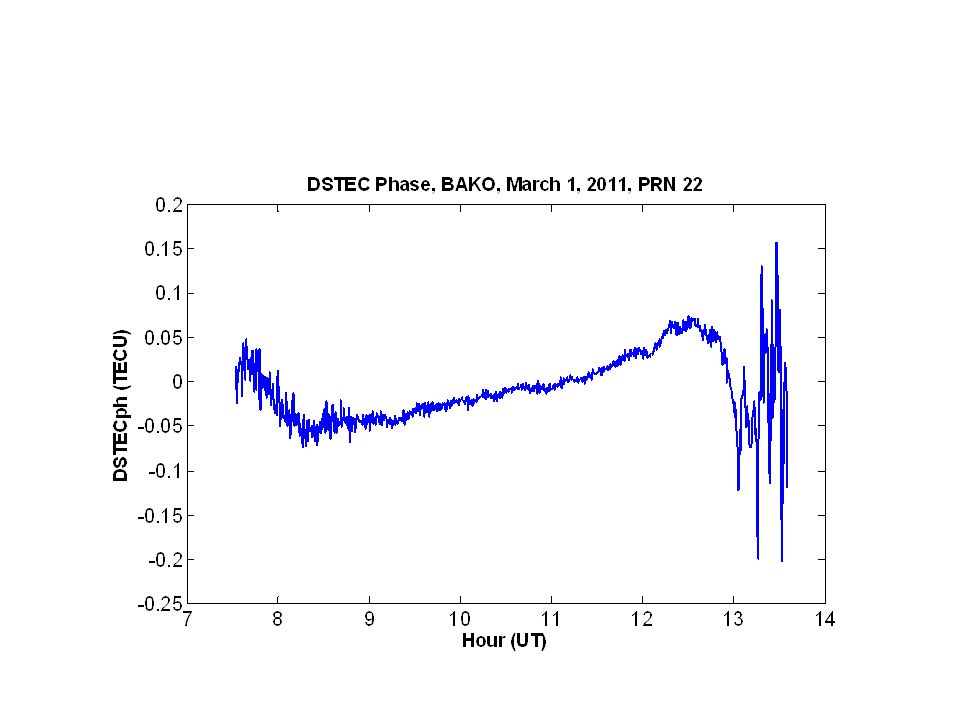
16
Application of GPS TEC: GPS Phase Scintillation Index: Igps

17
Igps phase scintillation index and FAI
Buldan et. al., 2011

18
Future Plans of Space Weather Monitoring using GNSS in Indonesi
GPS stations network in Indonesia Plans of Space Weather monitoring

19
GNSS observation network in Indonesia
Institutions have established GPS observation nework LAPAN (3 station) BPN ( CORS: 31) BAKOSURTANAL (IPGSN : 70) LIPI (SUGAR: 25 ) ITB (CORS: itb1) UGM (CORS: gmu1) ITS (CORS: itss) 132 GPS receiver 18 GPS reciever: real time
 BPN ( CORS: 31) BAKOSURTANAL (IPGSN : 70) LIPI (SUGAR: 25 ) ITB (CORS: itb1) UGM (CORS: gmu1) ITS (CORS: itss) 132 GPS receiver. 18 GPS reciever: real time.")
20
PLANS: DEVELOPMENT OF SPACE WEATHER MONITORING USING GNSS IN INDONESIA
Activity 2011 2012 2013 2014 LAPAN AND BAKOSURTANAL SPACE WEATHER MONITORING NETWORK 18 GPS receiver BIG 30 47 R E A L T I M E D A T A LAPAN and BPN SPACE WEATHER MONITORING NETWORK 33 GPS receiver BPN NATIONAL SPACE WEATHER MONITORING NETWORK 100 (LAPAN) BAKOSURTANAL ITB, UGM, ITS
 BAKOSURTANAL. ITB, UGM, ITS.")
21
Needs: Increase data storage capacity
Upgrade the data communication and networking insfrastructure Humans resources development: acquisition, data processing and maintaining, networking and dissemination Enhance the synergy among research and education institutions LAPAN-BIG-BPN-ITB-ITS-UGM

22
Conclusions Mitigation of Space Weather Effect in Indonesia for GNSS application is requiring real time and continous GNSS stations Development of GNSS applications for space weather monitoring in Indonesia is ongoing research on space observation technology uisng GNSS Status of GNSS applications for space weather monitoring using GNSS are including ionospheric TEC and scintillation estimation from IPGSN, ionospheric mapping using IGS. Future plans of GNSS applications for space weather monitoring using GNSS are including the use of BPN CORS network and Univerities CORS network to provide the real time ionospheric conditions over Indoensia The GNSS applications for space weather monitoring are requiring the synergy among research and education institutions, human resources development, and insfrastructure development.

23
Thank you for your attention

Similar presentations


>")


