Download presentation
Presentation is loading. Please wait.

1
Ms. Bindrim

2
A Satellite View

3
Africa’s Size # Second largest continent # 10% of the world’s population

4
Bodies Of Water Nile R. Congo R. Niger R. Mediterranean Sea Atlantic Ocean Red Sea Lake Victoria

5
The Congo River Basin # Covers 12% of continent # Crosses over 9 countries

6
Congo Rain Forest high temps year- round Yearly rainfall ~50- 60 in. Chimps, gorillas, hippos, and parrots live here

7
African Rain Forest # Annual rainfall up to 17 ft # Covers 37 countries # 15% of the land surface of Africa # Central Africa covered by the Congo Rain Forest

8
The Niger River Basin # Covers 7.5% of the continent # Extends over 10 countries

9
Hydroelectric Power

10
Deserts Sahara Desert Sahel Kalahari Desert

12
Desertification Spreading of the desert Causes: drought, or lack of rain Without plants growing, soil blows away leaving a dry, barren landscape Effect: widespread hunger in many African countries

13
The Sahel: The “Shore” of the desert A semiarid region south of the Sahara high temperatures, but more rainfall than desert Part of the Niger River Basin

14
The African Savanna: 13 million sq. mi. Found in both semiarid and tropical areas Flat grasslands with scattered trees and shrubs Animals like lions, elephants, giraffes, and zebras live here Has 2 brief dry seasons each year

16
Valleys & Plains Great Rift Valley Savanna Plains

17
Great Rift Valley Formed by 2 divergent plates Been pulling apart for 50 million years East Africa may become an island Fun Fact: Madagascar was created by divergent tectonic plates

19
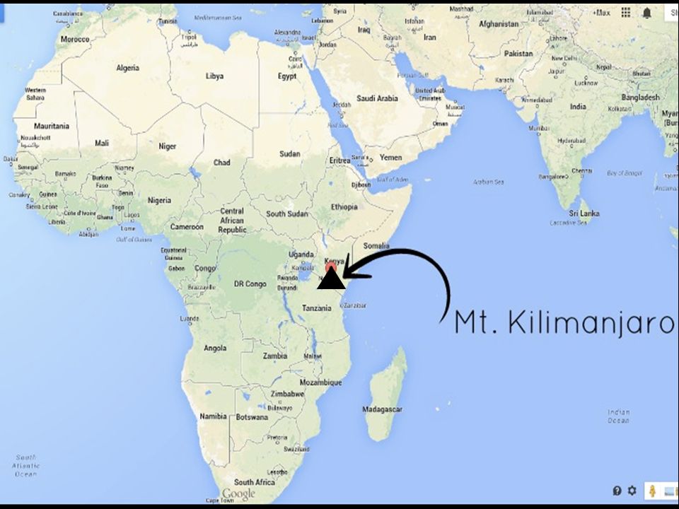
Mt. Kilimanjaro: Snow on the Equator! Name from the Swahili phrase “kilima njaro” meaning “shining mountain” The sun reflection on snow makes it appear to be shining Peak has snow all year

21
Africa: The “Tropical” Continent Tropic of Cancer 20° N Tropic of Capricorn 20° S Equator 0°

22
Vegetation Zones

23
Plateaus of Africa Southern Africa is covered in plateaus African plateau rises from coastal plains Steep cliffs line Southern and Eastern coasts

24
The Complete Topography Of AFRICA Nile River Congo River Zambezi River Niger River Orange River Limpopo River Mediterranean Sea Atlantic Ocean Pacific Ocean Indian Ocean Red Sea L. Victoria L. Albert--> L. Chad--> L. Tanganyika-> <--Gulf of Aden Drajensburg Mts. Ruwenzori Mts. Δ Mt. Kenya Δ Mt. Kilimanjaro Sahara Desert Sahel Kalahari Desert Namib Desert Libyan Desert Great Rift Valley Atlas Mts. Tropic of Cancer 20° N Tropic of Capricorn 20° S Equator 0°

Similar presentations


>")


