Download presentation
Presentation is loading. Please wait.

1
Public Land Survey Creating a Pattern on the surface of the earth in the Old Northwest Territories through a new surveying Process with a positive impact on the Government and Settlers Survey marker in Bellingham off Broadway Ave.

2
LAND ORDINANCE OF 1785 (related to the Northwest Ordinance) Following the end of the Revolution the new US faced a dilemma, the Northwest Territories
 Following the end of the Revolution the new US faced a dilemma, the Northwest Territories")
3
In part provided by British as attempt to destabilize the new nation local State disputes over ownership former British ally tribes in the area

7
A. Contributing factors for land ordinance and Public Land Survey System 1. Competition for control of continent -occupy (possession is 9/10ths of the law) 2. Need to raise funds through disposal of asset -Land main one -Under Articles of Confederation Congress couldn't raise taxes 3. Establish title -- based on ideology -- life, liberty, & (land) 4. Want to do this cheaply, easily and quickly
 2. Need to raise funds through disposal of asset -Land main one -Under Articles of Confederation Congress couldn t raise taxes 3. Establish title -- based on ideology -- life, liberty, & (land) 4. Want to do this cheaply, easily and quickly.")
8
B. European British Precedent -All land belongs to Crown -Title granted to individuals or Charter Companies C. New United States -Land belongs to people

9
D. Outcome -- Developed new method of surveying -- U.S. Public Land Survey First all land west of Appalachians and North of Ohio River given to US Government for eventual sale: 1. Policy of fixed price -price eventually lowered to increase sales 2. Sale of land to raise money, pay-off Revolutionary War debt 3. Creation of clear title -extinguish native claims -provide prior land survey -- generally followed 4. Old systems Abandoned -- Metes and Bounds (British system) -- Long Lots (French system)
 -- Long Lots (French system).")
10
Metes and Bounds – somewhat arbitrary survey system

11
Long Lots (French system)
")
12
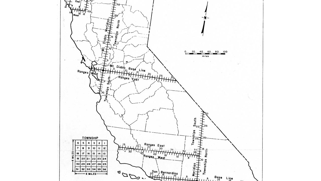
E. How the Public Land Survey System worked 1.In each state create a grid system anchored by: E-W Base Line N-S Principle Meridian Line From each Base Line count up or down (N or S) and call these Townships 2.From each Principal Meridian Line court left or right (E or W) and call these Range 3.Where any two intersect create a box which is further divided in 36 smaller squares each called a Section 4.These sections were then divided into 1/4th to produce a 160 acre farm (theoretically the ideal size for a "yeoman" or free farmer -- not a slave owner). 5.Basically a giant checkerboard
 and call these Townships 2.From each Principal Meridian Line court left or right (E or W) and call these Range 3.Where any two intersect create a box which is further divided in 36 smaller squares each called a Section 4.These sections were then divided into 1/4th to produce a 160 acre farm (theoretically the ideal size for a yeoman or free farmer -- not a slave owner). 5.Basically a giant checkerboard.")
Similar presentations


 Chapter 7 (sort of)>")


