Download presentation
Presentation is loading. Please wait.

1
I. Geography of Northern Africa Handout 3-2

2
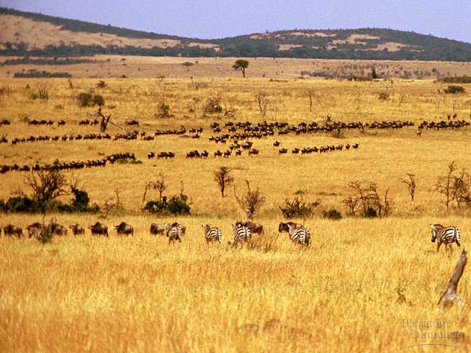
A.Vocabulary 1. Savanna-___________________________________ 2. Delta-______________________________________ ____________________________________________ 3. Cataract-___________________________________ ____________________________________________ A grassy plain

4
A.Vocabulary 1. Savanna-___________________________________ 2. Delta-______________________________________ ____________________________________________ 3. Cataract-___________________________________ ____________________________________________ A grassy plain low land formed at the mouth of some rivers by the silt the river drops there; often in shape of a triangle

6
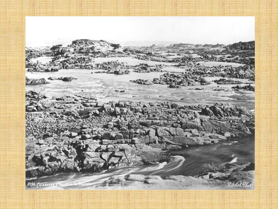
A.Vocabulary 1. Savanna-___________________________________ 2. Delta-______________________________________ ____________________________________________ 3. Cataract-___________________________________ ____________________________________________ A grassy plain low land formed at the mouth of some rivers by the silt the river drops there; often in shape of a triangle Waterfall or a spot where water runs fast over rocks

11
1. What does “ Paleolithic period ” mean? Old Stone Age From the beginning of the use of stone tools to the development of agriculture App. 2.5 million y.a. to 12,000 y.a.

12
2. Explain how the Sahara turned from savanna to desert. About 5,000 BC, the climate began to change, getting warmer. Sahara slowly dried up and the grasses began to die.

15
3. Complete the following statements about the Nile River by filling in the blanks. a. The Nile is the world ’ s ________________ river. longest

16
b. It flows ____________ __ more than ____________ _ miles. northward 4,000

17
c. Its main source is at ___________ __ in central Africa. Lake Victoria

18
d. The Nile River flows into the ____________ _ Sea. Mediterranean

19
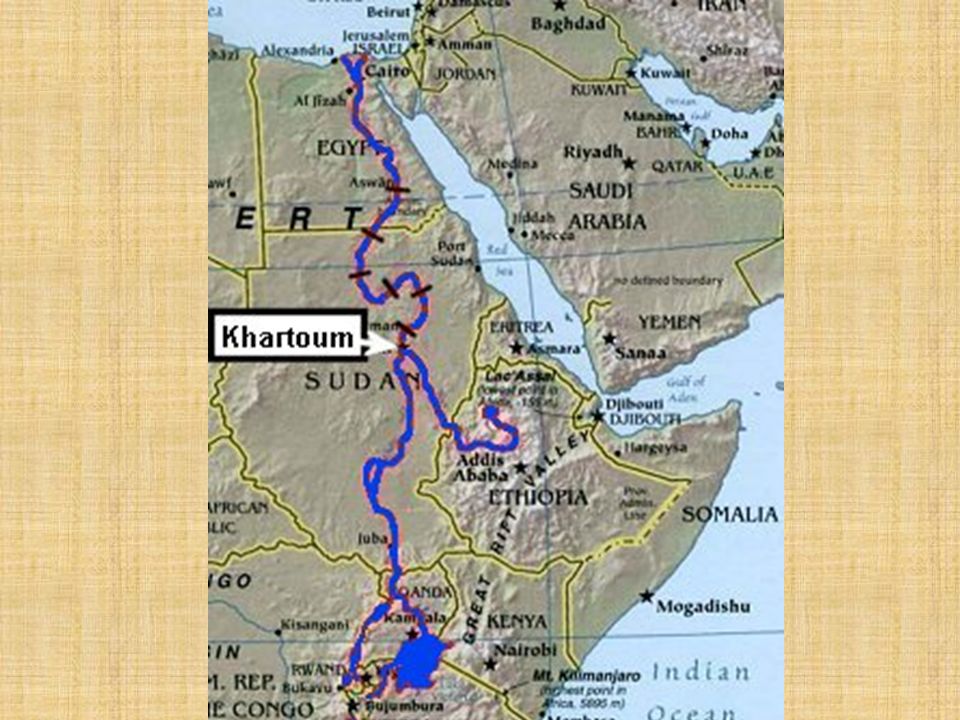
e. From the map on page 132, what are the two branches of the Nile River? Blue Nile

20
Khartoum, Sudan Blue Nile Lake Tana White Nile Lake Victoria

21
“Iteru”

22
4. What kinds of stone make up the cliffs near the Nile in Upper Egypt? LimestoneSandstone

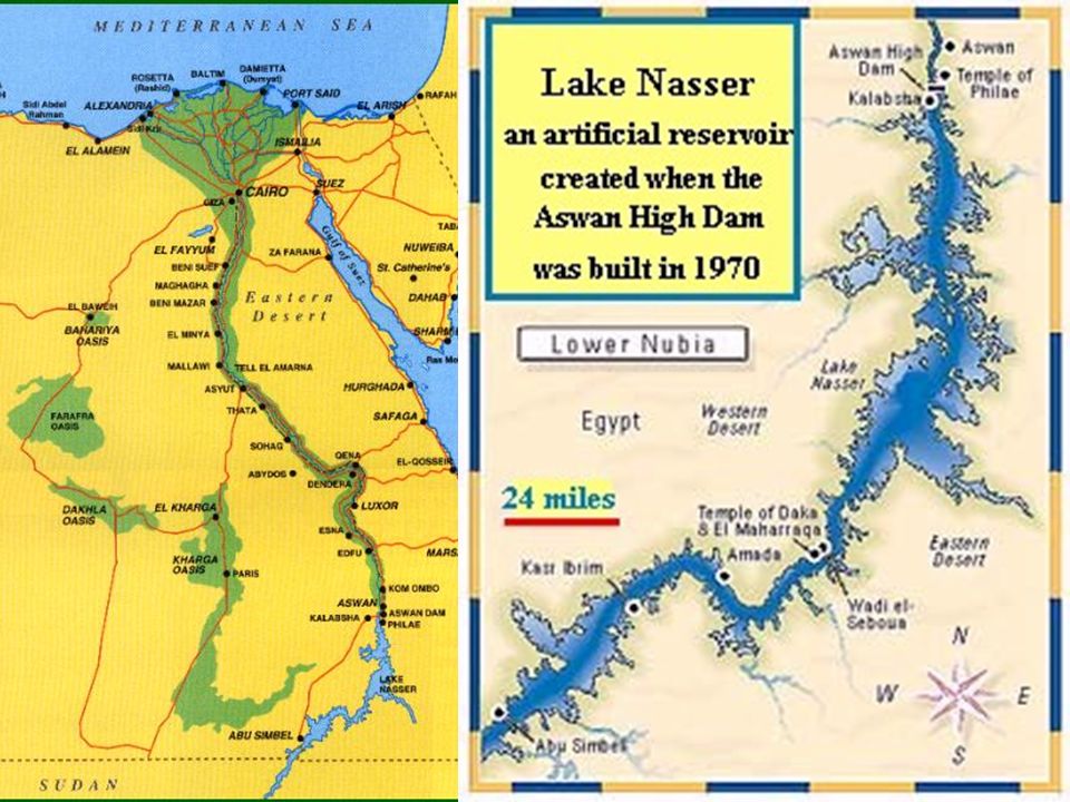
23
5. How did this affect the channel of the Nile and why? The river has cut a deep channel through the soft rock. Soft rock is much more easily eroded than harder rock.

24
6. What kind of stone makes up the cliffs in Nubia to the south? Granite

25
7. How did this affect the channel of the Nile and why? The river runs over the harder granite and erodes it much more slowly. We call these cataracts.

26
1. Explain how the soil in Egypt became so fertile. The river carries silt eroded from the riverbed. When the river flooded, then receded, it left mineral rich silt behind on the floodplain.

27
Farming Along the Nile

28
2. What did the Egyptians call their home and what did it mean? KemetBlack Land

29
3. According to Egyptian beliefs, who caused the yearly flood? The Nile god, Hapi

30
4. What event brought an end to the yearly flood of the Nile? In 1972, the Aswan High Dam was built to control flooding.

33
5. How do Egyptians today keep their land suitable for farming? They use mechanical irrigation and canals.

34
Aswan High Dam

35
6. What did the Egyptians call the Sahara and what did it mean? Deshuret

36
1. How did most farmers get and pay for their farmland? Rented land from large landowners and paid part of their crop in rent.

37
2. Give five examples of crops the Egyptians grew. Wheat Barley OnionsLettuceBeans

39
3. Name four animals Egyptians raised for food. cattle goats shee p pigs

40
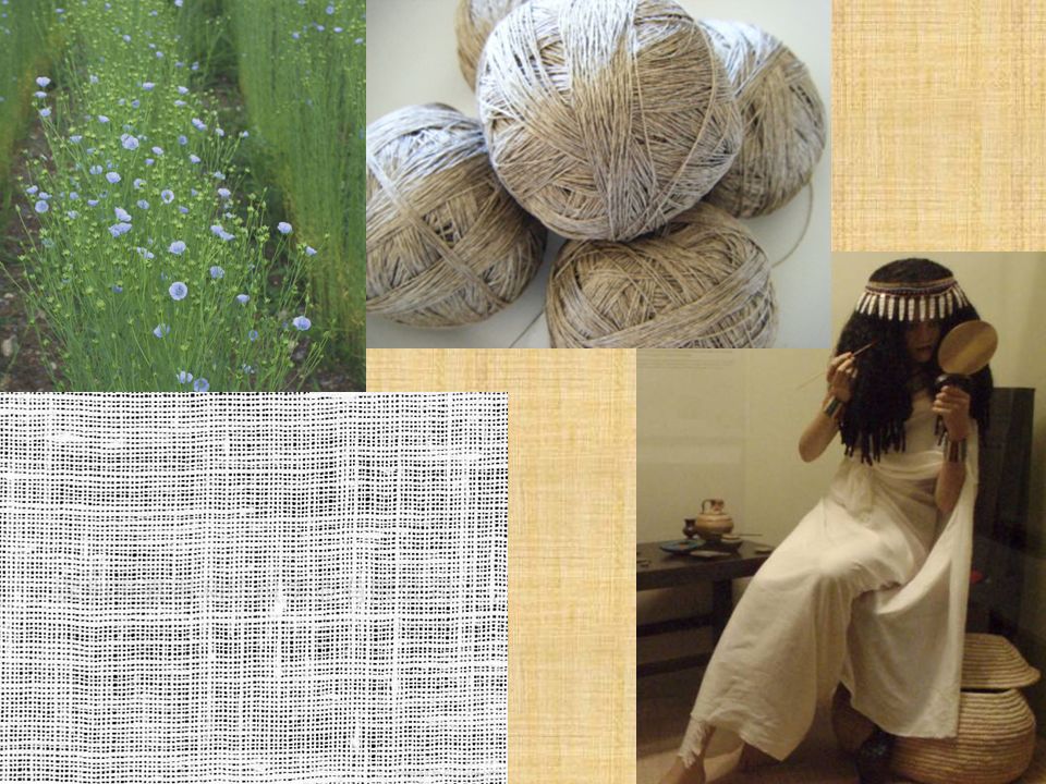
4. Out of what materials did Egyptians make clothing? Linen and wool

42
Where the Blue and White Nile Meet The Fertile Land of Egypt

43
E. Egypt was isolated by natural barriers 1. South-__________________ ________________________ 2. West-__________________ _______________________ 3. East-___________________ _______________________ 4. North-_________________ 6 cataracts of the Nile, mountains

44
E. Egypt was isolated by natural barriers 1. South-__________________ ________________________ 2. West-__________________ _______________________ 3. East-___________________ _______________________ 4. North-_________________ 6 cataracts of the Nile, mountains Western Desert (Sahara)
.")
45
E. Egypt was isolated by natural barriers 1. South-__________________ ________________________ 2. West-__________________ _______________________ 3. East-___________________ _______________________ 4. North-_________________ 6 cataracts of the Nile, mountains Western Desert (Sahara) Red Sea Sinai Peninsula Eastern Desert (Sahara)
 Red Sea Sinai Peninsula Eastern Desert (Sahara).")
46
E. Egypt was isolated by natural barriers 1. South-__________________ ________________________ 2. West-__________________ _______________________ 3. East-___________________ _______________________ 4. North-_________________ __________________ 6 cataracts of the Nile, mountains Western Desert (Sahara) Red Sea Sinai Peninsula Eastern Desert (Sahara) Mediterranean Sea
 Red Sea Sinai Peninsula Eastern Desert (Sahara) Mediterranean Sea.")
47
The US spent app. $663,800,000,000 on defense in 2010. That is equal to approximately $1,262,880 per minute.

Similar presentations


>")


