Download presentation
Presentation is loading. Please wait.

1
C.J. Cox Instructor

3
GEOGRAPHY Geo = earth graphy = to scribe, draw, or map

4
F the science of location F an integrated science that uses knowledge from many disciplines F the study of spatial relationships, (context &interconnectedness)
")
5
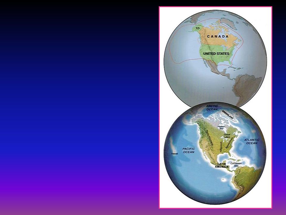
North America South America Asia Australia Africa Europe Antarctica Pacific Ocean Atlantic Ocean Indian Ocean Arctic Ocean

6
Geography and the New Global Order F The New Global Order F The Concept of Region F Geographic Growth F Basics of Geography F Natural Environments of the World F People & World Cultures F World Economic & Political Geography F Urban and Rural Landscapes

7
New Global Order F Old Classifications –First World u US, Europe, Australia u free market economies –Second World u Eastern Europe u planned and controlled economies –Third World u Africa, South America, underdeveloped poor economies

8
New Global Order F New Classifications –Developed Regions u US, Europe, Australia u countries with diversification of economies –service & technologically based countries –Developing Regions u Africa, South Asia, Middle & South America u countries based primarily on agriculture and basic manufacturing industries

10
Rice Farming in Vietnam

11
Mazirotti Plant in Italy

12
Rich & Poor

13
Globalization F Much of the world’s economic activity is now transnational in scope F accelerating economic, cultural and political interdependenceies across national borders F Globalization underscores virtually all contemporary geographies

14
Geography and the New Global Order F The New Global Order F The Concept of Region F Geographic Growth F Basics of Geography F Natural Environments of the World F People & World Cultures F World Economic & Political Geography F Urban and Rural Landscapes

16
THE CONCEPT OF REGION F Worlds within worlds F Areas with unifying characteristics F Regions may be large or small –continental or local –ie. World regions, countries, local regions F Subregions –regions within regions

17
THE CONCEPT OF REGION F Regions may be –economic –environmental –historical –cultural other ideas?

18
THE CONCEPT OF REGION F Formal Regions - clear definitive regions –ie.city administrative region F Functional Regions - regions that facilitate interaction between regions –positive linkages & conflicts –ie. ethnic regions

19
Geography and the New Global Order F The New Global Order F The Concept of Region F Geographic Growth F Basics of Geography F Natural Environments of the World F People & World Cultures F World Economic & Political Geography F Urban and Rural Landscapes

20
GEOGRAPHIC GROWTH & CHRONOLOGY F Age of World Isolation (to 1500AD) geographic advances lead by Greeks, Romans, Chinese, Arabs F Age of Discovery (1500-1650) F Age of Exploration (1650-1900) F Age of Specialization in geographic research(1900-) –beginnings of Physical, Cultural, Economic Geographies F Age of information (computerization) –information manipulation & integration
 geographic advances lead by Greeks, Romans, Chinese, Arabs F Age of Discovery ( ) F Age of Exploration ( ) F Age of Specialization in geographic research(1900-) –beginnings of Physical, Cultural, Economic Geographies F Age of information (computerization) –information manipulation & integration")
23
Geography and the New Global Order F The New Global Order F The Concept of Region F Geographic Growth F Basics of Geography F Natural Environments of the World F People & World Cultures F World Economic & Political Geography F Urban and Rural Landscapes

24
GEOGRAPHY BASICS F Location F Maps & Globes F Distribution F Diffusion

25
GEOGRAPHY BASICS F Location –where something is F Exact Location –latitude & longitude coordinate system F Relative Location –where something is relative to another location F Place Names

26
Latitude

27
GEOGRAPHIC GRID F Equator - A circle that divides the globe into two equal halves or hemispheres of north and south. Located at 0 ° latitude

28
GEOGRAPHIC GRID F North and South Poles - located at right angles or 90° from the plane of the equator. 90 0

30
Parallels are circular lines used to indicate latitude

32
Meridians are arcs used to indicate longitude

34
Prime Meridian: The meridian, designated as 0° E, W longitude, that passes through the Royal Observatory at Greenwich, England.

35
International Date Line: An arc that follows 180° longitude E,W. When crossing the date line, the calendar is turned forward or backward one day, depending on direction of travel.

38
C.J. Cox Instructor

39
WORLD REGIONAL GEOGRAPHY A New World Order

Similar presentations


 Today’s Agenda: Warm – Up>")


>")


