Download presentation
Presentation is loading. Please wait.

1
South Asia The Physical Geography

2
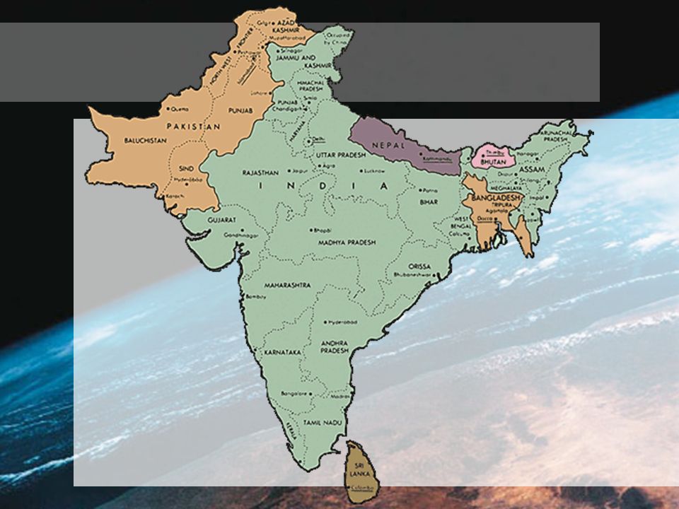
Standard 8.2.1 You should be able to identify the major political features of the region Demonstrate mastery by successfully labeling the following countries on a map:

4
Pakistan Capital: Islamabad

6
India Capital: New Delhi

8
Sri Lanka Capital: Colombo

10
Nepal Capital: Kathmandu

12
Bhutan Capital: Thimphu

14
Bangladesh Capital: Dhaka

15
Check for Understanding On the handout given to you by the teacher, label the countries in the map to follow under the section titled “Standard 8.2.1 Checking for Understanding”

16
2. 1. 3. 4. 5 6.

17
2. India 1. Sri Lanka 3. Bangladesh 4. Nepal 5. Bhutan 6. Pakistan

18
Standard 8.2.2 You should be able to IDENTIFY and LOCATE the major physical features of the region –Mountains (Himalaya, Hindu Kush, Vindya Range, Eastern and Westerh Ghats) –Plains/Plateaus (Indo-Gangetic, Chota Nogpur, Deccan, Karnataka) –Islands (Sri Lanka and Maldives) –Rivers (Indus, Ganges, Brahmaputra)
 –Plains/Plateaus (Indo-Gangetic, Chota Nogpur, Deccan, Karnataka) –Islands (Sri Lanka and Maldives) –Rivers (Indus, Ganges, Brahmaputra)")
19
Let’s Begin Use the section titled “The Land” in your handout to take notes

20
A Separate Land Subcontinent Large, distinct landmass joined to a continent Natural barriers 1/2 the size of the United States

21
Mountains: The Himalaya Plate tectonics Subcontinent collided with Asia - 60 million years ago 1000 miles across northern edge Mt. Everest - world’s highest peak

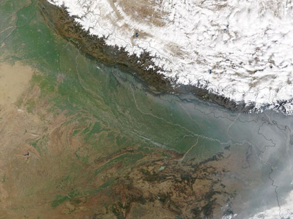
24
As seen from Space Do you remember what a rain shadow is?

26
Mt. Everest

27
29,035 Feet

28
Karakoram Mountains Northernmost part of South Asia Connect with Himalayas

29
Hindu Kush Completes chain in the west Kept India isolated and protected Khyber Pass - only way in for many years

32
Vindhya Range Central India Divides India into Northern and Southern regions Two distinct Indian cultures have emerged

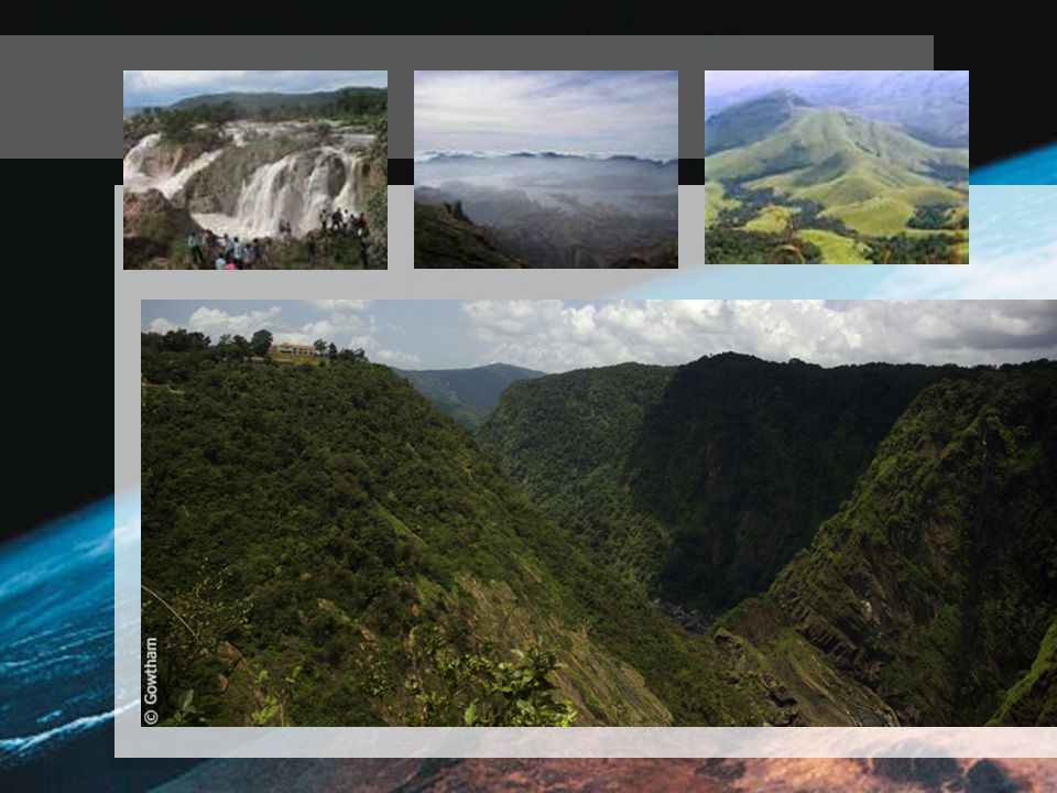
33
Eastern and Western Ghats Triangle of rugged hills Eroded hills

36
Plains and Plateaus Deccan Plateau Once covered in Lava Rich black soil Semi-arid Western Ghats prevent rain from reaching it

38
Karnataka Plateau South of the Deccan Receives more rain Dense rain forest

39
Tha Ganges Plain Indo-Gangetic Plain Holds 1/10th of human population Fertile plain World’s largest alluvial plain Watered by Ganges, Indus and Brahmaputra

41
Chota Nogpur Plateau Northeast India High tableland Forest

42
Sri Lanka Tear Drop shape Broke away from subcontinent

43
Maldives 116 Sq. miles of land area Cover 35,000 miles of ocean Southernmost nation of South Asia

45
Rivers - 3 Major Systems Indus River Mostly in Pakistan Empties into Arabian Sea Important transportation route “Cradle of Ancient India”

48
The Brahmaputra River From Himalaya into India and Bangladesh Joins Ganges at the delta Empties into Bay of Bengal Ships can navigate as far as 800 miles Hydroelectricity - 50% of Bangladesh’s power

50
The Ganges River Most important Summer monsoons cause massive flooding Hindus consider its waters sacred Most densely populated plain

54
Foldable Summary Create a four door foldable (Like the one used for the Climate and Vegetation of Sub Saharan Africa) 1st, create a two door foldable Next, divide each door into two doors Label each door using the following: Mountains, Islands, Rivers, and Plains/Plateaus
 1st, create a two door foldable Next, divide each door into two doors Label each door using the following: Mountains, Islands, Rivers, and Plains/Plateaus")
Similar presentations