Download presentation
Presentation is loading. Please wait.

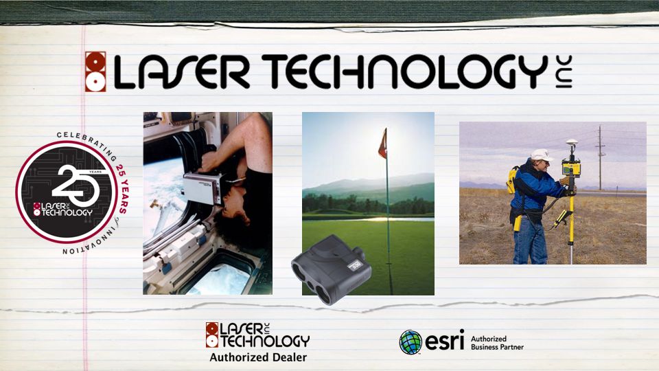
1
Mobile Mapping Using Lasers & Smartphones

2
Laser Technology & GeoSpatial Experts Partnership

3
Leader in Photo-based Data Collection United States Army Corps of Engineers AECOM United States Army Golder Associates United States Marine Corp Raytheon United States Air Force United States Navy National Park Service Georgia Department of Transportation Texas Department of Transportation Minnesota Department of Transportation Florida Department of Transportation State of Alaska State of Louisiana State of Nevada State of Rhode Island State of Tennessee New York State Department of Environmental Conservation Atlanta Regional Commission Rhode Island Natural History Survey Big Cypress National Preserve FEMA Bureau of Land Management Smithsonian Institution American Museum of Natural History Australia Department of Defense Canadian Armed Forces Department of Defense Parks Canada Rocky Mountain National Park Dinosaur National Monument The Nature Conservancy Department of State United States Coast Guard USDA Federal Highway Administration Glacier National Park USGS United States Fish and Wildlife Service United States Forest Service Australia Department of Environment and Heritage Government of the Northwest Territories British Embassy Ontario Ministry of Natural Resources State of Qatar Tasmania Department of Tourism Geoscience Australia County of Orange, CA Jefferson County, OH City of Bryan, TX City of College Station, TX City of Charlotte, NC City of Long Beach, CA City and County of San Francisco, CA City of Kissimmee, FL Lake County Stormwater Collier County, FL Miami-Dade County, FL City of Tucson, AZ Quinault Indian Nation Florida Fish and Wildlife Conservation Commission Los Angeles County Fire Department Manitoba Hydro Nueces River Authority Honolulu Board of Water Supply Missoula County Weed District Rhode Island Natural History Survey Office of the Chief Medical Examiner, New York City Calhoun County Emergency Management Association Washington DC Department of Health Appalachian National Scenic Trail Cape Hatteras National Seashore Ducks Unlimited National Marine Fishery Service Northrop Grumman AirPhoto USA Ayres Associates Bechtel Brown and Caldwell Ecological Resource Consultants EMA, Inc. EZ Storage Fisher Associates FMSM Engineers, Inc. General Dynamics AIS HNTB Corporation Inwood Consulting Engineers Johnson Engineering LD Bradley Land Surveyors Duke Energy Louis Berger Group Mesa Associates NGA Northstart Geomatics Osmose Utility Services Pacific International Engineering Parsons Brinkerhoff PBS & J PixEarth Reiss Environmental Smart Map Imaging Respec TechTrans The Titan Corporation Transpotek Engineers Vantage Point Photography Walt Disney Imagineering XPM Technologies Carter & Burgess Golder Associates – Jakarta Earthquake Engineering Research Institute Oil Spill Response, Ltd. Bishop Museum Pole Maintenance Company Spokane Appraisal Services, Inc. Auburn University Tufts University University of Louisiana Community College of Baltimore University of New Orleans East Carolina University University of New Mexico Oregon State University University of Alaska Massachusetts Institute of Technology ………..

4
GeoJot+ and TruPulse System 1.Use Android and Apple smartphones & TruPulse to quickly capture field data with geotagged photos 2.Automatically transfer photos & data to the office via the cloud 3.Process data back in the office creating reports, maps and database input 4.Manage teams: add, revoke, and transfer app licenses between Apple, Android, and Windows 6.x devices 1. GeoJot+ App 2. Cloud 3. GeoJot+ Core 4. GeoJot+ Administrator’s Dashboard

5
( GeoJot+ TruPulse Applications Pole audits Asset location & condition Joint use line spacing Bridge surveys Disaster response Environmental surveys & modeling Forestry Insurance Proof of Performance Compliance Monitoring And ……

6
Photos, Attributes, Height, Length Pole TAG (bar code) Xcel 6008 Owned by Xcel Energy Condition Rotten Pole Height 33.75 ft Attachment 1 - type: Telco - Main Attachment 1 - company ABC Telco Attachment 1 - height 21.8 ft Attachment nn - type Power - main Attachment nn - company Xcel Energy Attachment nn - height 28.4 ft Conductor nn - type ACAR Conductor nn- size 2.5 in Span 1 72.9 ft Distance to Trees 15.8 ft Violations Pole load Modification / Action required New pole
 Xcel 6008 Owned by Xcel Energy Condition Rotten Pole Height ft Attachment 1 - type: Telco - Main Attachment 1 - company ABC Telco Attachment 1 - height 21.8 ft Attachment nn - type Power - main Attachment nn - company Xcel Energy Attachment nn - height 28.4 ft Conductor nn - type ACAR Conductor nn- size 2.5 in Span ft Distance to Trees 15.8 ft Violations Pole load Modification / Action required New pole")
7
Wireless data transfer to Android app

8
GeoJot+ System Capabilities 1.Distance and Azimuth measurement (TruPulse) 2.Height (TruPulse) 3.Photographs 4.Attributes 5.Cloud-based data transfer 6.Data QA/QC 7.Offset locations 8.Mapped locations and reports 9.Input for databases & mapping systems 10.Barcode capture 11.Mobiles Teams
 2.Height (TruPulse) 3.Photographs 4.Attributes 5.Cloud-based data transfer 6.Data QA/QC 7.Offset locations 8.Mapped locations and reports 9.Input for databases & mapping systems 10.Barcode capture 11.Mobiles Teams")
9
Output to Meet Every Need Client Reports Watermarked Photos Database Input Webpages Google Earth Files ArcGIS Shapefiles & Geodatabases

10
GeoJot+ TruPulse Checklist Offset position Photos Attribute collection Height 3 to 5 meter accuracy Intuitive for non-GIS pros Optimized for teams Cloud transfer Output for every need Barcode collection BYOD - budget friendly

11
From field data collection….. to final reports GeoJot+ Core Administrator’s Dashboard GeoJot+ App

13
Laser Technology 101 To a reflector Phase Laser To any surface Pulse Laser (a.k.a reflectorless)
")
14
HD VD Shot 1: SD + INC Distance Measurement 101

15
N ̊ 1. Distance Sensor 2. Tilt Sensor 3. Compass Sensor 0° 90° 180° 270° Azimuth Measurement 101 SD + INC + AZ X, Y, Z

16
Performing a Height Routine Shot 2: INC Shot 3: INC HD HT Shot 1: SD + INC

17
Using the ML Mode in TP360 Performing a Missing Line Routine Shot 1: SD+INC+AZ Shot 2: SD+INC+AZ SD HD VD

18
Performing a Laser Offset Occupied GPS coordinate N AZ + SD + INC Remote GPS coordinate

19
TruPulse® Differentiators

20
Fully Integrated Range + Tilt + 3D Compass The only all-in-one laser compass with no pitch & roll limitations!

21
Navigates through the menus easily with graphical icons Ranges extremely far without a reflector Outperforms and costs less than many recreational rangefinders TruPulse® 200L NEW!

22
Achieves the highest distance and inclination accuracy Adjusts to any lighting condition with LED in- scope display Withstands harsh conditions with rugged and waterproof housing iOS Bluetooth compatible TruPulse® 200X NEW!

23
From field data collection….. to final reports

24
GeoJot+ and TruPulse Common Resellers

Similar presentations


 890-4330 www.fire.lacounty.gov.>")


 Fundamentals for Program Managers.>")


 serves as a model to solve contemporary science and policy issues ILS 372 Carolyn Rumery.>")