Download presentation
Presentation is loading. Please wait.

2
Geographical Information Systems A geographic information system (GIS) lets us visualize, question, analyze, interpret, and understand data to reveal relationships, patterns, and trends
 lets us visualize, question, analyze, interpret, and understand data to reveal relationships, patterns, and trends")
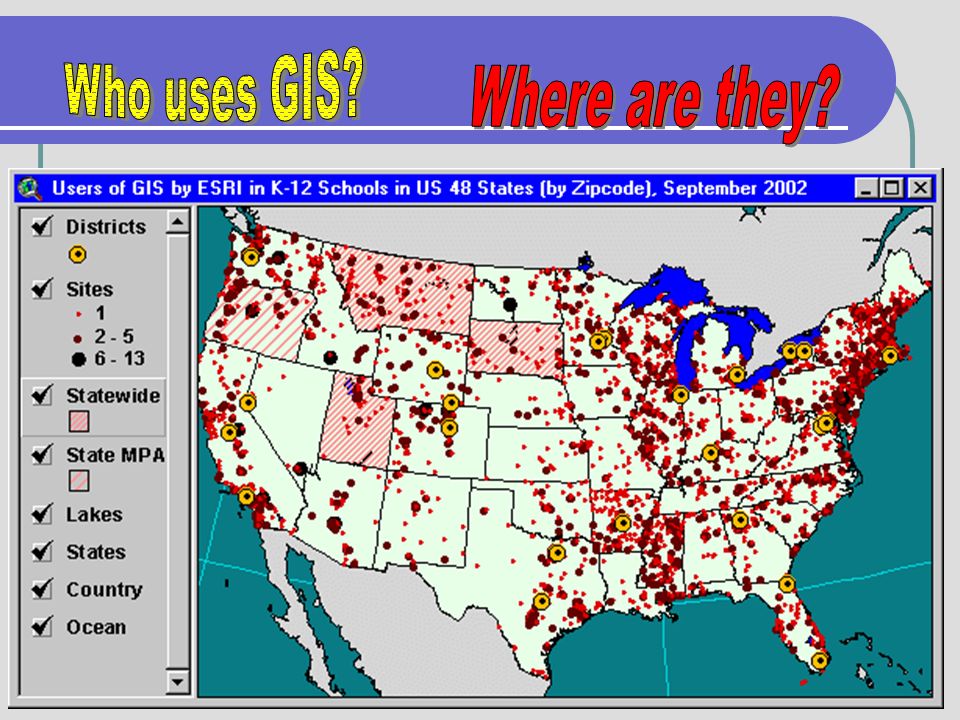
3
3D Mine with Well Data

4
Combining Various Display Methods

5
The Global Positioning System (GPS) is a satellite-based navigation system made up of a network of 24 satellites placed into orbit by the U.S. department of Defense. GPS was originally intended for military applications, but in the 1980s, the government made the system available for civilian use. GPS works in any weather conditions, anywhere in the world, 24 hours a day. There are no subscription fees or setup charges to use GPS.

6
Some Ways GPS is Used Fishing Hiking Sailing/Boating Automobile Cell Phones Pilots Biking Education

8
What is Geo-Caching? Treasure hunt with GPS unit to find locations Database of locations kept online It’s all about the trek What is in the cache: Logbook Treasure (can be anything) Clues One rule: Take from the cache and leave something of your own http://www.geocaching.com (FAQs)
 Clues One rule: Take from the cache and leave something of your own (FAQs).")
9
Ragged Island Geocache

10
Ragged Island Track Cache

11
Ragged Island Cache

12
Geocache Found

13
Geo Cache Contents

14
Deer Park Geocache

15
Geocache Website http://www.geocaching.com

16
Deer Park Geocache

17
GPS & GIS Resources http://step.nn.k12.va.us

18
. eTrex

19
5 Main “Pages”

20
Menu Page

21
Installing Batteries

22
. Left Side View

23
. Right Side View

24
Clearing Tracks Select the Main Menu Select TRACKS Use the up/down button to Select Clear Next, select yes Then Page button to return to Menu

25
Menu Page Delete Tracks

26
Clear Tracks

27
Deleting Waypoints Return to the Menu Page Select Waypoints Select Delete all

28
WayPoints Page Deleting WayPoints

29
SkyView Page

30
Satellite Page

31
5 Main “Pages”

32
Map Page

33
Trip Computer Page

34
Menu Page

35
Menu Page- Select Waypoints

36
Geocaching - Entering Location

37
Entering Location (Geocache)
")
38
Waypoints Page-Goto 1.Press Enter 2.Select 001

39
Entering Location (Geocache)
")
41
Edit Location Latitude & Longitude Hardest step

42
Menchville Geocaches A. N37 05.808 W76 31.734 B. N37 05.805 W76 31.790 C. N37 05.811 W76 31.832 D. N37 05.852 W76 31.814 E. N37 05.881 W76 31.748 F. N37 05.843 W76 31.679 G. N37 05.810 W76 31.670 H. N37 05.895 W76 31.777

43
Waypoint Page 001

44
Pointer Page

45
Follow The Pointer

46
Review Waypoint- GOTO

Similar presentations


 users. A person hides a cache and.>")

