Download presentation
Presentation is loading. Please wait.

1
Geography 101

2
The Five Basic Themes of Geography
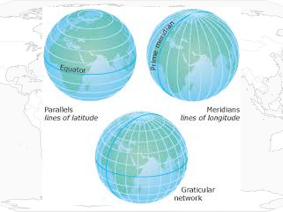
1. Location – Where a place is, can be absolute or relative. a. Absolute Location provides a definite reference to locate a place. The reference can be latitude and longitude, a street address, or even the Township and Range system. 1. Latitude – Angular distance north or south from the Earth’s equator marked in degrees. 2. Longitude – Angular distance expressed in degrees east or west of the Prime Meridian, which runs through Greenwich, England. b. Relative Location Relative location describes a place with respect to its environment and its connection to other places.

4
The physical & cultural characteristics of an area.
.2. Place The physical & cultural characteristics of an area. Human-Environment Interaction The relationship between people and the land. Movement The effort of people to overcome the limits of place. Region Any area based on one characteristic.(This is larger than place. E.g. The Spanish speaking part of the Americas). Spanish spoken in the United States. Darker shades of blue indicate higher percentages of Spanish speakers.
. Spanish spoken in the United States. Darker shades of blue indicate higher percentages of Spanish speakers.")
5
2. Title – Tells you what kind of information the map is showing.
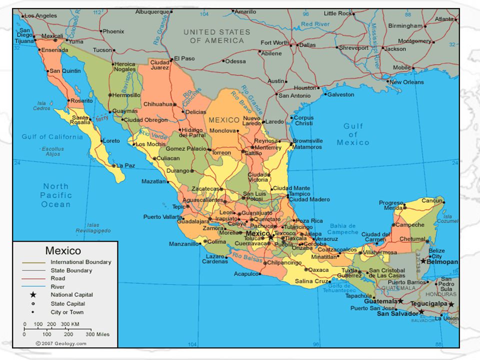
3. Map Skills. a. Reading a map. 1. Maps feature important tools to help you interpret the information they contain. 2. Title – Tells you what kind of information the map is showing. 3. Legend or Key – Explains the symbols, colors & lines used on the map. aa. Scale Bar – Shows the relationship between map measurements & actual distances on the earth. bb. Compass Rose – Indicates direction. The F our Cardinal Directions – North, South, East & West, are usually indicated with arrows or the points of a star. The Intermediate Directions, northeast, northwest, southeast & southwest, may also be shown.

6
cc. Cities – Represented by a dot.
dd. Capitals – Represented by a star within a circle. ee. Boundary Lines – On political maps of large areas, boundary lines highlight the borders between different countries, states or counties. Now lets identify the information presented on the Map on the next slide?

8
General Information. 1. There are seven continents. A continent by definition is any of the great divisions of land on the globe. 1. Africa. 2. Antarctica. 3. Asia. 4. Australia. 5. Europe. 6. North America. 7. South America. 2. There are four oceans. An ocean by definition any of the large bodies of water into which the great ocean (the whole body of salt water that covers nearly ¾ of the surface of the Earth) is divided. 1. Arctic. 2. Atlantic. 3. Indian. 4. Pacific.
 is divided. 1. Arctic. 2. Atlantic. 3. Indian. 4. Pacific.")
9
Importance of Geography
Geography students should acquire the tools that will allow them to understand place and the implications of the meanings we give to place. Students will encounter how geography has unique characteristics that differentiate them from other places while being able to identify and use this information. Being able to identify the sense of a place is important but so is the recognition that not everyone in a place shares this meaning. The characteristics we choose to describe places are just that: choices. Places exist because people make them.

10
Who Chooses Place? The way physical spaces are organized arises from human interaction. The strong often dictate what a place is. Geography and boundaries are dynamic rather than static and through choices lines or boundaries are drawn. If places are made by people, then we must ask how and why while inquiring about the impact of these decisions. Boundaries have historical and political purposes. Once they are drawn, they affect how we think of the people who reside within and across the boundaries.

11
Perspectives of the WORLD
The concept of the center of the world is usually established by prominent civilizations, or strong, that view themselves as superior or the middle of the world. If you look at a modern map; Europe and the United States are often depicted as the center of the world.

12
The world according to the Greeks 1500 BCE
Chinese admiral named Zheng He, perhaps sailed around the world before Columbus The world according to the Chinese 1418 Fact: China means the 'MIDDLE COUNTRY'

13
Map of the Modern World Ask who is the center for the world?

14
Why Boundaries are Important
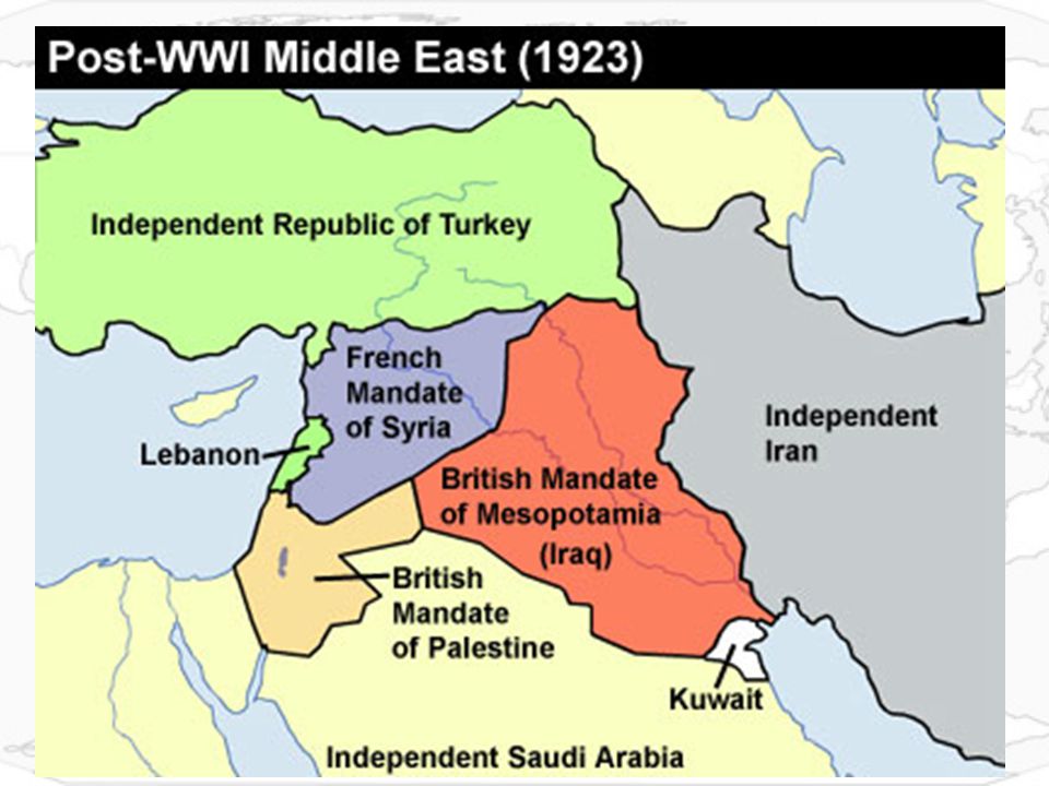
Map of Ottoman empire in 17th century Ottoman empire. A map of the Middle East by Frederick de Wit, c During the 17th century most of eastern Europe, the Middle East and North Africa was governed from Istanbul by the Muslim Ottoman Empire. The modern middle east is an excellent area to explore the concepts of transformative geography

15
Map of Middle East before World War I

17
Ethnic boundaries do not match country boundaries, especially in Iraq, Iran, Afghanistan, and Pakistan. The mismatch has affected many of the conflicts in the area.

18
Map of the Modern Middle East as Established by Treaties with European Nations

19
Redrawn map of the Middle East with Ethnic Considerations

20
Geography 101 Assignment:
Students will get blank world map and label: The Seven Continents (7) The Four Oceans (4) Charlotte, NC (1) Students will circle the middle east on the map (1) Students will draw the equator and label (1) Students will draw the Prime Meridian and label. (1) Working around the room students will look at the posters of Families from around the World and find and label these countries on their map. (12) Students will color and separate land from water (2) Create a legend (1) Compass Rose (1) total of 31 points
 The Four Oceans (4) Charlotte, NC (1) Students will circle the middle east on the map (1) Students will draw the equator and label (1) Students will draw the Prime Meridian and label. (1) Working around the room students will look at the posters of Families from around the World and find and label these countries on their map. (12) Students will color and separate land from water (2) Create a legend (1) Compass Rose (1) total of 31 points.")
22
Haiti Iraq China Mali Thailand Mexico England Bhutan Kuwait Japan Albania Russia Haiti Iraq China Mali Thailand Mexico England Bhutan Kuwait Japan Albania Russia

Similar presentations


.>")


>")


