Download presentation
Presentation is loading. Please wait.

1
Intro to Physical Geography and North America

2
Regional Physical Geography Today: North America First regions Unit 2 and Unit 3: North and South America Next class: Quiz over North America notes, learn about South America Following class: MAP TEST, begin new unit.

3
Introduction to Physical Geography Ch 2 and 3 in textbook

4
p. 34 in textbook shows landforms (similar to this) for reference
 for reference")
5
Tectonic Plates p. 37

6
p. 37 textbook reference map

7
p. 61 in textbook has climate region map for reference

8
Vegetation Map p. 66 in textbook for reference

9
External Forces Shaping the Earth

10
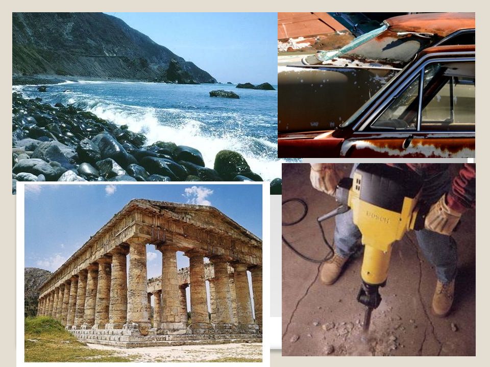
Weathering vs. Erosion Weathering - physical and chemical processes that change the characteristics of rock on or near the earth’s surface. The final result of weathering is sediment. ◦Mechanical weathering - changes in physical composition…drilling and blasting to build roads. ◦Chemical weathering - changes in chemical composition…bike left outside in the rain

12
Erosion Erosion occurs when weathered material (sediment) is moved by wind, water, ice, or gravity. Glaciers, waves, running water, or blowing winds cause erosion by grinding rock into smaller pieces. Types of erosion: ◦Water ◦Wind ◦glacial

13
End Result? What do the processes of weathering and erosion contribute to? Forming soil! ◦Soil is the loose mixture of weathered rock, organic matter, air, and water…fertile soil is a certain mixture of these ingredients, along with climate and time.

14
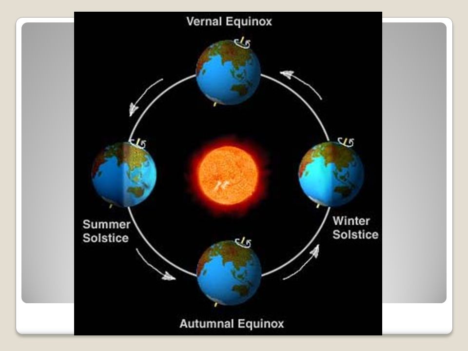
Seasons What causes changes in the seasons? ◦The tilt of the earth’s axis as it revolves around the sun Solstices - summer and winter Equinox - spring and autumn

16
Weather vs Climate What is weather? What does the weather report consist of on the nightly news?

17
Weather Weather is the condition of the atmosphere at a particular location and time. What causes weather? ◦Water vapor ◦Cloud cover ◦Landforms and bodies of water ◦Elevation ◦Air movement

18
Climate Climate is the term for weather conditions at a particular location over a long period of time…weather patterns. Specific temperature and rainfall or average temperature and rainfall?

19
p. 61 in textbook has climate region map for reference

20
What affects Climate? Wind and Ocean currents - help distribute the sun’s heat Zones of latitude - low or tropical, middle or temperate, and high or polar Elevation - as altitude increases, the air temperature drops about 3.5˚F for every 1,000 feet…Mt. Kilimanjaro Topography - landforms and bodies of water can facilitate and serve as barriers in distributing heat, moisture, etc.

21
Can climates change over time? Yes! Some climate changes are natural and others are a result of human activity on earth. ◦El Nino - a natural change in climate ◦Global Warming – may be the result of human activity…the greenhouse effect

22
Physical Geography of US and Canada

23
Landscape Influenced Development What about the landscape of the US and Canada has influenced our development? Vast lands – total square miles: 9,365,000 Sq. Miles, 16.3% of world’s total land mass Natural Resources

24
Varied Landforms Coastal Plains Appalachian Mountains Great Plains Rocky Mountains Continental Divide – line of highest points in the Rockies that marks the separation between rivers flowing eastward and westward.

25
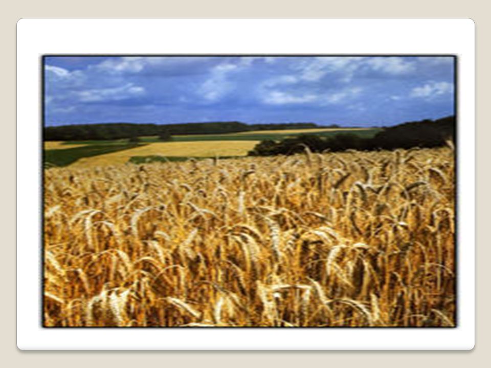
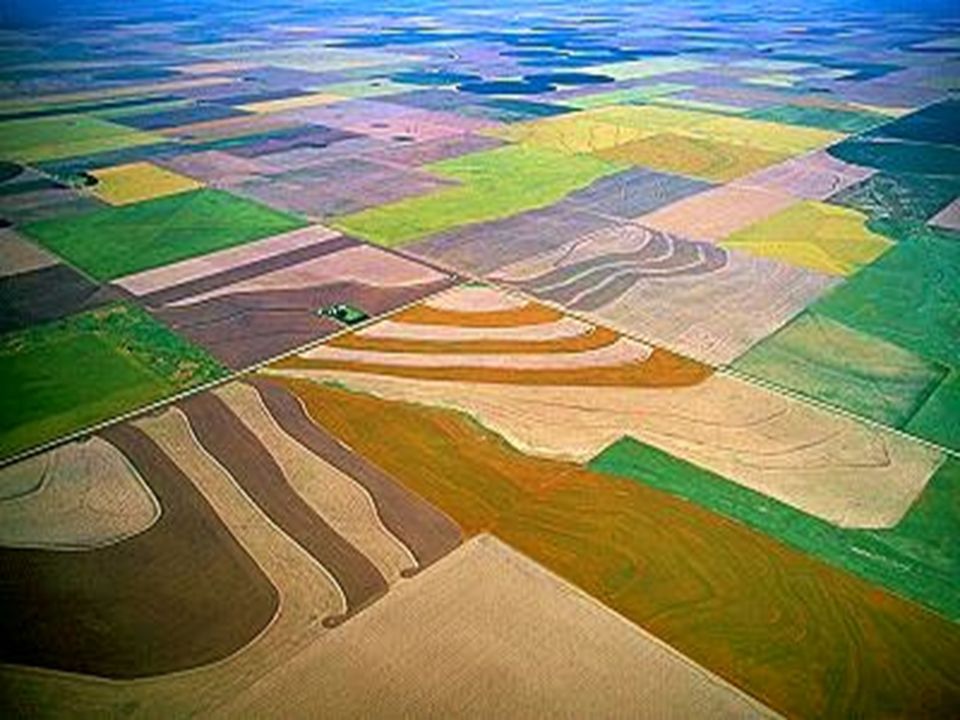
The Great Plains The Great Plains covers nearly one-fifth of the continental United States. A vast stretch of prairie where few trees grow, these grasslands used to be tall grass prairie before it was noticed they would support dry field crops like wheat. It now serves as the western part of America's "Breadbasket." This is the Wheat Belt and the limited rainfall in the region is perfect for wheat cultivation.

29
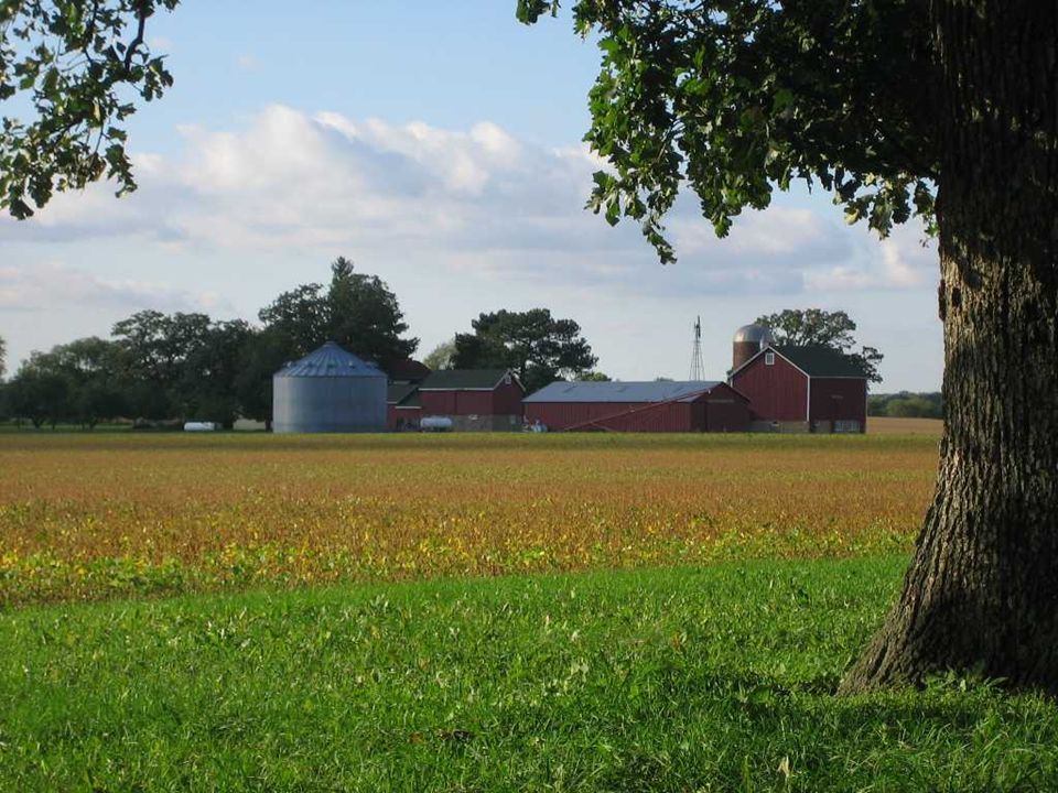
The Interior Lowlands includes the Nashville Basin, the "Hill Country" of Texas, the Midwest, and vast stretches of flat to rolling land in Canada. A large part of this area is the "Breadbasket" of the United States - the Corn Belt. However, most of the corn grown here isn't for human consumption. Rather it is used as animal fodder. Interior Lowlands: Grain Belts

30
The Canadian Shield The Canadian Shield has experienced glacial scouring from the last ice age 11 to 13 thousand years ago. Notice all the glacial lakes of this area (e.g. Great Lakes, Lake Winnipeg, Great Bear Lake, Great Slave Lake, etc.) and the fjords of the island north. The islands of the Arctic realm (e.g. Baffin Island, Ellesmere Island, and Victoria Island) are all inscribed with former glacial troughs.
 and the fjords of the island north. The islands of the Arctic realm (e.g. Baffin Island, Ellesmere Island, and Victoria Island) are all inscribed with former glacial troughs..")
31
Pacific Mountains and Valleys ^ Yukon River Mt. McKinley or Denali >

32
Appalachian Mountains These mountain extending 1,600 miles north and south gently sloping are very old 400 million years.

33
Islands The Aleutian Islands and Hawaiian Islands- Volcanic in origin. Arctic Islands- Largest are Ellesmere, Victoria and Baffin.

34
Climates and Vegetation Huge mixture of climates ◦Why?

35
Climate Zones

36
Rocky Mountains: The Rocky Mountains are the dominant mountain range for North America. It contains the continental divide, where water will drain either to the east (e.g. the Mississippi River, or Rio Grande watersheds), or to the west (to the Colorado, Columbia, or Yukon River watersheds).
, or to the west (to the Colorado, Columbia, or Yukon River watersheds)..")
37
Natural Resources Oceans and Waterways Land and Forests Minerals and Fossil Fuels

38
Vegetation Map

39
How did we get here? Migration from Asia over Beringia – a land bridge that once connected Siberia and Alaska Migrants were nomads, hunting and gathering game and wild plants Where were the first settlements? What prompted the move from a nomadic to a sedentary lifestyle?

40
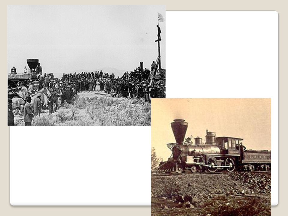
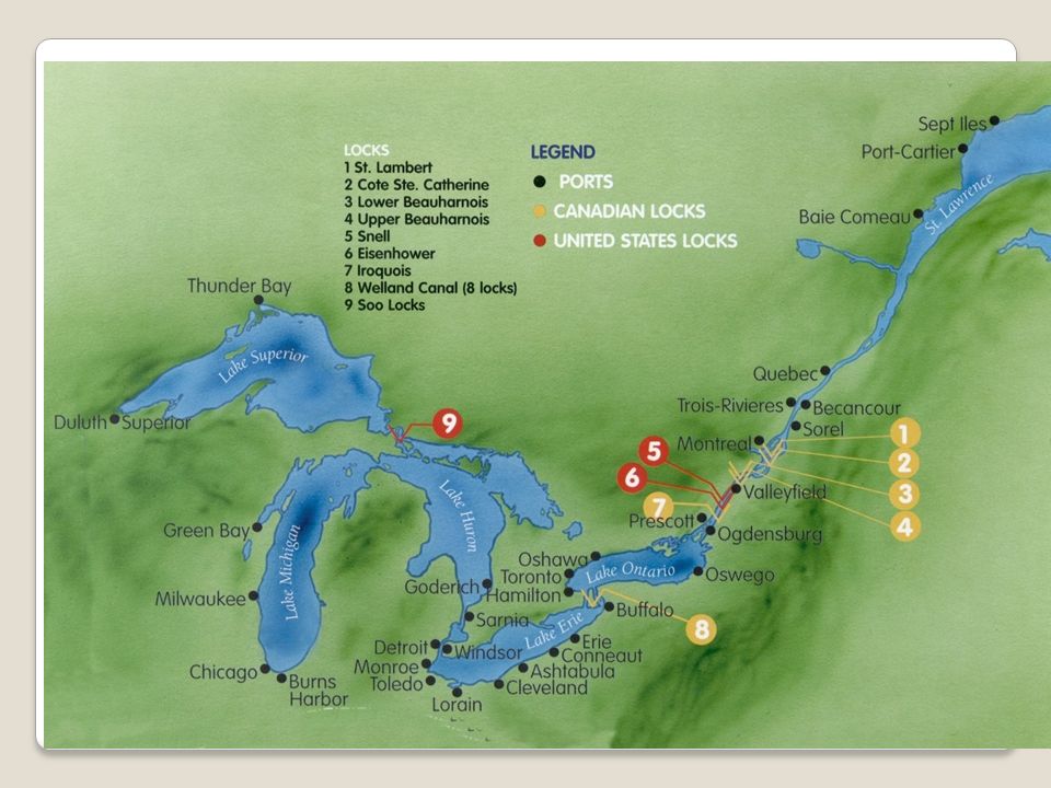
Expansion of the U.S. Overcoming distances Trails and inland waterways Oregon Trail Santa Fe Trail St. Lawrence Seaway – connects Great Lakes to the Atlantic Ocean Erie Canal Railroads – Transcontinental Railroad completed in 1869 Highways 1950’s interstate initiative under President D. Eisenhower

45
Assignments: Using the textbook: Complete North America Resource Activity Read chapter 5 section 1 and section 2. Take notes/outlines as you read. Open-notes quiz next class period over class notes and chapter notes. Work on maps lizardpoint.com ilike2learn.com Work on vocabulary and Climate packet

Similar presentations


>")


