Download presentation
Presentation is loading. Please wait.

1
The Modelshed Framework Praveen Kumar and Ben Ruddell, CUAHSI HIS Update July 28, 04

2
What is a Modelshed? A volumetric spatial (GeoVolume?) model unit, registered in three dimensions by a GIS, with which time-varying data, model fluxes, spatial relationships and descriptive metadata are associated
 model unit, registered in three dimensions by a GIS, with which time-varying data, model fluxes, spatial relationships and descriptive metadata are associated.")
3
What can the Modelshed Framework do? Store data for diverse spatio-temporal applications & phenomena A generalized 4D data model for environmental science Addresses issues of scale, heterogeneity, and resolution Build on top of existing data models (e.g. ArcHydro) to leverage existing data structures and tools Establish new relationships Models environmental fluxes Connects raster data and numerical models with object-relational data models
 to leverage existing data structures and tools Establish new relationships Models environmental fluxes Connects raster data and numerical models with object-relational data models.")
4
Modelshed UML

5
Timeseries UML

6
Flux UML

7
AreaLink UML

8
OrthogonalLink UML

9
Applications: Helping Raster & Vector Talk How can continuous data in rasters be related to database objects? –Summarize the data using statistics, aggregated by overlapping Modelshed areas –Statistics are stored as indexed data records –Modelsheds can be physically meaningful, like watersheds –This process can be automated for a large number of rasters

10
Applications: Helping Raster & Vector Talk

11
Applications: Automating data management with the Modelshed Tools The ModelShed Tools automate some database tasks: –Adding new descriptive indexes –Building the index of raster datasets –Automatically processing a timeseries of raster datasets based on areas in the database, and ingesting the statistical data into the database –Building AreaLink tables ModelShed Tools are an extension to ArcGIS 8, and use ArcGIS Spatial Analyst geoprocessing routines

12
Dynamic Features Supports database features that move and change in time The full range of Modelshed features are still supported, including vertical indexing, flux links, and area links. A parallel UML structure for static and dynamic features

13
Dynamic Features in Time

15
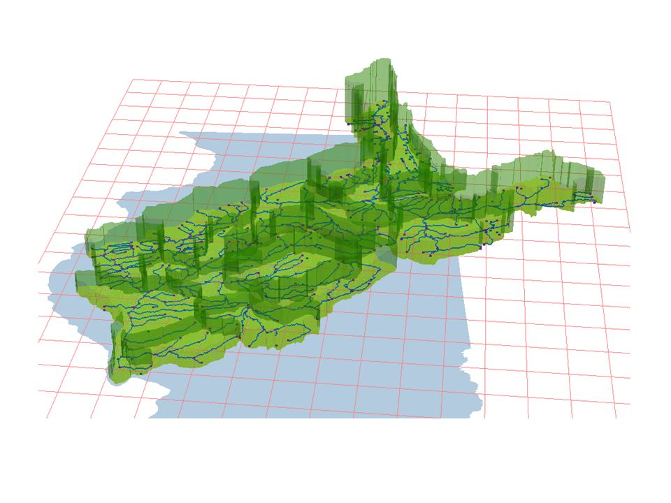
Applications 2: ILRDB A prototype geodatabase of the Illinois River Basin using the Modelshed geodata model Combining base hydrography from the NHD / ArcHydroUSA database with supercomputer- generated regional climate data, remote sensing data, land use data, and multi-layer soils data A proof of concept for study using a much more extensive multi-disciplinary integrated database

16
Illinois River Basin Database (ILRDB)
")
18
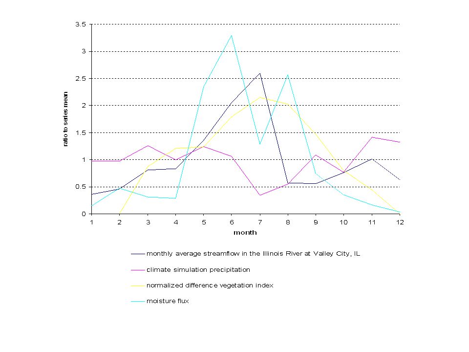
Studying the relationships between large-scale phenomena and hydrology using the ILRDB Climate simulation precipitation and humidity data is modeled along with NDVI vegetation and surface hydrology Query-based analysis is used to analyze the relationships between these datasets

Similar presentations


 >")


