Download presentation
Presentation is loading. Please wait.

1
Rebecca Boger Earth and Environmental Sciences Brooklyn College

2
What is GIS? Functions Features Attributes Data models and databases Vector Raster Geodatabases How do we know where are we on the Earth’s surface? Datum Projection Coordinates ArcGIS overview

3
Computer system hardware Geographically referenced digital data Computer software that carries out various management and analysis tasks People

4
1. Much information has a spatial and / or temporal component − Location − Pattern − Trend 2. Quick and easy access to large and varied amounts of data − Search and update data − Model − Analysis 3. Output capabilities – maps, graphs, statistics tailored to desired needs

5
Visualization Looking at data on a map to get information see relationships Geodata management Updating and organizing data to be useful Analysis Applying tools to answer questions and support decisions

6
Uses of GIS are almost limitless and apply to most every field Source: http://www.colorado.edu/geography/gcraft/notes/intro/intro_f.html

7
Location: Where is it? Condition: What is it? Trend: What has changed? Routing: Which is the best way? Pattern: What is the pattern? Modeling: What if?

8
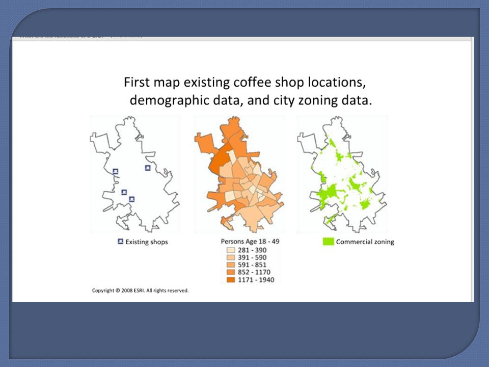
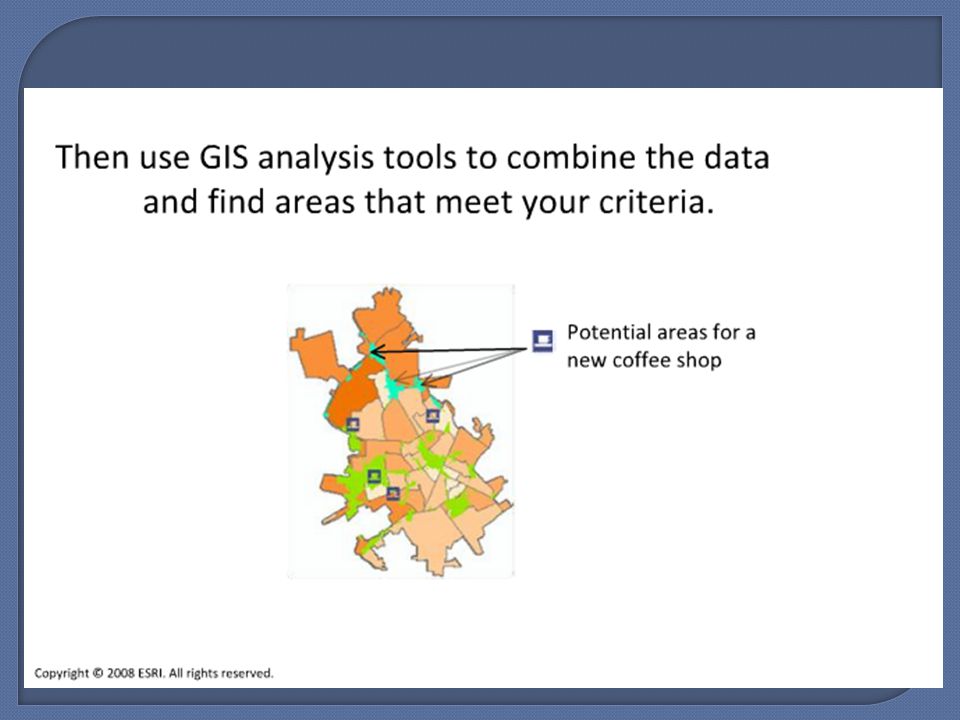
Analysis : applying tools to geographic data to answer questions Example: Suppose you own a several coffee shops and want to expand in the same city Question: What are the potential areas for a new shop?

12
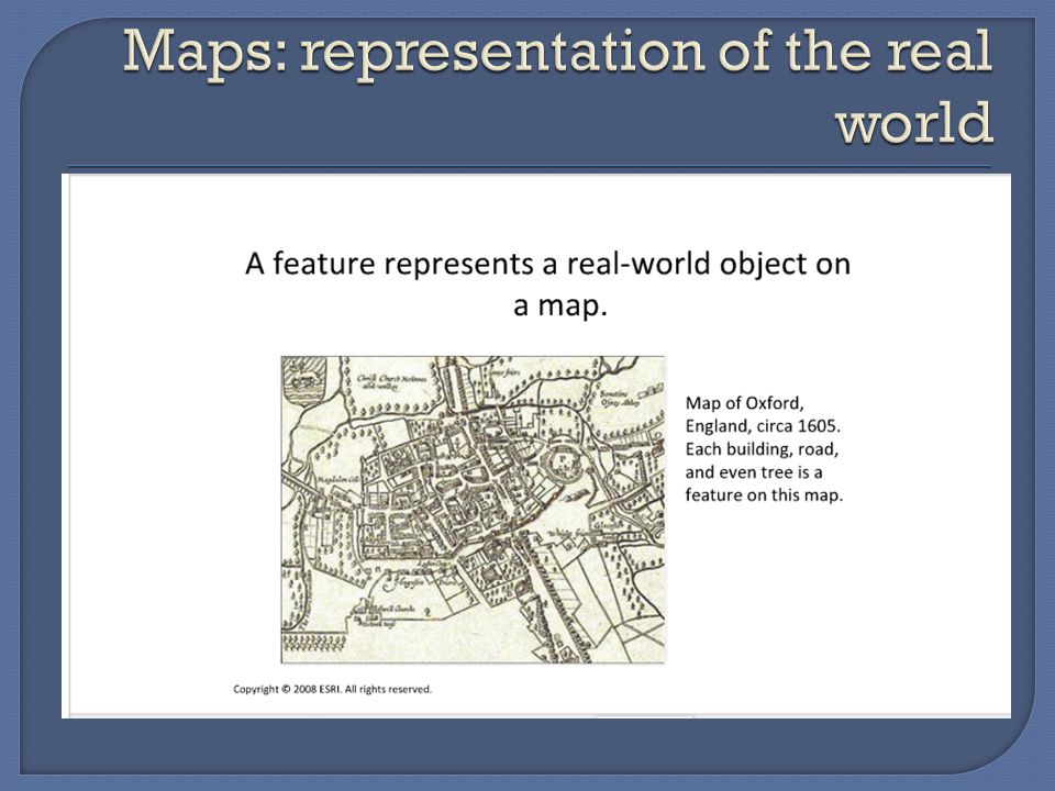
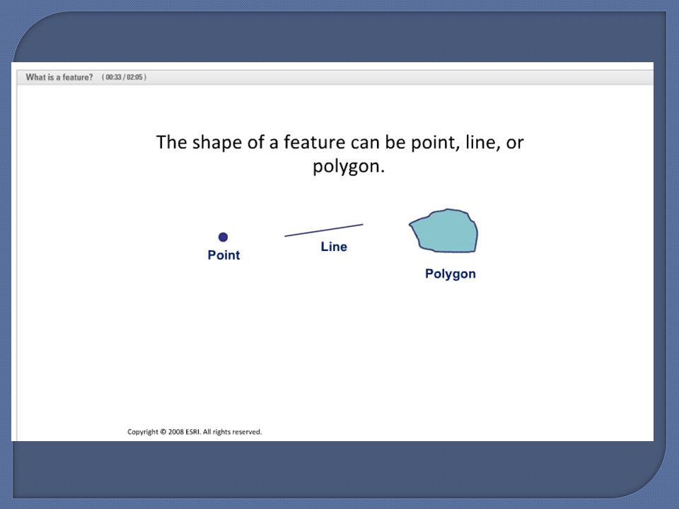
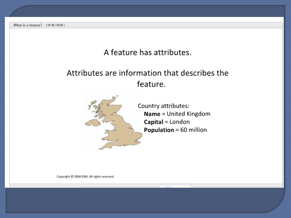
Shape Location Symbol Attributes

17
What is GIS? Functions Features Attributes Data models and databases Vector Raster Geodatabases How do we know where are we on the Earth’s surface? Datum Projection Coordinates ArcGIS overview

18
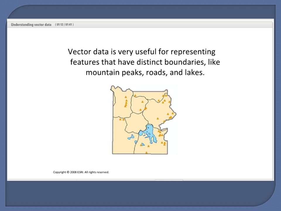
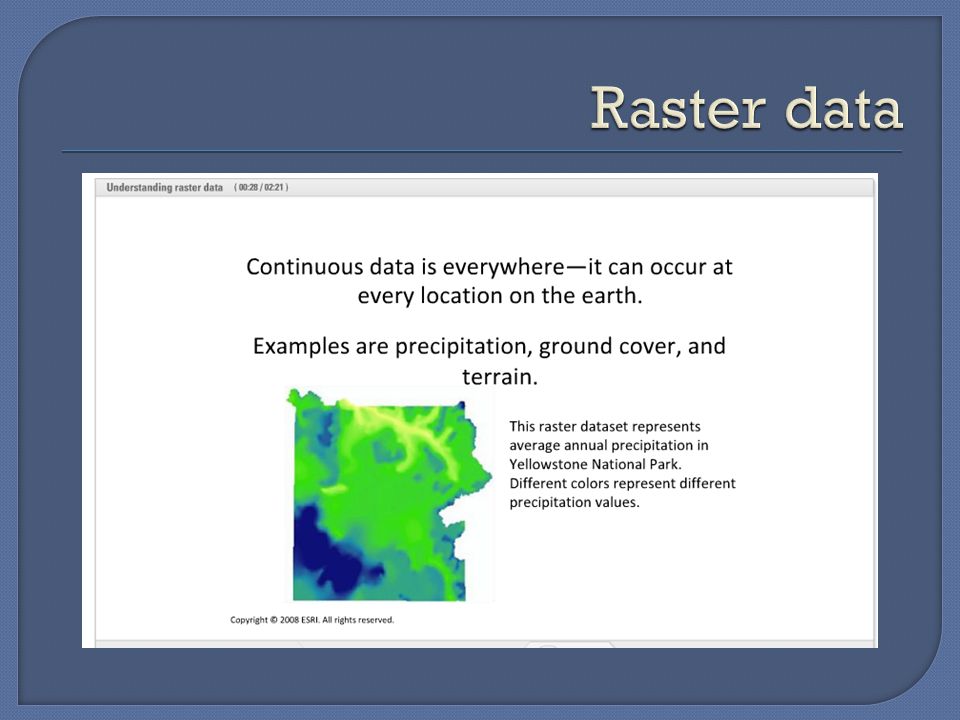
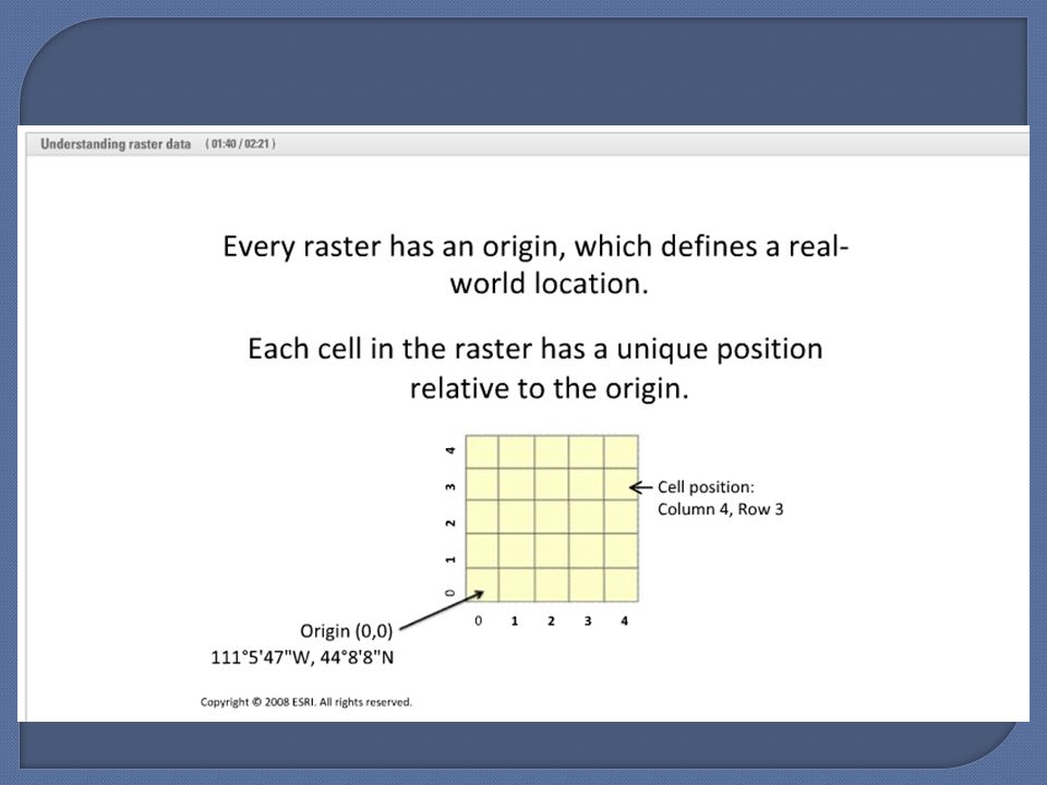
Raster: continuous data, imagine a grid placed over the Earth’s surface Vector: discrete objects – lines, points and polygons

25
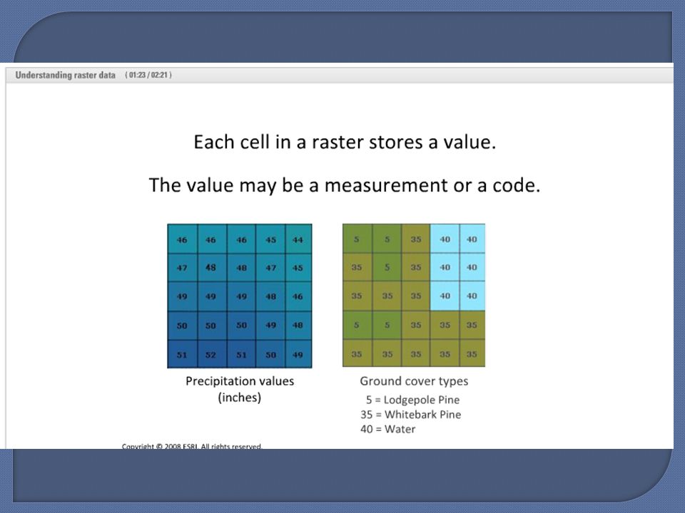
Each cell (pixel) has one value distributed over the entire area Reality – there may be variance within the area E.g., mapping elevation data with a cell size of 30mx30m Apply a mean, median or modal value, or other type of representation Can also be coded for categorical data (non numeric), such as land cover type Can convert between raster and vector
 has one value distributed over the entire area Reality – there may be variance within the area E.g., mapping elevation data with a cell size of 30mx30m Apply a mean, median or modal value, or other type of representation Can also be coded for categorical data (non numeric), such as land cover type Can convert between raster and vector")
26
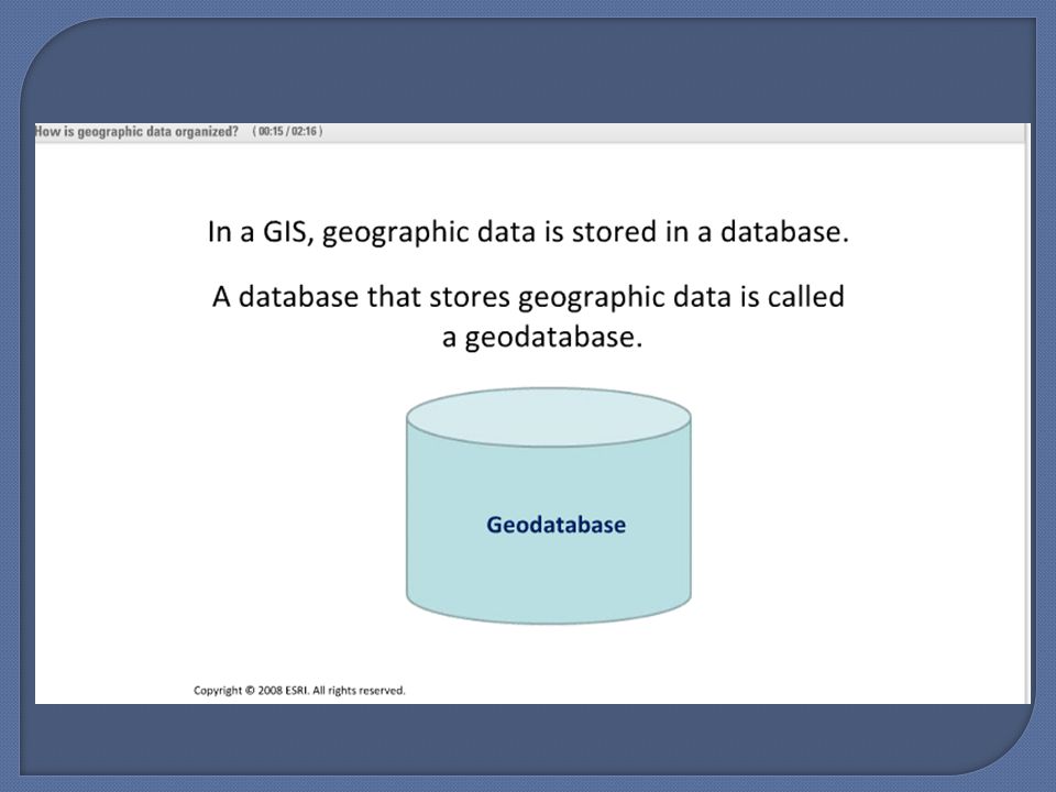
Spatial data Data with some form of spatial or geographical reference Can be located in 2- or 3-dimensional space Attribute Data Describes the characteristics of spatial features Examples: Is it green or blue? How much is it worth? When was it built? Usually stored in a relational database that is linked to spatial data files

27
Information stored in tables Each row called a record Each spatial feature is linked to a record Columns or fields recording attributes Source: http://www.colorado.edu/geography/gcraft/notes/datacon/datacon_f.html

29
Source: ArcGIS desktop help tool

30
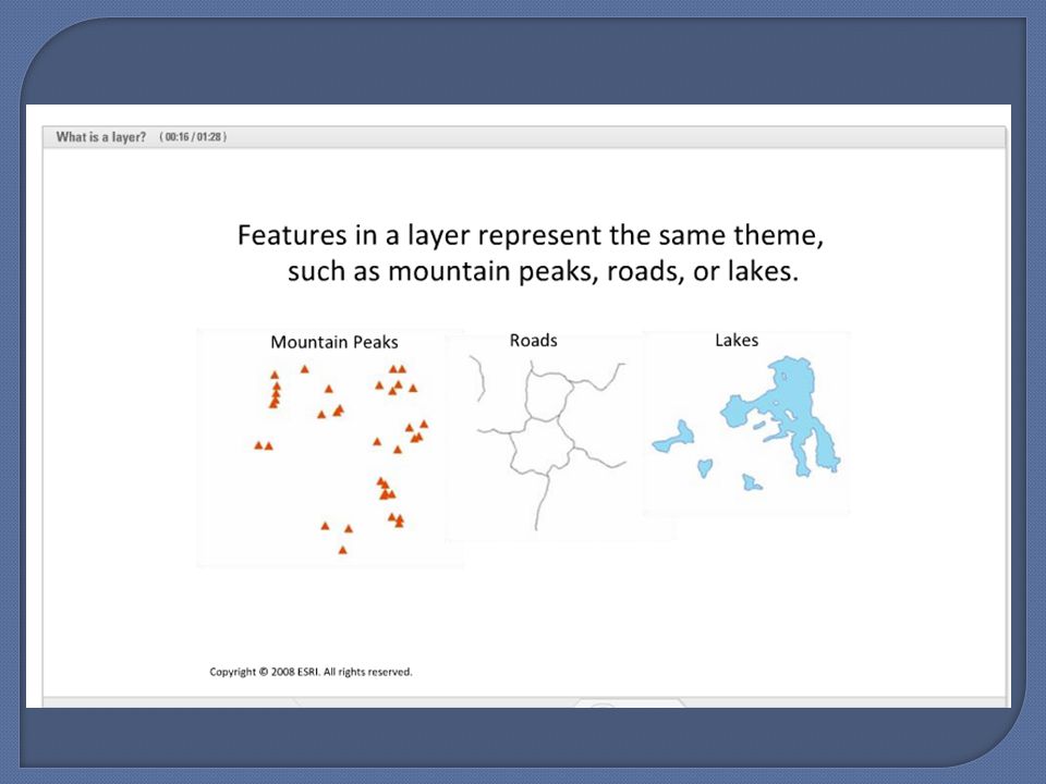
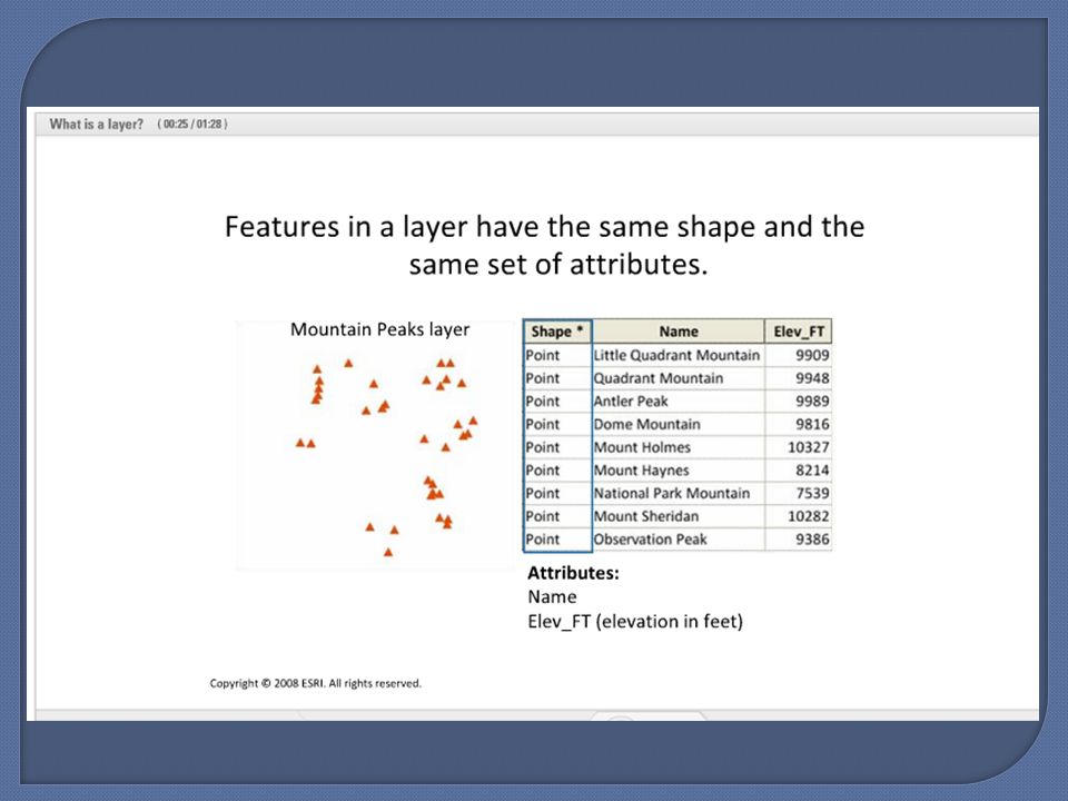
Geographic data are organized into feature classes Feature class is a digital dataset with the same shape and attributes Layer is a visual representation of a feature class in a map Feature class table as one record and one column for each attribute

31
What is GIS? Functions Features Attributes Data models and databases Vector Raster Geodatabases How do we know where are we on the Earth’s surface? Datum Projection Coordinates ArcGIS overview

32
How to place a 3D Earth on a flat 2D paper map Something gives Shape Area Distance Angles A spherical globe of Earth can preserve all

33
Geodesy: science of measuring the shape of the Earth Create a set of known locations – datum Map projections transform the datum to a flat surface

34
Depiction of spherical Earth on 2D surface Many different types Designed for different uses Extent of area covered (small or large scale) Where on Earth Shape of area depicted (e.g., long north/south orientation of California versus east/west orientation of Kansas)
 Where on Earth Shape of area depicted (e.g., long north/south orientation of California versus east/west orientation of Kansas)")
35
Reference systems: Where are you relative to something else? E.g., city grid and addresses Latitude and longitude Universal Transverse Mercator (UTM)
.")
36
What is GIS? Functions Features Attributes Data models and databases Vector Raster Geodatabases How do we know where are we on the Earth’s surface? Datum Projection Coordinates ArcGIS overview

37
GIS tasks can be categorized into two main functionalities: ArcMap: Mapmaking, editing, and spatial analysis ArcCatalog: database design and data management; search for spatial data, preview it, create and manage metadata Similar to working with Windows Explorer ArcToolbox: window containing set of tools, merged in ArcMap and ArcCatalog Overlapping functionalities

38
Viewing spatial data by creating and querying a map Main document has *.mxd extension Map document stores the layers, symbology, and layout, but does NOT store the actual geographic data (can be large files) Directs to where the geographic files are located Geodatabases help with keeping track of datasets for map project
 Directs to where the geographic files are located Geodatabases help with keeping track of datasets for map project")
39
Manage your data: find datasets on your hard drive, copy and move datasets around your system, document datasets with metadata Particularly useful because a single geographic dataset is often composed of multiple files or folders. Copying and deleting sometimes cannot be done with using Microsoft Windows Explorer.

40
Geoprocessing Processing geographic information through operations called commands or tools ArcToolbox important way to conduct geoprocessing Basic analysis tools, conversion tools (import and export), data management tools, geocoding tools, linear referencing tools, and spatial statistic tools Extensions: provide other tools for geoprocessing
, data management tools, geocoding tools, linear referencing tools, and spatial statistic tools Extensions: provide other tools for geoprocessing")
41
ESRI data structure homogeneous collection of features that can have either point, line, or polygon shapes. “package” of separate files (at least 3) with different extensions.shp: shape file, stores feature geometry.shx: shape index, stores an index to the feature geometry.dbf: dBase file of attribute information can be other files
 with different extensions.shp: shape file, stores feature geometry.shx: shape index, stores an index to the feature geometry.dbf: dBase file of attribute information can be other files.")
Similar presentations