Download presentation
Presentation is loading. Please wait.

1
Introduction to Geographic Information Systems (GIS) part I Marcel Fortin GIS & Map Librarian, University of Toronto gis.maps@utoronto.ca www.library.utoronto.ca/maplib January 8 th, 2007 This presentation http://www.library.utoronto.ca/maplib/temp/ALD/ARC1012.ppt
 part I Marcel Fortin GIS & Map Librarian, University of Toronto January 8 th, 2007 This presentation")
2
Objectives ► Understand the basic premises of GIS Cartography / Map Making Geographic Analysis ► By Learning the basics of GIS software and databases Different geographic datasets Basic map creation

3
Agenda ► What is not and what is GIS? ► What are Geospatial Data? ► What is not GIS? ► Examples of GIS applications ► Software FYI ► Data Access FYI ► GIS Services/Education at the U of T ► Demos ► Where do Google Earth/Maps Fit in

4
What is not GIS?

5
What is not a GIS – Scanned Maps

6
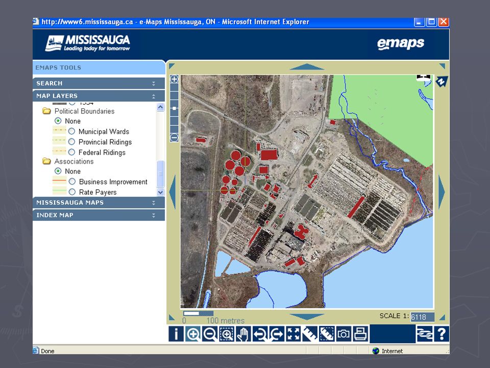
E-maps are not a GIS http://www.ladocumentationfrancaise.fr/cartotheque/decoupage-administratif-france-2005.shtml

7
GPS IS NOT GIS http://www.skyfly.cz/pristroj/image/mage315.jpg

8
GIS not CAD

9
What is GIS? A GIS is a computer application with the capacity to assemble, store, manipulate, analyze, and display geographically referenced information (geospatial data)
.")
10
What are Geospatial data? Data must “fit” with other data Geospatial data are georeferenced data (ie. they have a geographic field) postal codes postal codes Province Province City City longitude and latitude longitude and latitude lot numbers lot numbers concession numbers concession numbers census tract census tract wards wards Air photographs Air photographs Etc. Etc.
 postal codes postal codes Province Province City City longitude and latitude longitude and latitude lot numbers lot numbers concession numbers concession numbers census tract census tract wards wards Air photographs Air photographs Etc. Etc..")
11
Provinces

12
Postal Data

13
Longitude / Latitude

14
Parcel Information

15
Air Photos (or other raster imagery) 0.5000000 0.0000000 -0.5000000 627995.1250249 4836671.8749751
")
16
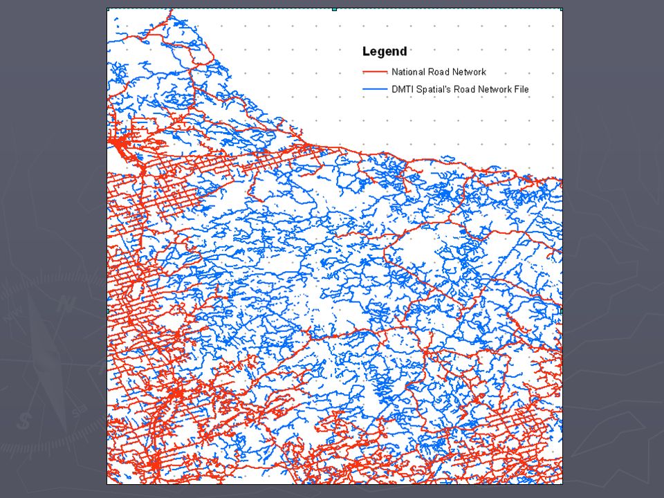
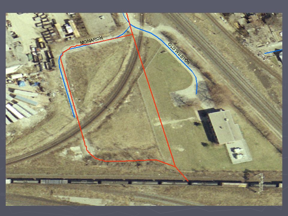
Road Network File

17
Combination of “Layers” 1999 Orthorectified Aerial photograph overlayed with the DMTI Spatial’s Street Network file for Ontario

19
Vector and Raster 01 VectorRaster.mxd

20
Projection Issues projections.mxd

21
Thematic / Census Mapping census.mxd

22
Topographic Mapping 04.0 TopographicMapping.mxd

23
3D Mapping 3dmapping.mxdLINE175990487002002FBS.dwg 030m11_0100_deme.dem (global mapper) 06_3DToronto1.sxd06_3DToronto2.sxd07_3DVancouver.sxd
 06_3DToronto1.sxd06_3DToronto2.sxd07_3DVancouver.sxd")
24
Software FYI

25
Software Campus “Standard” ESRI Site License (campus consortium) ArcGIS (desktop)ArcGIS (desktop) ArcInfoArcInfo ArcEditorArcEditor ArcView (free version now available from map library)ArcView (free version now available from map library) ArcIMS (web) / ArcSDE (spatial data engine) / ArcGIS ServerArcIMS (web) / ArcSDE (spatial data engine) / ArcGIS Server
 ArcGIS (desktop)ArcGIS (desktop) ArcInfoArcInfo ArcEditorArcEditor ArcView (free version now available from map library)ArcView (free version now available from map library) ArcIMS (web) / ArcSDE (spatial data engine) / ArcGIS ServerArcIMS (web) / ArcSDE (spatial data engine) / ArcGIS Server")
26
Making Sense of “ArcWording” Functions Umbrella Flavour 3D Analyst, Spatial Analyst, etc. Extensions ArcGISArcInfoArcEditorArcView ArcMap|ArcToolbox|ArcScene|ArcCatalog

27
Other Software Options Commercial Microsoft MapPoint (software licensing office)Microsoft MapPoint (software licensing office) OracleOracle FMEFME AutoCad MapAutoCad Map ArcGIS for Autocad (see http://www.esri.com/software/arcgis/arcgis-for- autocad/index.html)ArcGIS for Autocad (see http://www.esri.com/software/arcgis/arcgis-for- autocad/index.html) Mapinfo (site license via Geography Department)Mapinfo (site license via Geography Department) Global MapperGlobal Mapper Open Source GRASS (desktop)GRASS (desktop) MapServer (web)MapServer (web) ThubanThuban QGISQGIS See http://www.freegis.org for more software titlesSee http://www.freegis.org for more software titleshttp://www.freegis.org
Microsoft MapPoint (software licensing office) OracleOracle FMEFME AutoCad MapAutoCad Map ArcGIS for Autocad (see autocad/index.html)ArcGIS for Autocad (see autocad/index.html) Mapinfo (site license via Geography Department)Mapinfo (site license via Geography Department) Global MapperGlobal Mapper Open Source GRASS (desktop)GRASS (desktop) MapServer (web)MapServer (web) ThubanThuban QGISQGIS See for more software titlesSee for more software titleshttp://")
28
Data FYI

29
Data Issues ► Data Culture (Canada vs. USA) Feast or Famine ► Data Management ► Datasets of Interest ► Data Selection ► Data Creation
 Feast or Famine ► Data Management ► Datasets of Interest ► Data Selection ► Data Creation.")
30
Data Culture : Feast or Famine YearDatasets Web Server / Intranet Media 19993 3 Gb (a few 100 files) 3 CDs 2007450 Over Tb (millions of files) 1200 CDs/DVDs
 3 CDs Over Tb (millions of files) 1200 CDs/DVDs")
31
Data Culture – Mixed Bag ► Federal government Geobase.ca NTDB DEMs now free! Geogratis.ca NTDB topo data and raster imagery now free! ► Provincial Governments Ontario OGDE via libraries or vendors Manitoba free from download BC and Alberta pay for some free download for others ► Municipal Toronto pay Mississauga pay Brampton pay Burlington free Peterborough free London Free

32
Data Selection and Accuracy

36
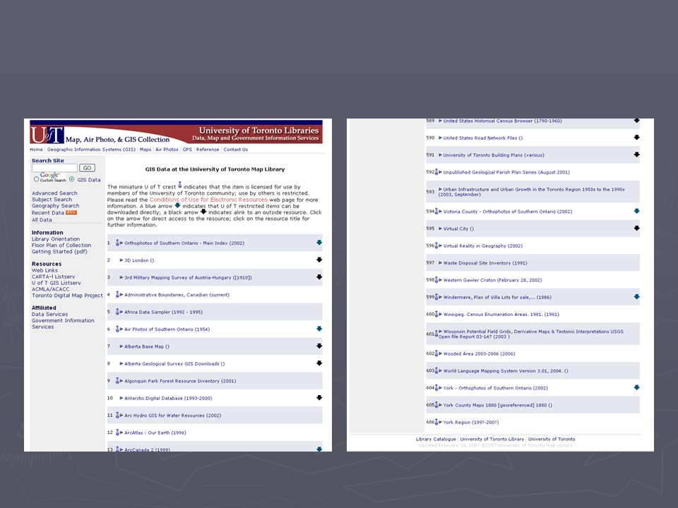
Data Starting Point http://www.library.utoronto.ca/maplib

39
Data Creation

40
Data Creation – Waste Disposal Sites 08DataCreation.mxd

42
Future Historical GIS 1860’s Map of Toronto with roads overlayed. Note the Lakeshore highway’s location.

43
Open Street Map

44
Examples and Demos

45
Common Examples of GIS

46
http://map.toronto.ca/imapit/iMapIt.jsp?app=TOMaps

48
Where do Google Earth/Maps fit in? Convergence or Confusion?

49
Google Earth The Good It’s Fun Geographic Literacy Geographic Interest Technology Boom Ease of Use Collaboration and sharing of hundreds of digitizing projects

50
Google Earth The Good

51
Google Earth The Bad “Why do we still fund GIS Projects when there’s Google Earth” – Treasury Board Official at Depository Services Program Function

52
Google Earth The Ugly

54
Google Earth GIS Convergence Can now convert GIS Layers to KML format even in ArcGIS http://www.library.utoronto.ca/maplib/map.html http://www.library.utoronto.ca/maplib/map.html Can do your own cartography Can do some analysis

55
Future GPS / GIS Convergence 11 GPS.mxd

56
Map & GIS Services at U of T Libraries 1960’s Map Library in Geography Department 1970’s Moved to Robarts 1 st floor 1996 Merged and moved to 5 th floor Robarts 1999 GIS & Map Librarian Hired 2002 Data & GIS Services Area Created 2002 GIS Analyst Hired 2003 UTM GIS Librarian hired (North American first) 2006 UTM GIS Technician hired 2007-2008 – Data & GIS Services expansion (unMAGICed?)
 2006 UTM GIS Technician hired – Data & GIS Services expansion (unMAGICed )")
57
GIS Staff St. George Campus GIS Team GIS & Map LibrarianGIS & Map Librarian Map CataloguerMap Cataloguer Map ProcessorMap Processor GIS AnalystGIS Analyst Graduate GIS Assistant(s)Graduate GIS Assistant(s) UTMississauga Campus GIS and Data LibrarianGIS and Data Librarian GIS TechnicianGIS Technician
Graduate GIS Assistant(s) UTMississauga Campus GIS and Data LibrarianGIS and Data Librarian GIS TechnicianGIS Technician.")
58
Communication & Teaching GEODATA-l Listserv New Datasets Software upgrades Workshops RCAT Lab One on one teaching No Grad Courses anymore ESRI Virtual Campus

59
GIS Services Facts ► 1960’s Map Library in Geography Department ► 1970’s Moved to Robarts 1 st floor ► 1996 Merged and moved to 5 th floor Robarts ► 1999 GIS & Map Librarian Hired ► 2002 Data & GIS Services Area Created ► 2002 GIS Analyst Hired ► 2003 UTM GIS Librarian hired

60
San Francisco data ► www.geographynetwork.com 09.1California.mx www.geographynetwork.com ► California Spatial Information Library http://gis.ca.gov/index.epl http://gis.ca.gov/index.epl ► San Francisco Government GIS http://www.sfgov.org/site/gis_index.asp?id=372 http://www.sfgov.org/site/gis_index.asp?id=372

Similar presentations