Download presentation
Presentation is loading. Please wait.

1
WISER: 25 May 2011 Debbie Hall Map Room Bodleian Library Maps and mapping: Online Maps Online Mapsand Digital Mapping

2
Online maps and digital mapping Maps available online Digital map data available online Introduction to MapInfo Practice session

3
Maps as a resource for research and teaching Online maps Scanned images from map collections Mapping generated on demand Digital mapping / “born digital” Digital mapping software and data

4
Raster mapping No special software required Can be inserted directly into a document Limited modification possible Widely available on the Internet Both historic and modern mapping

5
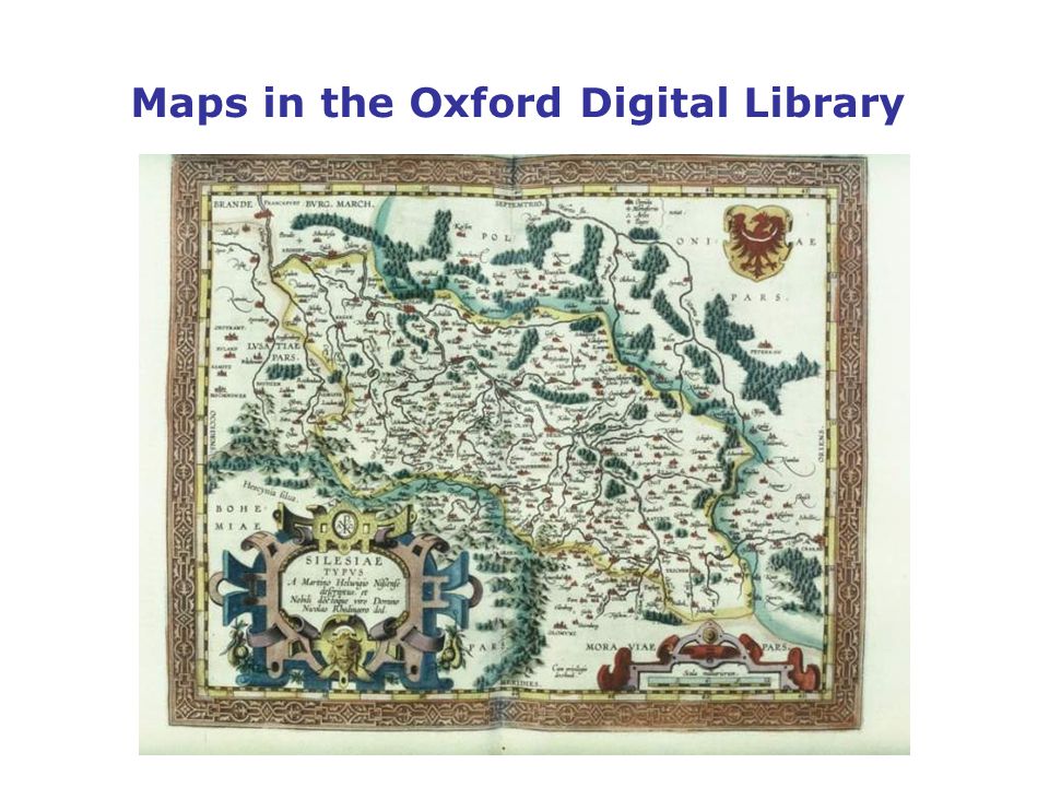
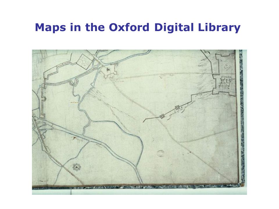
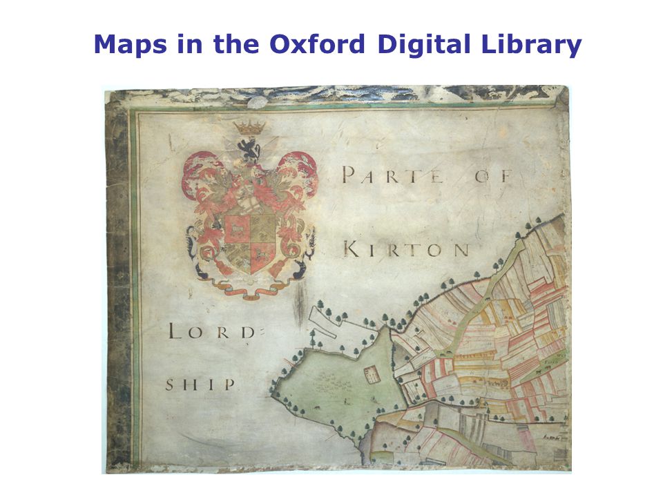
Maps in the Oxford Digital Library Around 1000 map images are available The ODL is bringing together digital collections from across the University Search by mapmaker, title and subject http://www.odl.ox.ac.uk/collections/index.html

6
Maps in the Oxford Digital Library

10
Web resources Worldwide Websites with map images are everywhere Content and quality varies considerably Some sites may be infringing copyright Links to sites with map images are regularly added to the Map Room website

11
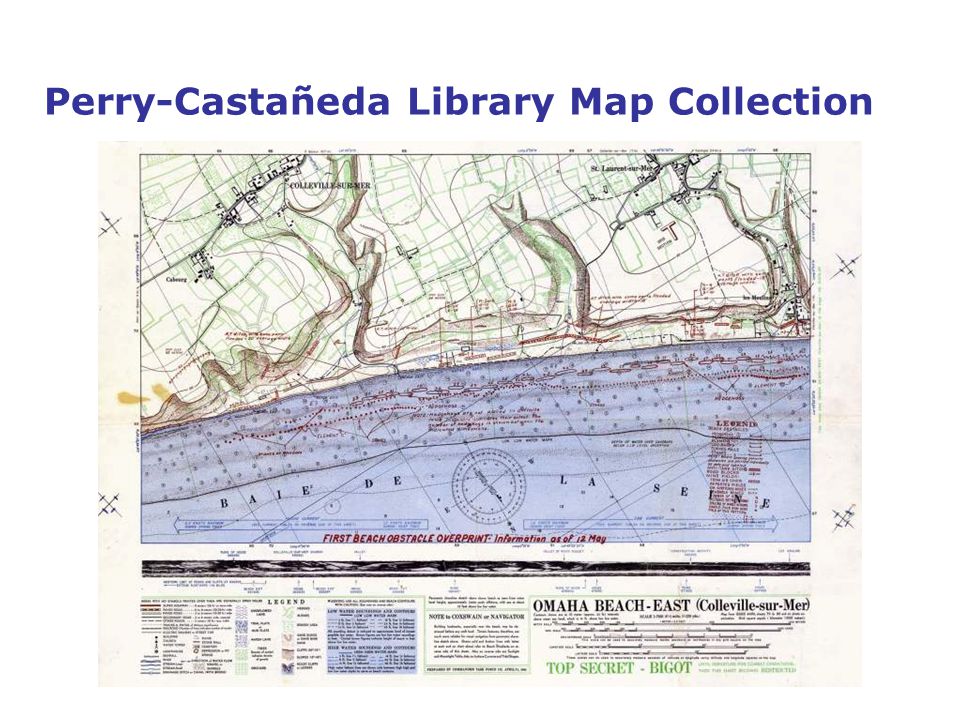
Perry-Castañeda Library Map Collection 11,000 maps online Modern and historical mapping Most mapping is public domain Non-copyright modern mapping is mostly published by the US government (CIA, etc) http://www.lib.utexas.edu/maps/
")
12
Perry-Castañeda Library Map Collection http://www.lib.utexas.edu/maps/

13
Perry-Castañeda Library Map Collection

15
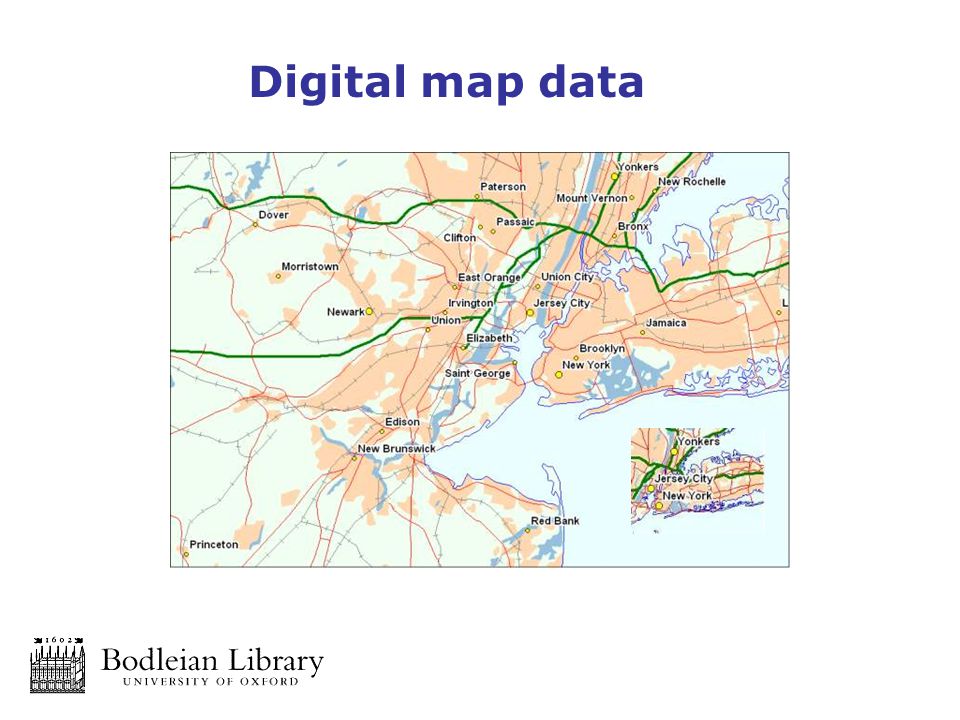
http://bell.lib.umn.edu/hist/ James Ford Bell Library

16
Other good examples Environment Agency http://www.environment-agency.gov.uk/ National Library of Scotland Map Library http://www.nls.uk/maps/index.html David Rumsey Collection http://www.davidrumsey.com/

17
Other good examples Map history site (including links to images) http://www.maphistory.info/ Ancient world mapping centre http://www.unc.edu/awmc/ Euratlas: history and geography of Europe http://www.euratlas.com/
 Ancient world mapping centre Euratlas: history and geography of Europe")
18
EDINA Digimap http://edina.ac.uk/digimap Free access to modern and historic Ordnance Survey mapping Maps can be viewed online, printed or saved and downloaded for use in digital mapping programs Use is restricted to personal, teaching and research and limited academic publishing

19
EDINA Digimap © Crown Copyright

20
EDINA Digimap Source: Digimap http://edina.ac.uk/digimap © Crown Copyright

21
EDINA Digimap Source: Digimap http://edina.ac.uk/digimap © Crown Copyright

22
OS Open data Free Range of scales and data products available Includes large scale vector data

23
Edina UK Borders Uk digitised boundary data Modern census borders Modern and historical county boundaries http://edina.ac.uk/ukborders/

24
Digital map data in the Bodleian Great Britain, Europe and World datasets Free of charge for use in the Map Room Can be extensively modified and adapted to suit specific needs

25
Digital map data

27
Sources of digital map data Bartholomew digital data 3 World datasets Europe dataset Great Britain dataset London dataset DIGIMAP digital Ordnance Survey data UKBorders historical boundary data Global Insight World data

28
Maps and data – using a GIS A GIS (Geographic Information System) is a computer program which enables the creation, editing and viewing of spatial data Spatial data relates to real world objects – places, roads, rivers, trees… A GIS is spatially aware – it works with real world co-ordinates, distances and areas … and it creates maps!
 is a computer program which enables the creation, editing and viewing of spatial data Spatial data relates to real world objects – places, roads, rivers, trees… A GIS is spatially aware – it works with real world co-ordinates, distances and areas … and it creates maps!")
29
Maps and data – using a GIS MapInfo ArcGIS ArcGIS online http://www.arcgis.com/home/webmap/viewer.html

30
MapInfo - a GIS and digital mapping tool “The World’s premier desktop mapping application” MapInfo Professional is a powerful Microsoft® Windows®- based mapping and geographic analysis application; Designed to easily visualize the relationships between data and geography; Enables discovery of trends hidden in spreadsheets and charts; Performs powerful data analysis and calculations; Creates custom maps and content for analysis Works well with existing IT infrastructure Designed and tested with Windows operating systems; Imports and exports data in a wide variety of formats

31
MapInfo - a GIS and digital mapping tool MapInfo is a professional and fully functional mapping program It is site-licensed by the University It can be used by all Departments and University members It can be installed on any desktop or laptop PC MapInfo workstations are available in the Bodleian Map Room (temporarily in Duke Humfrey Reading Room)
")
32
Mapping spatial data using a GIS A GIS is a database management program – just like Access Data is stored as records in tables – just like Access A GIS can interpret spatial referencing and display data as a map

33
Adding your own data Source: http://www.getty.edu/research/conducting_research/vocabularies/tgn/index.html

34
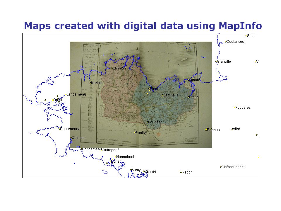
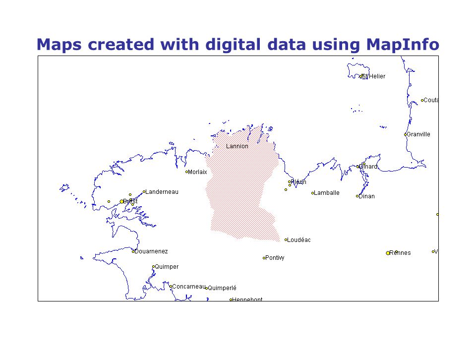
Maps created with digital data using MapInfo

38
Create high-quality cartography

39
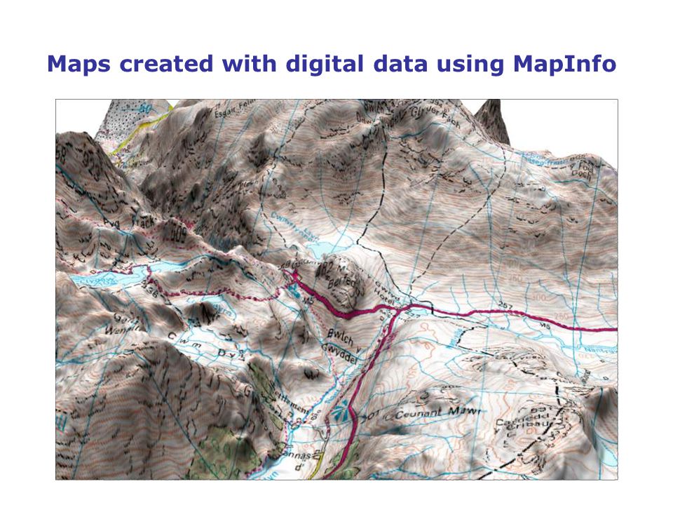
Maps created with digital data using MapInfo

42
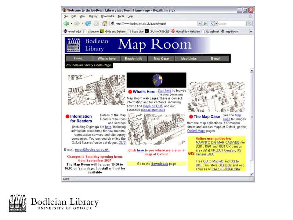
Where to seek assistance in creating your digital maps (1) Go online for online tutorials via the Bodleian Map Room website at: http://www.bodley.ox.ac.uk/guides/maps
 Go online for online tutorials via the Bodleian Map Room website at:")
43
Where to seek assistance in creating your digital maps (2) Duke Humfrey Reading Room Bodleian Library Tel: 01865 (2)87300 Email: maps@bodleian.ox.ac.ukmaps@bodleian.ox.ac.uk
 Duke Humfrey Reading Room Bodleian Library Tel: (2)")
44
Where to seek assistance in creating your digital maps (3) Here’s a quick introduction Fuller courses will be available shortly Only limited data available You can access this data via SOLO at http://solo.bodleian.ox.ac.uk
 Here’s a quick introduction Fuller courses will be available shortly Only limited data available You can access this data via SOLO at")
Similar presentations


![[ Digimap ] The internet map collection for UK academia Dr Hugh Buchanan User Support Co-ordinator Data Library, University of Edinburgh.](/13/3887664/big_thumb.jpg "[ Digimap ] The internet map collection for UK academia Dr Hugh Buchanan User Support Co-ordinator Data Library, University of Edinburgh.>")


