Download presentation
Presentation is loading. Please wait.

1
South Asia Notes #1

2
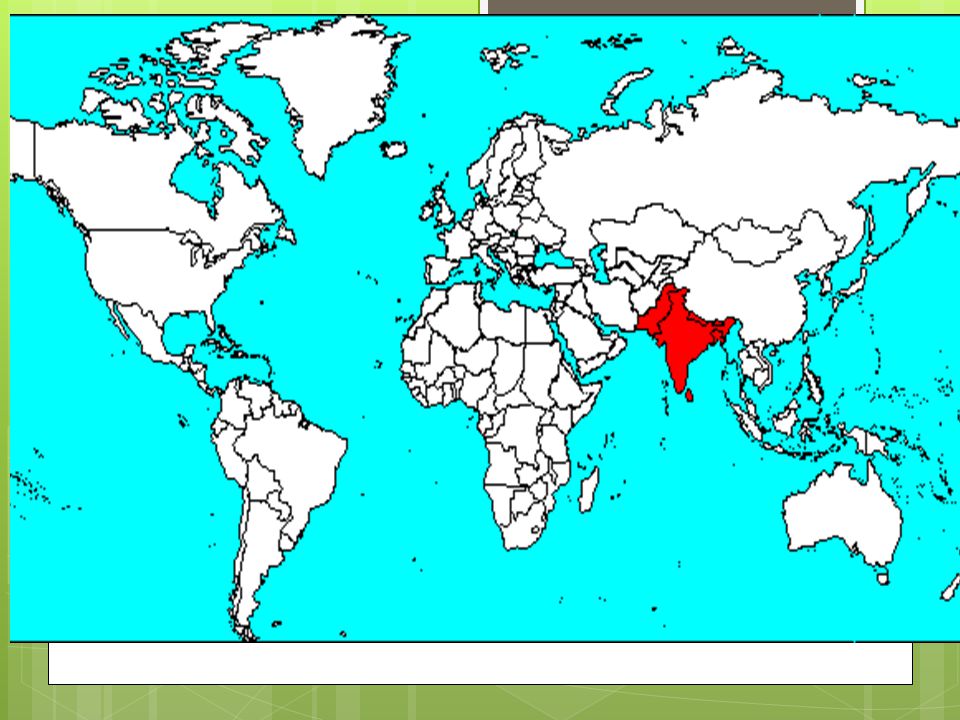
South Asia Region in the southern part of the continent of Asia. Seven countries of South Asia have great cultural and religious diversity they include: India, Pakistan, Bangladesh, Bhutan, Maldives, Nepal, and Sri Lanka.

4
Three of the World’s most populous countries are in South Asia (India, Pakistan, Bangladesh) 1China1,336,718,015 2India1,189,172,906 (7 th area) 3United States 313,232,044 4Indonesia 245,613,043 5Brazil 203,429,773 6Pakistan 187,342,721 7Bangladesh 158,570,535 8 Nigeria 155,215,573 9Russia 138,739,892 10 Japan 126,475,664 TOTAL World Population6.9 billion (9.25 by 2050) *Courtesy U.S. Census Bureau, December 31, 2011. (India is projected to have the highest population in the World by 2050, 1.65 billion)
.")
5
Seven Countries of South Asia Tear drop island Check it out! The Maldives comprise an archipelago (island groups)
.")
6
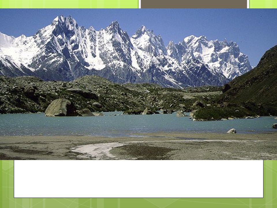
Geographic Features Himalayan Mountains (Mt. Everest, world’s tallest peak in the heart) Countries of Nepal and Bhutan within. The Hindu Kush mountains rugged barrier btw Pakistan and Afghanistan. Site of many historical bloody battles-fought over passage ways Thar Desert (straddles NW India, SE Pakistan) Three rivers systems Indus (thru Pakistan), Ganges (India), and Brahmaputra (Bangladesh)
 Countries of Nepal and Bhutan within. The Hindu Kush mountains rugged barrier btw Pakistan and Afghanistan. Site of many historical bloody battles-fought over passage ways Thar Desert (straddles NW India, SE Pakistan) Three rivers systems Indus (thru Pakistan), Ganges (India), and Brahmaputra (Bangladesh).")
7
South Asia The world’s highest mountains, the Himalayas, form the northern boarder of India The Himalayas isolate South Asia from the rest of Asia, serving as a border!

8
The Himalaya mountains are the result of a landmass collision between sub-continent India from the south and China/Tibet from the North!

10
No Indian has climbed all 14 of the 8,000-metre peaks so far, because of political barriers. Two are in Pakistan, three more straddle the border between Pakistan and China – and one, lies between China and Tibet. Due to political tension btw India & the countries, Indian climbers often deterred hard to get a visa. Indians, especially women, have made a name for themselves as intrepid adventurers and climbers.

11
K2, located on the Pakistan-Chinese border, is the 2nd highest mountain in the world; Pakistan's highest mountain; and the world's 22nd most prominent mountain. http://www.youtube.com/watch?v=2fQ-8eS-K6I http://www.youtube.com/watch?v=2fQ-8eS-K6I The name K2 was given in 1852 by British surveyor T.G. Montgomerie with "K" designating the Karakoram Range and "2" since it was the 2nd peak listed. K2 is nicknamed the "Savage Mountain" for its severe weather. It is typically climbed in June, July, or August. K2 has never been climbed in winter!

12
Western Ghats were a barrier to trade development, hard for traders to reach the land!

13
Western Ghats are a biodiversity hot spot. Rolling hills that stretch from the north of Mumbai to the southern tip of India. Contains a large proportion of the country's plant and animal species; many of which are only found here and nowhere else in the world! Western Ghats are a biodiversity hot spot. Rolling hills that stretch from the north of Mumbai to the southern tip of India. Contains a large proportion of the country's plant and animal species; many of which are only found here and nowhere else in the world!

14
Western Ghats About one-third of the plants, almost half the reptiles, and more than three-fourths of the amphibians known in India are found here.

15
Western Ghats SW Ghats home to the largest population of Asian elephants, as well as Bengal tigers, sloth bears, and much more. Mounting threats The Western Ghats were once covered in dense forests. Today, a large part of the range has been logged or converted to agricultural land for tea, coffee, rubber and oil palm, or cleared for livestock grazing, reservoirs and roads.

16
Resources Farming #1 economic activity. Delta soil in Bangladesh so rich, farmers can plant and harvest THREE crops of rice a year.

17
South Asia’s energy is generated from its mineral resources! India: 4 th in world coal production Has enough petroleum to supply half its oil needs Uranium deposits provide fuel for nuclear energy (weapons) Large iron-ore deposits found in Deccan Plateau (middle of India). Diamonds India supplies most of the world’s mica, key component for electrical equipment (cellphones). Pakistan: coal, gas, oil and uranium Sri Lanka variety of gem stones (sapphires and rubies)
 Large iron-ore deposits found in Deccan Plateau (middle of India). Diamonds India supplies most of the world’s mica, key component for electrical equipment (cellphones). Pakistan: coal, gas, oil and uranium Sri Lanka variety of gem stones (sapphires and rubies).")
18
Climate, Monsoons, cyclones! South Asia has six main climate zones. Tropical wet zone along western and eastern coasts of India and Bangladesh Climate varies in South Asia, but the region is greatly affected by monsoons, or seasonal winds. Dry winds in winter blow from NE and wet winds come from the southwest in summer (June-Sept.)
.")
19
Monsoons (means season in Arabic) Heavy rainfall comes in summer- crucial to life on the subcontinent! Monsoons are essential for crops in the region, since farming is the major economic activity. Farmers plant seeds before monsoon season, seeds take root in dry soil, grow because of the rains.

20
Cyclones cyclone, Most extreme weather pattern of South Asia is the cyclone, violent storm with fierce winds and heavy rains. Violent tropical storms are called cyclones in the Indian Ocean, typhoons in NW Pacific and Hurricanes in the Atlantic. Cyclones most destructive in Bangladesh, because high waves can swamp large parts of the country. 1970 cyclone killed est. 500,000!

Similar presentations