Download presentation
Presentation is loading. Please wait.

1
Weather Discussion January 4

3
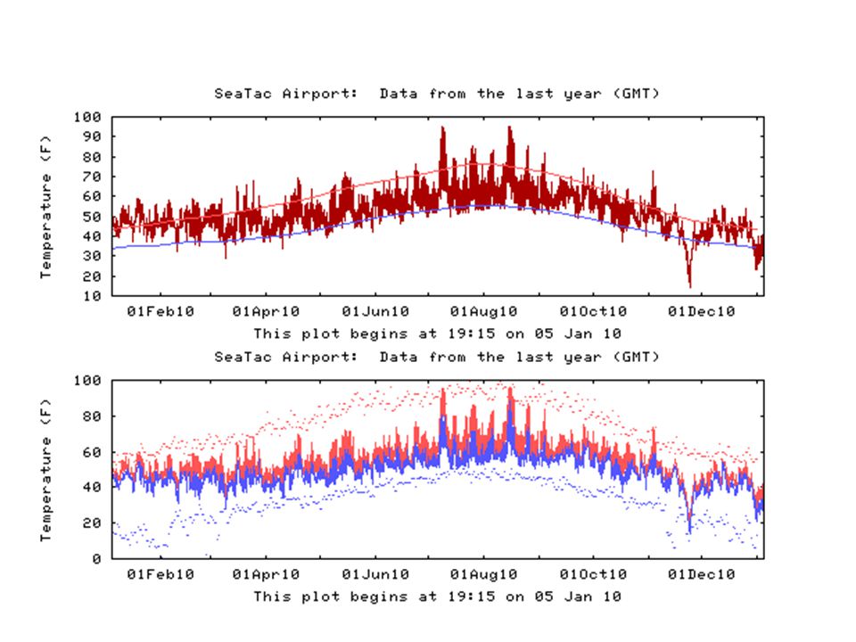
Year in Review SEATAC HAD THE WARMEST AVERAGE January TEMPERATURE EVER WITH 47.0 DEGREES BREAKING THE PREVIOUS RECORD IN 2006 OF 46.6 DEGREES. OLYMPIA HAD THE SECOND WARMEST JANUARY EVER AT 43.7 DEGREES AND QUILLAYUTE NEAR FORKS ALSO HAD THE SECOND WARMEST JANUARY EVER AT 46.3 DEGREES.

4
Year in Review SPRING...COOL AND WET. AVERAGE WESTERN WASHINGTON TEMPERATURES IN MAY AND JUNE RANGED BETWEEN 1 AND 3 DEGREES BELOW NORMAL WHILE PRECIPITATION WAS ONE TO 2.5 INCHES ABOVE AVERAGE. SEATAC AIRPORT DID NOT REACH 75 DEGREES OR GREATER UNTIL JUNE 23RD...THE LATEST EVER.

5
Year in Review TWO HEAT SUMMER WAVES WITH HIGH TEMPERATURES IN THE 90S...ONE IN JULY AND THE OTHER IN AUGUST. SEATAC AIRPORT AVERAGES ONLY THREE DAYS PER YEAR OF 90 DEGREES OR ABOVE - 2010 HAD SIX DAYS IN THE 90S AND 21 DAYS OF 80 OR BETTER WITH AN AVERAGE OF 25 DAYS PER YEAR.

6
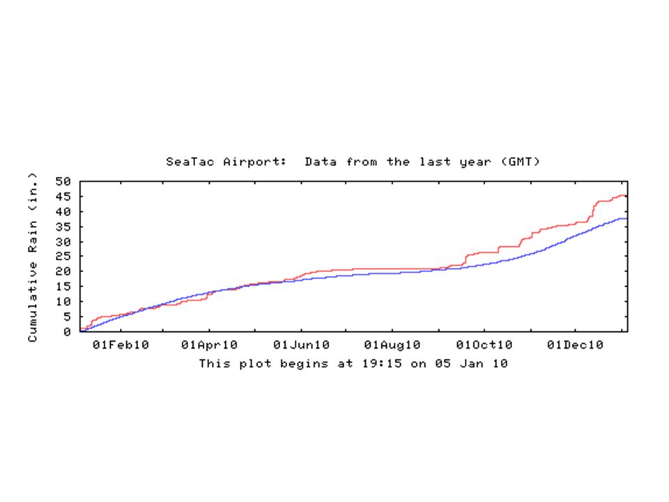
SEATAC AIRPORT HAD ITS THIRD WETTEST SEPTEMBER EVER WITH 4.80 INCHES - JUST OVER THREE INCHES ABOVE NORMAL. In NOVEMBER SEATAC AIRPORT HIT 74 DEGREES ON THE 3RD AND THEN ON THE 24 TH PLUNGED TO 14 - A 60 DEGREE RANGE IN ONE MONTH - THE GREATEST EVER ON RECORD

8
Last Five Days: Low Dewpoints and Lots of Frost Dewpoint

10
Recent Evolution of Equatorial Pacific SST Departures ( o C) Longitude Time
 Longitude Time")
11
Niño Region SST Departures ( o C) Recent Evolution The latest weekly SST departures are: Niño 4 -1.5ºC Niño 3.4 -1.5ºC Niño 3 -1.5ºC Niño 1+2 -0.6ºC
 Recent Evolution The latest weekly SST departures are: Niño ºC Niño ºC Niño ºC Niño ºC")
12
SST Departures ( o C) in the Tropical Pacific During the Last 4 Weeks During the last 4-weeks, SSTs were at least 1.0°C below average between 160°E and the South American coast, with departures more than 2.0°C below average in some areas.
 in the Tropical Pacific During the Last 4 Weeks During the last 4-weeks, SSTs were at least 1.0°C below average between 160°E and the South American coast, with departures more than 2.0°C below average in some areas.")
13
Pacific Niño 3.4 SST Outlook Figure provided by the International Research Institute (IRI) for Climate and Society (updated 14 December 2010). Nearly all models indicate that La Niña (Niño-3.4 SST anomalies -0.5°C or less) will peak during the Northern Hemisphere Winter 2010-11. La Niña is expected to last at least into the Northern Hemisphere spring 2011.
 will peak during the Northern Hemisphere Winter La Niña is expected to last at least into the Northern Hemisphere spring")
14
The seasonal outlooks combine the effects of long-term trends, soil moisture, and, when appropriate, the ENSO cycle. TemperaturePrecipitation U. S. Seasonal Outlooks January - March 2011

16
U.S. Temperature and Precipitation Departures During the Last 30 and 90 Days 30-day (ending 1 Jan 2011) temperature departures (degree C) 90-day (ending 2 Jan 2011) % of average precipitation 90-day (ending 1 Jan 2011) temperature departures (degree C) Last 30 Days Last 90 Days 30-day (ending 2 Jan 2011) % of average precipitation
 temperature departures (degree C) 90-day (ending 2 Jan 2011) % of average precipitation 90-day (ending 1 Jan 2011) temperature departures (degree C) Last 30 Days Last 90 Days 30-day (ending 2 Jan 2011) % of average precipitation.")
Similar presentations


 Pacific Decadal Oscillation Annular modes.>")


 September 2008 summary: Congress has made little progress on the federal.>")


>")