Download presentation
Presentation is loading. Please wait.

1
World Geography Identifying Landforms & Their Effect on World History

2
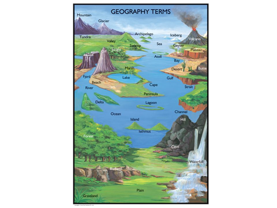
What is Geography? Geography= the study of the physical features of the earth and of human activity as it is affected by these physical features Landform= a physical/natural feature of the earth’s surface – rivers, mountains, islands, oceans, peninsulas, etc.

4
River River= a large natural stream of water emptying into an ocean, lake, or other body of water – the first civilizations developed along rivers (Mesopotamia, Egypt, Indus, & Yellow River) – rivers provide irrigation, drinking water & transportation
 – rivers provide irrigation, drinking water & transportation")
5
River Valley Civilizations

6
Indus River in Pakistan

7
Yangtze and Huang He (Yellow) River in China
 River in China")
9
Island Island= a piece of land surrounded by water – limited space/resources need to colonize or conquer other lands – limited trade (forces trade with other nations) – easy to defend from intruders – difficult to unit under one ruler/government
 – easy to defend from intruders – difficult to unit under one ruler/government")
10
Great Britain

11
Archipelago Archipelago= a group or chain of islands – promote trade and cultural diffusion

12
Japan

13
Indonesia

14
Gulf Gulf= a large area of a sea or ocean partially enclosed by land

15
Bay Bay= a body of water forming an indent (or pocket) in the shoreline – smaller than a gulf
 in the shoreline – smaller than a gulf")
16
Bay

17
Cape Cape= a piece of land jutting (poking out) into the sea or some other large body of water
 into the sea or some other large body of water")
18
Cape of Good Hope

19
Delta Delta= form as rivers empty their water and sediment (sand/rocks) into another body of water such as an ocean – often triangular in shape – deposits of rich silt provide very fertile farmland
 into another body of water such as an ocean – often triangular in shape – deposits of rich silt provide very fertile farmland")
20
Delta

21
Sea Sea= a large body of salt water completely or partially enclosed by land – highways of trade – barrier to both cultural diffusion and invasion – rich source of food and other resources (minerals and oil)
")
23
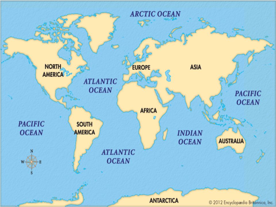
Ocean Ocean= the huge body of salt water that covers almost 75% of the earth’s surface – Atlantic Ocean – Pacific Ocean – Indian Ocean – Arctic Ocean

25
Mountain Mountain= a natural elevation (rise) of the earth's surface having considerable mass, usually steep sides, and a height greater than that of a hill – act as barriers to invasion and cultural diffusion – little farm land terrace farming
 of the earth s surface having considerable mass, usually steep sides, and a height greater than that of a hill – act as barriers to invasion and cultural diffusion – little farm land terrace farming")
26
Greek City-States

27
Himalayan Mountains

28
Terrace Farming

29
Valley Valley= an elongated lowland between ranges of mountains, hills,, often having a river running along the bottom

31
Plain Plain= a wide, flat, usually treeless area of land – fertile soil, easy to reach, good for road building and farmland – hard to defend and provides no natural protection from the elements Steppes= a large area of flat grassland Savanna= a grassy plain in tropical and subtropical regions, with few trees

33
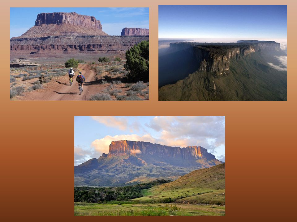
Plateau Plateau= an elevated, level area of land – “tableland”

35
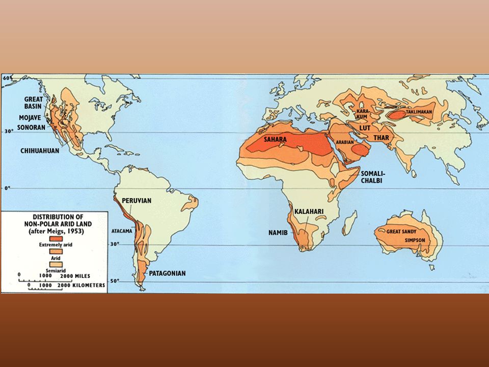
Desert Desert= a dry, often sandy region of little rainfall, extreme temperatures, and little vegetation – lack of water and resources – barrier to invasion and cultural diffusion

37
Sahara Desert in Africa

38
Gobi Desert in China

39
Strait Strait= a narrow waterway joining two larger bodies of water

40
Bosporus Strait Strait of Gibraltar

41
Constantinople on the Bosporus Strait

42
Isthmus Isthmus= a narrow strip of land connecting two larger masses of land – Canals (man-made waterways) are often built through isthmuses
 are often built through isthmuses")
44
Isthmus of Suez Isthmus of Panama

45
Peninsula Peninsula= a piece of land that projects into a body of water – water on three sides – connected to the mainland by an isthmus

48
Lake Lake= a body of (usually fresh) water surrounded by land
 water surrounded by land")
49
Loch Ness

50
Lake Victoria

Similar presentations