Download presentation
Presentation is loading. Please wait.

2
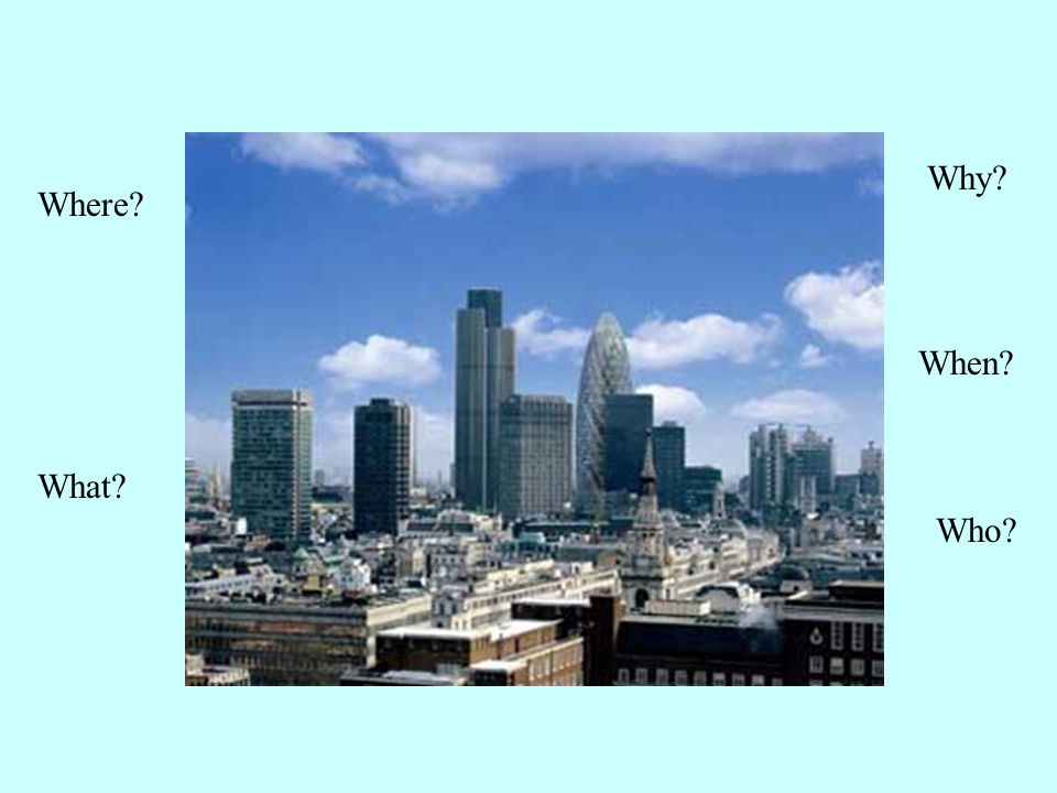
Where? What? Why? When? Who?

3
Key questions What are the different areas found in a MEDC city? How has Swansea’s CBD changed? What is the land used for in Swansea CBD? Where are these land uses found in Swansea’s CBD?

4
What does this show? A – CBD B – Manufacturing area (the twilight zone) C – Old inner city D – Medium class residential (interwar housing) E – High class residential outer suburbs
 C – Old inner city D – Medium class residential (interwar housing) E – High class residential outer suburbs.")
5
Burgess land-use zone model A – CBD B – Inner city Manufacturing area C – Inner city housing (the twilight zone) D – Inner suburbs - Medium class residential (interwar housing) E – Outer suburbs - High class residential (Modern houses)
 D – Inner suburbs - Medium class residential (interwar housing) E – Outer suburbs - High class residential (Modern houses)")
6
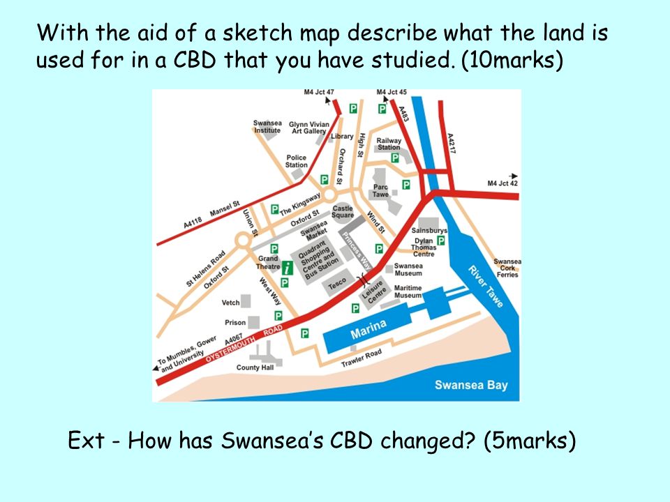
Swansea How has Swansea’s CBD changed? Housing shops factories roads other services e.g. leisure

7
Old South Dock & Spontex factory – Marina 1980s Old Gasworks – Tesco 1990s 1940s bomb damaged centre 1960s City Centre Shops – redeveloped Old North Dock – Parc Tawe shops and leisure 1985 Prince of Wales Docks – 2004 SA1 - Swansea Waterfront Congestion around Tawe bridges – E/W Fabian Way Quadrant Centre County Hall Wind Street - Café Quarter Swansea High Street 2014 ‘mixed Urban Village use’ St. David’s Shopping Centre demolished 2013 – extend Quadrant?

8
Swansea City AFC left the Vetch Field Now the ‘Vetch Veg’ allotment for inner city community Future development? Moved to Liberty Stadium purpose built About 2Kms north towards Enterprise Park

9
The docks have changed! – they had to.

10
The South Dock has been changed to the Marina District

11
The North Dock was filled in to become Parc Tawe A retail park found in the far east of the CBD along the River Tawe. Much of this is comprehensive redevelopment

12
The Prince of Wales Dock is being redesigned as SA1 -Swansea Waterfront -With some protected landmarks -New housing -And new offices

13
Swansea was heavily bombed in WWII The city centre had to be largely rebuilt

14
The City Centre around Castle Square A lot of concrete was used – back in the 1960s Now it is being redeveloped

15
What is the land used for in Swansea CBD?

16
The main retail area is located in the centre of the CBD, along Oxford Street which is pedestrianised and home to national chain stores.

17
Just south of Oxford Street is Swansea Market – Wales largest indoor market and the Quadrant which is a large indoor shopping centre with big name chain and department stores such as Debenhams.

18
St. David’s Centre Completed in 1982, the complex was unsuccessful, in terms of filling its outlet spaces and retaining customers. Demolished in Autumn 2013. Now left as a car park with the Quadrant Centre behind it.

19
What is the land used for in Swansea CBD? Wind Street Museum / Leisure Quarter

20
Wind Street is being retained as the café quarter –narrow streets are common in the older areas of the CBD It is located in the East of the CBD, surrounding the main retail area. Salubrious Place is a new hotel and Leisure complex at the end of Wind Street.

21
The other main entertainment area is found on the Kingsway, north of Oxford Street (Retail). Here you can find bars, restaurants and clubs.

22
Leisure To the south of the Quadrant and Tesco’s is the leisure and culture area with the National Waterfront Museum. As well as the popular 1970s Leisure Centre - closed 2003 Reopened in March 2008 following refurbishment now called ‘The LC’

23
What is the land used for in Swansea CBD?

24
Office districts The main office area is located in the north of the CBD along the main roads of Mansel and Orchard street. Mix of low rise and high rise offices. Mansel Street Oldway Centre - 36 Orchard Street, Swansea

25
The Boulevard The main east west road through the city centre (Fabian Way to Oystermouth Road) is being redesigned. 2014
26
With the aid of a sketch map describe what the land is used for in a CBD that you have studied. (10marks) Ext - How has Swansea’s CBD changed? (5marks)
 Ext - How has Swansea’s CBD changed. (5marks).")
27
Deprivation

28
Inner city

29
Urban fabric

30
Swansea

31
Narrow roads

32
Terraced

33
Landore copper works

34
Townhill

35
Segregation

36
Liberty Stadium

37
Hafod

38
Unemployment

39
St. Thomas Ward

40
Education

41
Swansea Vale

42
Housing tenure

43
Alberto Culver

44
Sketty / Uplands / Brynmill

45
Age

46
Ethnic minority

47
Castle

48
Council housing

49
Suburbs

50
High tech industry

51
M4 Motorway

52
Healthcare

53
SA1 development

54
Detached

55
Grants

56
Evening post newspaper press

57
Affluent

58
Religion

59
Owner occupied

Similar presentations