Download presentation
Presentation is loading. Please wait.

1
Physical Geography of United States and Canada

2
Landforms Mountains on east and west edges of both United States and Canada Rocky mountains link the U.S. and Canada – from New Mexico to Alaska Mountains formed because of collisions between tectonic plates

3
Rocky Mountains

4
Landforms (con’t) Dry basins and plateaus found between the Pacific Ranges and the Rocky Mts. Colorado Plateau was eroded by the Colorado River to form the Grand Canyon Great Basin includes Death Valley – the hottest and lowest place of the U.S.

5
Death Valley

6
Great Plains located east of the Rocky Mts. Extend 400 miles across center of USA Grasses, very little trees, ideal for farming, little change in elevation

7
Great Plains

8
Eastern Mts. include the Canadian Shield and Appalachian Mts. Canadian Shield is a gigantic core of rock that anchors N.America; makes up the eastern half of Canada and NE United States Appalachian Mts. Extend from Quebec to central Alabama

9
Canadian Shield ( from space )
")
10
Canadian Shield Canadian Shield

11
Coastal lowlands are east and south of the Appalachian Mts. Islands –Manhattan Island - @ mouth of Hudson River; major world economic center –Hawaii – formed by volcanic mountains in Pacific Ocean –Canada’s islands – Newfoundland, Prince Edward Island, Cape Breton Island – in East; Vancouver Island – in West

12
Manhattan Island

13
Water In North America, the high ridge of the Rockies is called the Continental Divide –A divide is a high point or ridge that determines the direction that rivers flow –Some rivers have their headwaters, or source, in the Rockies –Many tributaries, or brooks, rivers, and streams, flow into these rivers

14
Rivers Mississippi River is N.America’s longest river; goes from Minnesota to the Gulf of Mexico St. Lawrence River is one of Canada’s most important rivers; it links cities of Quebec, Montreal, and Ottawa

15
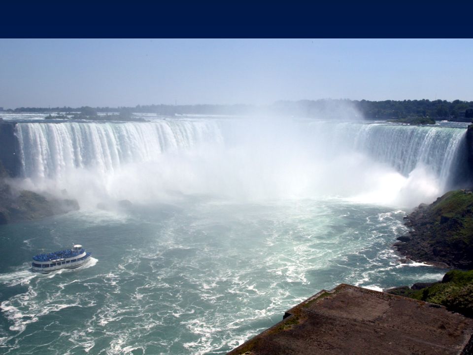
Fall Line The Fall Line marks the place where the higher land of the Piedmont drops to the lower Atlantic Coastal Plain Rivers become rapids and waterfalls along the line Cities of Philadelphia, Baltimore, and Washington D.C. are along the fall line Niagara Falls (along US and Canada border) used for hydro-electric power
 used for hydro-electric power.")
Similar presentations


 Coastal Range 2) Basin & Range 3) Rocky Mountains 4) Great Plains 5) Interior Lowlands 6) Canadian Shield 7) Appalachian.>")


