Download presentation
Presentation is loading. Please wait.

1
Brazil

2
Maps

3
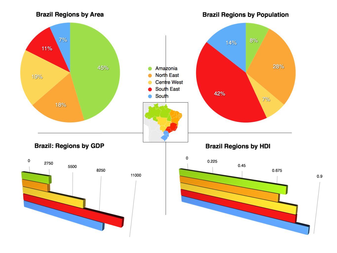
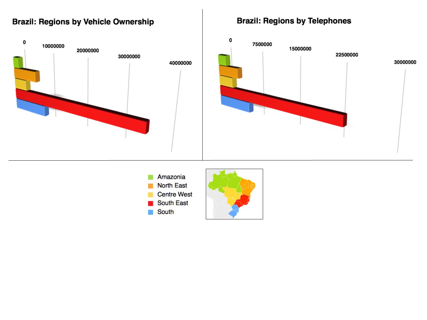
Amazonia North East Centre West South East South Regions of Brazil Please be aware of the colour coding throughout this powerpoint. The colours of the geographical regions of Brazil found on this map are reflected in graphs, pie charts, lettering and in the background colour of text areas

4
Brazil You will also see superimposed on the various maps of Brazil this purple shape which indicates the economic core of the country. Watch out for the purple spot

5
Rainfall and Temperature Convert the 0 F to 0 C

6
Brazil: Natural Vegetation types

7
Brazil: Physical Landscape

8
Brazil: Land use

9
Brazil: Economic Activity Agriculture Industry Mines & Deposits

10
Increasing Population Density Brazil: Population Density

11
Brazil:Cargo Flows

12
Brazil: Railways

13
Brazil: Tourist Attractions

14
Graphs

18
End

Similar presentations