Download presentation
Presentation is loading. Please wait.

1
AFRICAN PHYSICAL GEOGRAPHY

2
Introduction Massive continent, 2 nd largest. Large, complex, and often misunderstood Equally in North and South hemisphere

3
The Nile River Longest River in the World White Nile and Blue Nile meet in Sudan to form the Nile River Flows northward, emptying in the Mediterranean Sea Without the annual flooding in Egypt land would not be arable

4
The Nile Lower Nile Upper Nile THE NILE RIVER

5
SUEZ CANAL Located in Egypt Divides the mainland Egypt from the Sinai Peninsula Connects the Mediterranean Sea with Red Sea One third the distance that it was before

6
SUEZ CANAL

7
SAHARA DESERT Sahara Desert is the largest desert in the world Why 1. On the Tropic of Cancer 2. Permanent high pressure system 3. Rain Shadow by Atlas Mountains

8
SAHARA DESERT There are two main types of landscape in the Sahara – Erg – sand dunes – Reg – gravel covered plain

9
SAHEL Semi-arid region just south of the Sahara Dry grasslands with scattered trees Desertification is a growing problem – Growing of the desert caused by climate changes and over grazing

10
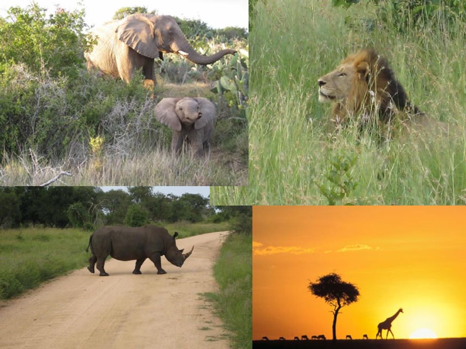
SAVANNAS Tropical grasslands with scattered trees and shrubs This is where many of the African Safaris take place Large populations of wildlife Serengeti – means “endless plains” – Largest mammal migration and game reserve

12
Tsetse Fly The Good, the Bad, and the Ugly Bad – Carries a disease the make its victims (humans and domesticated animal) have “Sleeping Sickness” Good – Wildlife are immune. Humans and livestock avoid some of these areas creating a natural game preserve

13
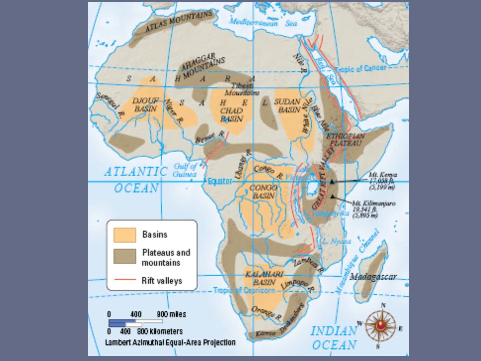
A Vast Plateau Huge plateau covers most of Africa (1,000 ft. above sea level). Basins - huge depressions on plateau (Chad, Sudan, Congo Basins). Water collects here. Plateaus separated by escarpments—steep slope with flat plateau on top
. Basins - huge depressions on plateau (Chad, Sudan, Congo Basins). Water collects here. Plateaus separated by escarpments—steep slope with flat plateau on top.")
15
CONGO RIVER BASIN Located near the equator in central and western Africa This is where the majority of Africa’s tropical rain forests are located

16
The Great Rift Valley Located in Eastern Africa Largest Rift Valley in the world Caused by the diverging Indian Tectonic Plate Surrounding lakes and rivers are very deep

17
Mount Kilimanjaro: Africa’s highest mountain at 19,341 feet Located on the Equator in Tanzania near Kenya Formed by volcanic activity from the Great Rift Valley Only year round snow capped mountain in Africa – Known in Swahili as “Shining Mountain”

18
Lake Victoria Located in the middle of the Great Rift Valley of Eastern Africa It is a shallow depression Largest lake in Africa

19
Victoria Falls Forms a border between Zambia and Zimbabwe Largest waterfall in the world

20
Okavango Swamp/River Worlds largest inland river delta River is absorbed by the Kalahari Desert Large game reserve in the desert

21
Kalahari Desert Largest Desert in southern Africa Has many oasis which makes it habitable Oasis – vegetated areas in a desert caused by fresh water springs

22
CAPE OF GOOD HOPE Southern most point of Africa Converging currents from the Indian and Atlantic Oceans make waters dangerous for sailing but great wildlife South African Penguins Only Place in the world Great Whites breach

Similar presentations
>")


 What might cause people to plant or graze their animals.>")


