Download presentation
Presentation is loading. Please wait.

1
Types of Maps Types of Maps

2
Map Contents Take out your notes!
Key/Legend: explains symbols or colors used on the map. Scale Scale: allows the estimation of distances. Compass Rose: indicates which direction is north, south, east and west.

3
Types of Maps Cartographer: a person who studies and makes maps
Climate Maps Economic or Resource Maps Physical Maps Political Maps Road Maps Topographic Maps Thematic Maps Cartographer: a person who studies and makes maps

4
Climate Maps Climate maps are maps that describe general weather conditions of an area or region such as: Rainfall Snowfall Temperature Different colors are used to differentiate climate or precipitation zones.

5
Economic or Resource Map
Economic or resource maps show resources specific to an area. Cartographers use symbols, as seen in the key, to show the locations of natural resources or economic activities. For example, wind turbines on a map of Michigan can tell you that wind energy is generated in that area.

6
Physical Map Physical maps illustrate the physical features of an area, such as the mountains, rivers, ad lakes. The water is usually shown in blue. Colors are used to show relief. Relief - differences in land elevations.

7
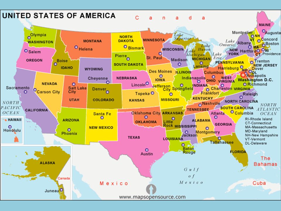
Political Map Political Maps show state and national boundaries by using differing colors. They also show capitals and major cities. A capital city is usually marked with a star within a circle.

8
Road Maps Road Maps show major, and sometimes minor, highways, roads, airports, railroad tracks, cities, and other points of interest in an area. People use road maps to plan trips and for driving directions.

9
Topographic Map Topographic maps include contour lines or color differentiation to show the shape and elevation of an area. Lines or colors that are close together indicate steep terrain, and lines or colors that are far apart indicate flat terrain.

10
Thematic/Electoral Map
Thematic Maps are designed to show specific data. This Electoral Map is designed to show the viewer the states that have the most electoral votes, and who vote democrat and who voted republican in the 2004 election.

11
Everyday Maps Barefoot World Atlas Google Maps Google Earth

12
Class/Take-Home Activity
In-Class: Color Label States Oceans Lakes Capitals Include Title Legend/Key Compass At Home: Study U.S. States and Capitals If you have questions, this PowerPoint will be posted on the classroom website. Due Wednesday!

Similar presentations