Download presentation
Presentation is loading. Please wait.

1
The European Digital Archive of Soil maps: The Soil Maps of Africa Senthil Selvaradjou and Luca Montanarella EUROPEAN COMMISSION JOINT RESEARCH CENTRE Institute for Environment and Sustainability

2
European Digital Archive of Soil Maps Digitize existing soil maps available in a number of archives (ISRIC, FAO, WOSSAC, IRD,……) Make this information available to all users and interested stakeholders Permanently store rare and valuable soil data in a centralized system for future uses Georeference the archived digital soil maps Vectorize the raster files as input in GIS systems
 Make this information available to all users and interested stakeholders Permanently store rare and valuable soil data in a centralized system for future uses Georeference the archived digital soil maps Vectorize the raster files as input in GIS systems")
3
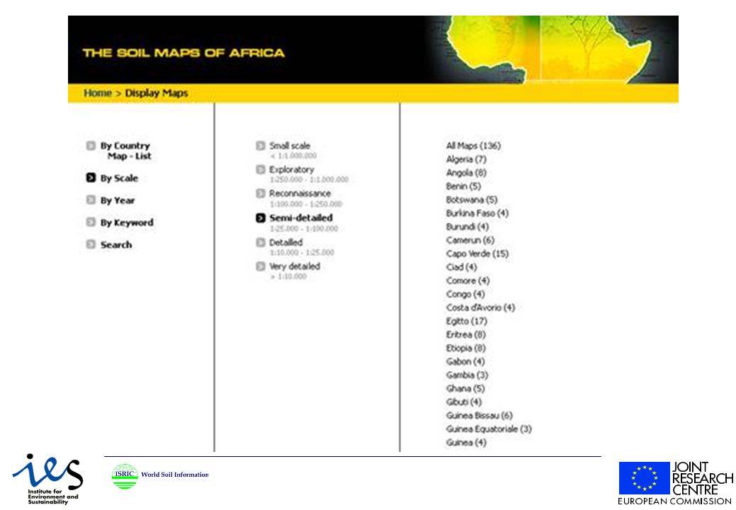
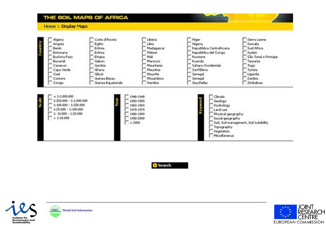
The Institute of Environment and Sustainability (IES) of the European Commission (Italy) and ISRIC – World Soil Information initiated the European Digital Archive of Soil Maps (EuDASM) in October 2004, by conserving the information on existing soil maps at regional-, national and global scale. EuDASM aims to support the fast- developing, thematic, digital soil mapping strategies pertaining to soil protection. EuDASM - Volume I: SOIL MAPS OF AFRICA contains More than 2000 soil and related maps in digital format from African countries at different scale and coverage levels: continental level (overall coverage - 82, Northern Africa – 15; Southern Africa – 15; Eastern Africa –30; Western Africa – 15; ), Algeria (25), Angola (12), Benin (15), Botswana (47), Burkina Faso(37), Burundi (1), Cameroon (66), Cape Verde (10), Central African Republic (12), Chad (70), Comoros (3), Congo-DR (6), Congo PR (9), Côte dIvoire (39), Egypt (75), Ethiopia (49), Gabon (13), Gambia (20), Ghana (76), Guinea (29), Kenya (343), Lesotho (17), Liberia (4), Libya (19), Madagascar (42), Malawi (10), Mali (33), Morocco (23), Mauritania (12), Mauritius (7), Mozambique (48), Namibia (8), Niger (22), Nigeria (180), Reunion (2), Rwanda (13), Senegal (21), Seychelles (4), Sierra Leone (21), Somalia (18), South Africa (67), Saint Helena (9), Sudan (27), Swaziland (19), Tanzania (98), Togo (40), Tunisia (26), Uganda (11), Zambia (54), Zimbabwe (64) Maps are presented full-scale, with thumbnail pictures and metadata to permit user- friendly navigation The maps in EuDASM - Volume I are holdings of ISRICs World Data Centre for Soils (http://www.isric.org/).
, Algeria (25), Angola (12), Benin (15), Botswana (47), Burkina Faso(37), Burundi (1), Cameroon (66), Cape Verde (10), Central African Republic (12), Chad (70), Comoros (3), Congo-DR (6), Congo PR (9), Côte dIvoire (39), Egypt (75), Ethiopia (49), Gabon (13), Gambia (20), Ghana (76), Guinea (29), Kenya (343), Lesotho (17), Liberia (4), Libya (19), Madagascar (42), Malawi (10), Mali (33), Morocco (23), Mauritania (12), Mauritius (7), Mozambique (48), Namibia (8), Niger (22), Nigeria (180), Reunion (2), Rwanda (13), Senegal (21), Seychelles (4), Sierra Leone (21), Somalia (18), South Africa (67), Saint Helena (9), Sudan (27), Swaziland (19), Tanzania (98), Togo (40), Tunisia (26), Uganda (11), Zambia (54), Zimbabwe (64) Maps are presented full-scale, with thumbnail pictures and metadata to permit user- friendly navigation The maps in EuDASM - Volume I are holdings of ISRICs World Data Centre for Soils (")
13
Soil Survey of Algeria 1923

14
Future perspective Complete the archive in order to achieve global coverage Georeference on-line the digital maps Raster to vector conversion for GIS applications Integration in the European Soil Information System

Similar presentations


 Digital Migration and Spectrum.>")
 18 – 20 January 2012 Genene Bizuneh African Development Bank Lagoon Beach Hotel Cape Town,>")
 Matters and How to Handle it? ICT Conference on Broadband Access to all in East Africa Kampala, Uganda 15 – 19 April 2013.>")


