Download presentation
Presentation is loading. Please wait.

1
Innovations in GIS: A Key Transport Planning Tool James Colclough- AECOM 07 October 2010

2
Presentation 1.What is GIS? 2.Traditional uses in transport planning 3.Key applications 4.Current and future uses

3
What is GIS? 1/4

4
Geographical Information Systems Level 1 text 24pt Arial –Level 2 bullet 20pt Arial Level 1 text 24pt Arial –Level 2 bullet 20pt Arial GIS is a collection of computer hardware, software, and geographic data for capturing, managing, analysing, and displaying all forms of geographically referenced information.

5
Traditional uses in transport planning 2/4

6
Traditional uses in transport planning Basic mapping for presentational purposes, usually within reports Some analytical tools used, but have not always utilised the full capability of GIS Data management using simple file structures

7
Key applications 3/4

8
Data Management & Access Transport databases Traffic counts TrafficMaster/ITIS data Traffic accidents October 4, 2015Presentation TitlePage 8 Land use data Model results Census data Address gazetteers

9
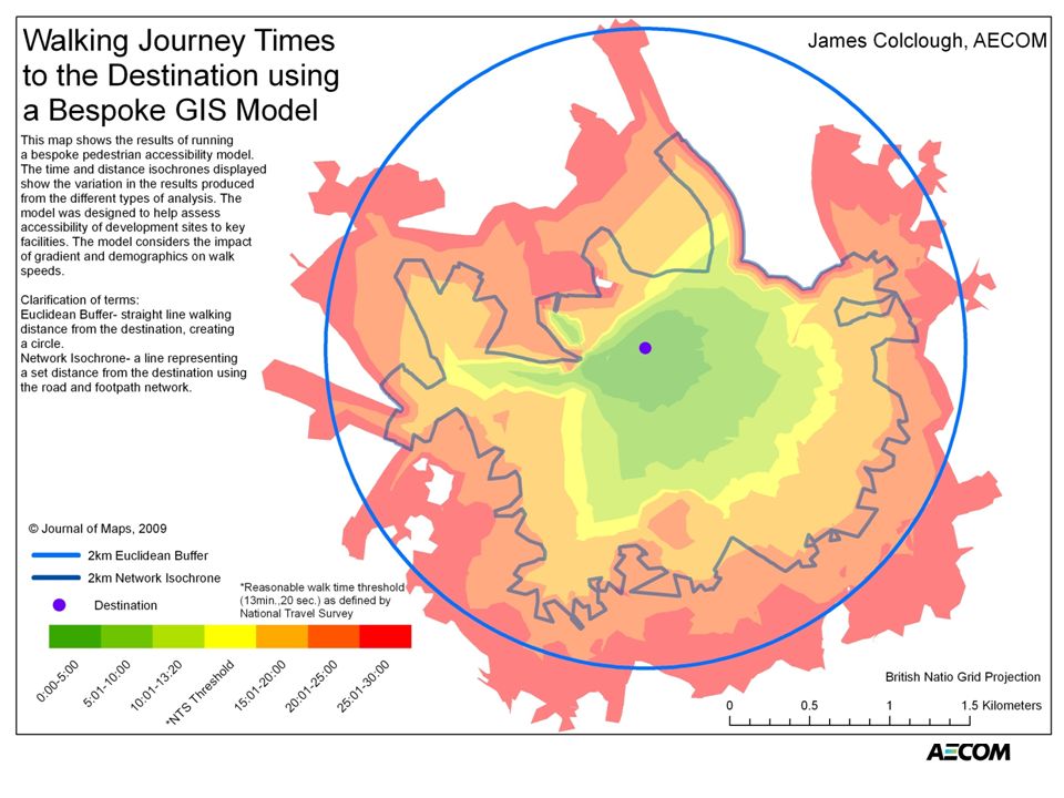
Accessibility Planning ACCESSION Highway models built within a GIS Pedestrian/cycling models that consider the impact of gradient.

11
Route Monitoring Vehicle speeds, congestion hotspots, and journey times Bus patronage assessments- linkage with socio- economic data Freight analysis

12
Traffic Modelling Data preparation Analysis Visualisation and presentation Strategic model development- e.g.DIAMOND

13
Aviation Impact assessments for strategic planning Map-based visualisation Online access to GIS tools Scaleable solutions

14
Future uses 4/4

15
Web-based data tools

16
Data Mashups

17
Technological Integration October 4, 2015Presentation TitlePage 17

18
Application development Bespoke planning applications (e.g. accessibility models) GIS at core of standalone tools- Centro Public Transport Prioritisation Tool
 GIS at core of standalone tools- Centro Public Transport Prioritisation Tool.")
19
Thank you james.colclough@aecom.com

Similar presentations


 for biological data analysis and data upload to STORET>")


 integrates hardware, software, and data for capturing, managing,>")