Download presentation
Presentation is loading. Please wait.

1
No. 1 Georgia’s Geography SS8G1 The student will describe Georgia with regard to physical features and location. (a, b, c, d)
.")
2
Location?

3
Location: Georgia is located on the southeastern coast of the U.S. It’s absolute location is 30°- 35° N latitude and 80° - 85° W longitude It’s relative location is north of Florida, east of Alabama and south of Tennessee Georgia is located in the Northern and Western Hemisphere Within Georgia there are five geographic regions and many natural physical features CREATED/PUBLISHED Cincinnati, E. Mendenhall, 1864

4
Can you locate Georgia?

5
The Regions of Georgia are based upon physical geography and are referred to as … naturalhistory.uga.edu naturalhistory.uga.edu Hodler, T.W. and H.A. Schretter. 1986. The Atlas of Georgia. University of Georgia Press, Athens.

6
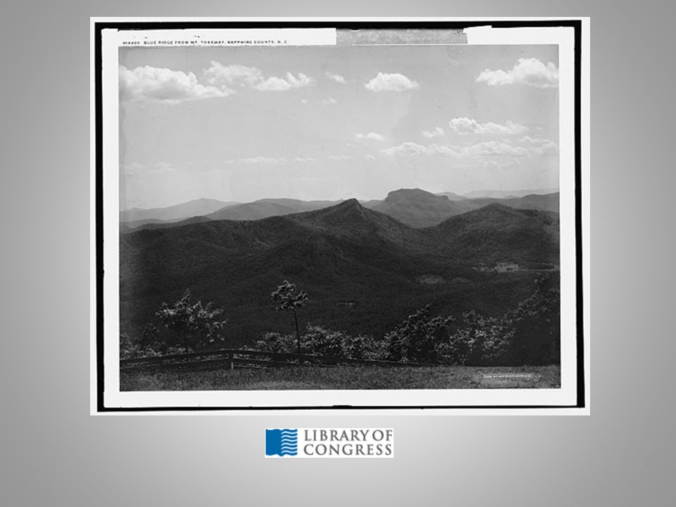
Blue Ridge Located in the northeastern corner of the state below North Carolina and west of South Carolina It’s major physical feature is the mountain ranges of Cohutta and Blue Ridge

8
Ridge and Valley Located between Blue Ridge and Appalachian Plateau regions in north Georgia Georgia’s “Apple Capital” Carpet Capital of the world is in Dalton, GA which is located in this region

9
Appalachian Plateau TAG corner, northwestern edge of the state on the borders of Tennessee, Alabama and Georgia Smallest region Many historic Civil War battles took place here, i.e. Chickamauga Lookout Mt with many hardwood forests

10
Piedmont Known for its red clay and rolling hills Home of the state’s capital, Atlanta, and most of the state’s population (½) North of the fall line Was once known as the cotton belt produces wheat, soybeans, corn, poultry and cattle, also much of the states business and industry are found here Chattahoochee, Flint, Ocmulgee and Oconee Rivers
 North of the fall line Was once known as the cotton belt produces wheat, soybeans, corn, poultry and cattle, also much of the states business and industry are found here Chattahoochee, Flint, Ocmulgee and Oconee Rivers")
11
Atlanta

12
Fall Line Boundary between the rolling hills of the Piedmont and softer soil of the Coastal Plain region Marks the ancient shore line when the Atlantic Ocean once covered the Coastal Plain Many cities are located along this line that marks a change in elevation Columbus, Macon, Milledgeville, Thomason and Augusta Waterfalls provide a good source of power

13
Savannah River near Augusta, fall line waterfall.

14
Coastal Plain Largest region, located south of the Piedmont and Fall Line Includes the 14 Barrier Islands The rivers Savannah, Ogeechee, Altamaha, Satilla and St. Marys all empty into the Atlantic Ocean in this region Many of the State’s valuable crops are farmed in this region’s fertile soil, Vidalia onions, peanuts, pecans, corn and soybeans Important wetlands such as the freshwater Okefenokee Swamp and the tidewater salt marshes

15
Farms, Islands, Salt Marshes

16
SS8G2 The student will explain how Interstate Highway System, Hartsfield-Jackson International Airport, and Georgia's deep-water ports help drive the states economy.

17
Georgia has a vast network of Interstate Highways which connect many of our borders and cities.

18
Interstate Highways Five major interstates include: I-85, I-75, I-20, I-95, I-16 Interstate highways have limited access and higher speeds compared to regular roadways. This transportation mode moves people and products across our state quickly. Multiple jobs are required to maintain these roads, support the travelers, and provide for the motor vehicles

19
Income is generated from roads…

20
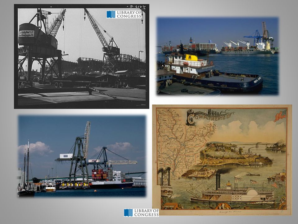
Georgia has two major deep-water ports, Savannah and Brunswick. Not only do these ports provide jobs for Georgians but they move foreign and domestic products into Georgia, (known as container shipping) These ports are then connected to the Interstate system as well as Georgia’s vast railroad network. Thereby, providing more jobs to transport and sell these goods.
 These ports are then connected to the Interstate system as well as Georgia’s vast railroad network. Thereby, providing more jobs to transport and sell these goods..")
22
Waterways Georgia also has two inland barge terminals, Bainbridge and Columbus There are also many rivers in Georgia which provided early settlers with a ready means for travel The largest rivers in Georgia are the Savannah, Chattahoochee, Flint, Altamaha, Ogeechee, Oconee, Ocumulgee, St. Marys and Satilla

23
Airports Hartsfield-Jackson International Airport in Atlanta is the busiest airport in the world. This links our local businesses with the world. Hub for Delta, Airtran, UPS Georgia has 104 total airports

24
Railroads Railroads are connected to the deep water ports and to many cities in Georgia as well as across the country. Georgia’s major Railroads are CSX, Norfolk Southern, and GDOT short lines.

25
Georgia’s Railroads

26
Georgia’s physical features There are five physiographic regions Many rivers, mountains, swamps, marshlands, and barrier islands Transportation is key to Georgia’s economic development with the many miles of interstate highways, railroads, deep-water ports and airports

27
For addition information on regions or transportation try these websites http://naturalhistory.uga.edu/~gmnh/gawildlif e/index.php?page=information/regions University of Georgia Museum of Natural History http://naturalhistory.uga.edu/~gmnh/gawildlif e/index.php?page=information/regions http://www.n-georgia.com Maps of Georgiahttp://www.n-georgia.com http://www.georgia.org/Pages/default.aspx Georgia Department of Economic Development www.georgiaencyclopedia.org

Similar presentations