Download presentation
Presentation is loading. Please wait.

2
Ruth Ann Trudell NY State GIS Users Conference Lake Placid, NY October, 2009

3
Project Objective Canal History Inspection Methods, Data Storage and Need for modernization Database Development Lessons Learned

4
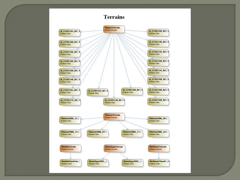
Provide a single storage location for all spatial and tabular data pertinent to Canal Inspections.

6
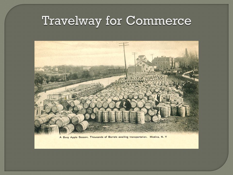
Travelway for Commerce

7
Current Canal System

8
Operated and maintained by the Canal Corporation, New York State Thruway Authority Inventory performed by NYS DOT through MOU Canals managed primarily for recreational purposes and historic values

9
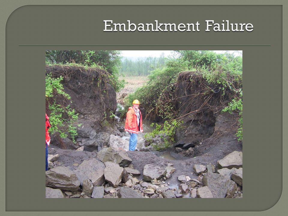
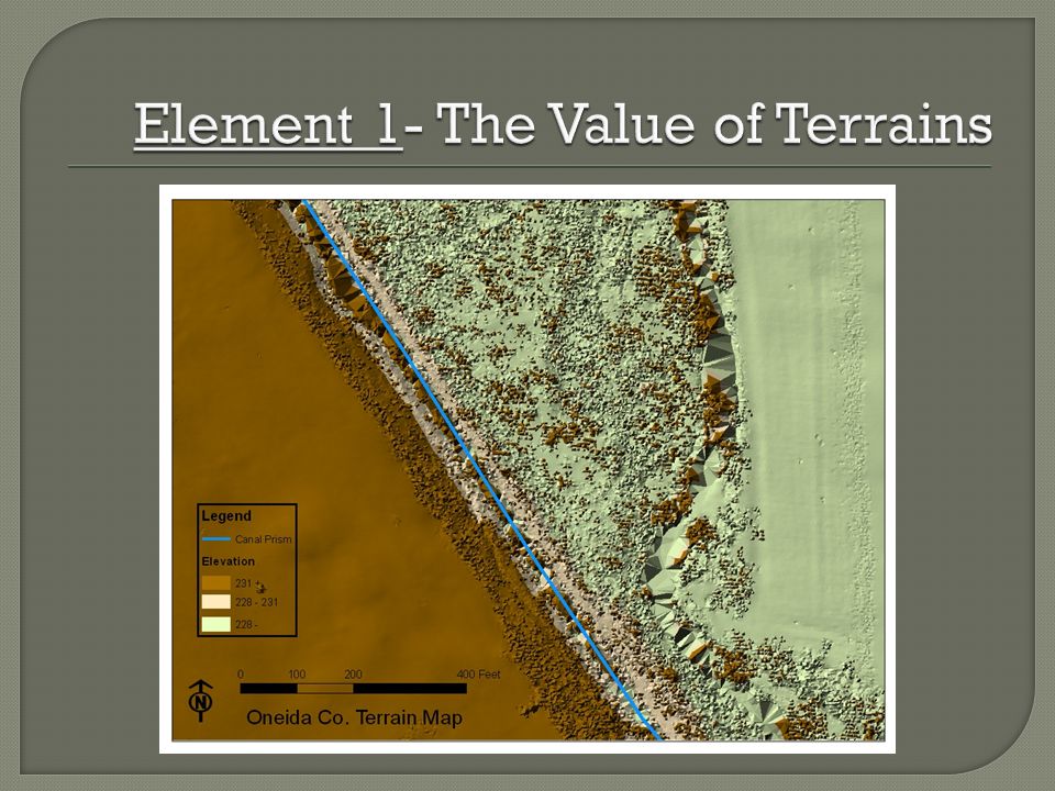
Parts of canal are embedded in the landscape; parts raised above. Portions are raised above the surrounding landscape with the use of levees or embankments.

12
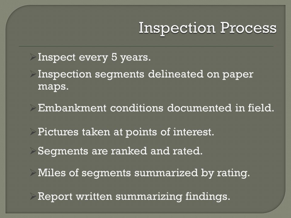
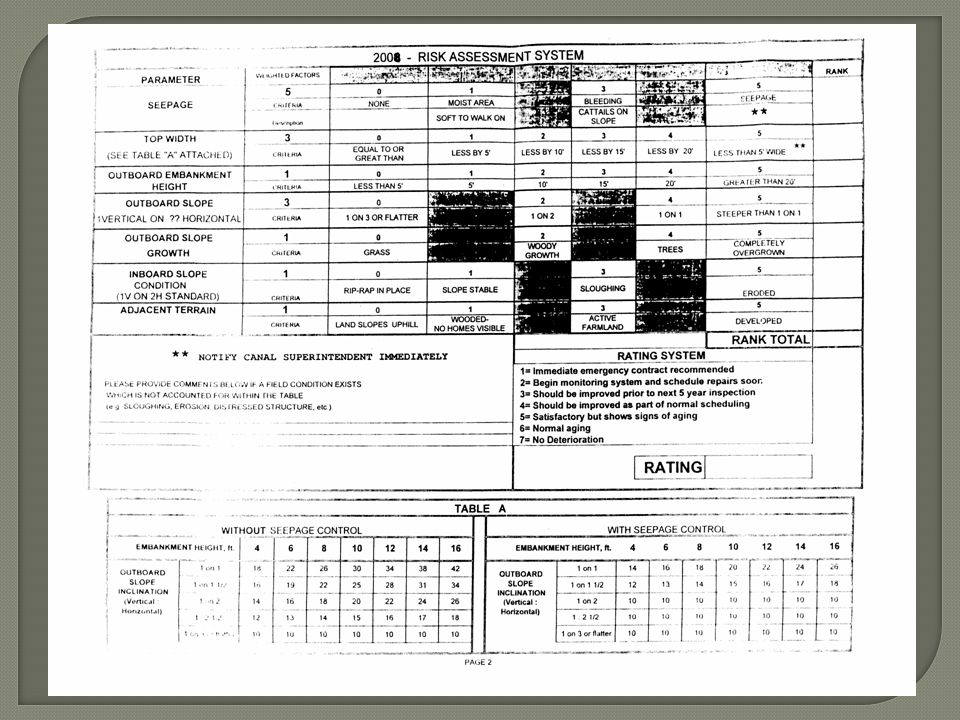
Inspect every 5 years. Inspection segments delineated on paper maps. Embankment conditions documented in field. Pictures taken at points of interest. Segments are ranked and rated. Miles of segments summarized by rating. Report written summarizing findings.

13
Inspection Segment Map

16
Paper maps, inspection forms and reports. Disparate spatial files stored on CC and DOT servers. Solution? A Database!

18
Determine Business Needs/Database Structure Decide upon Database Elements Populate Database Test by Querying Database

19
Validate data input and output needs (business functions) Discuss Database Considerations Spatial representations- feature classes vs. linear referencing Appropriate route Aggregation/disaggregation of data Image hyperlinks

20
Personnel GDBFile GDBAccess DB Access based, user familiarity Queries and data input done within ArcGIS environment User familiarity Spatial data storage, Limited storage capacity Spatial data storage Large storage capacity No spatial data storage; User develops relates in ArcMap GPS check-in/check- out Topology stored Terrain storage capability

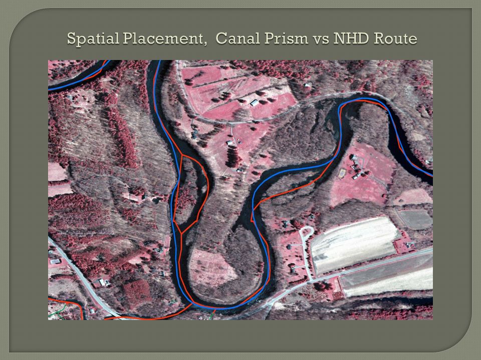
25
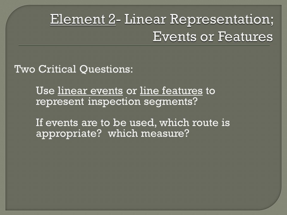
Two Critical Questions: Use linear events or line features to represent inspection segments? If events are to be used, which route is appropriate? which measure?

26
Events vs. Feature

28
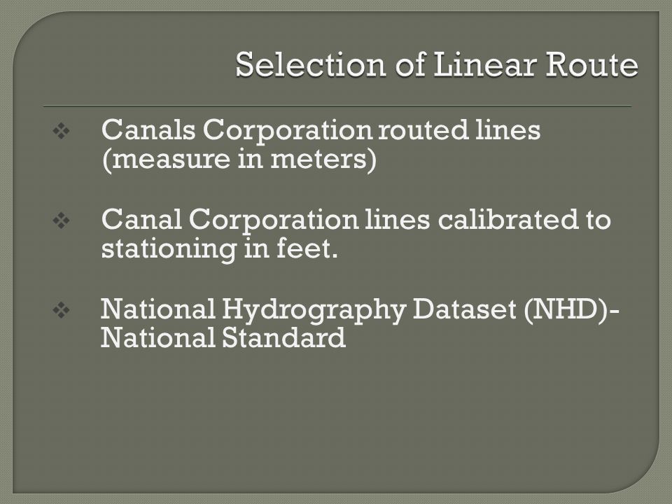
Canals Corporation routed lines (measure in meters) Canal Corporation lines calibrated to stationing in feet. National Hydrography Dataset (NHD)- National Standard
- National Standard.")
29
Event Feature

31
And YES, of course a Data Dictionary!

33
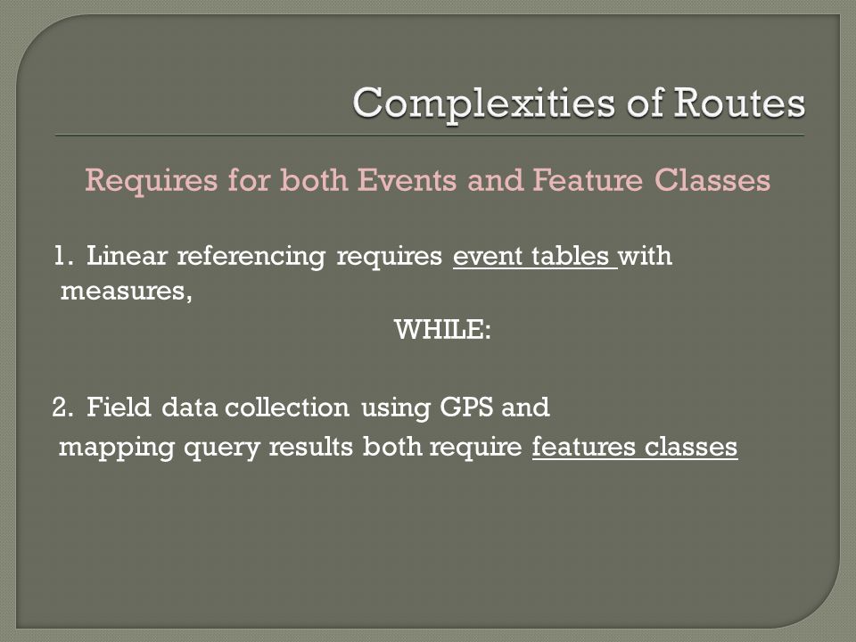
Requires for both Events and Feature Classes 1. Linear referencing requires event tables with measures, WHILE: 2. Field data collection using GPS and mapping query results both require features classes

34
Tabular Data Input-Existing Feature

37
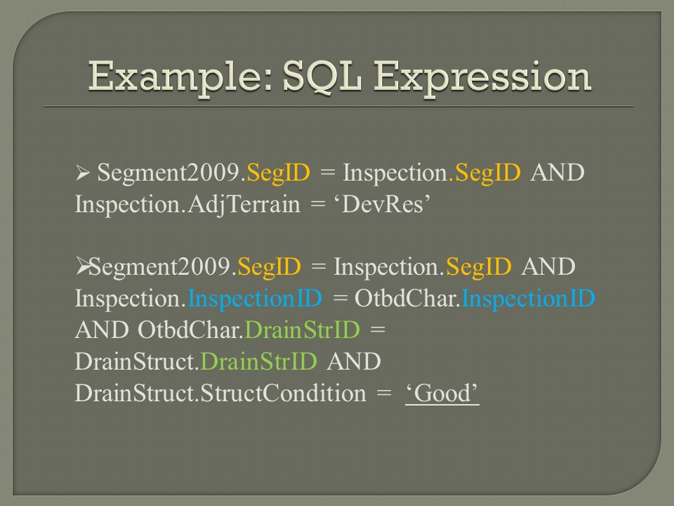
Segment2009.SegID = Inspection.SegID AND Inspection.AdjTerrain = ‘DevRes’ Segment2009.SegID = Inspection.SegID AND Inspection.InspectionID = OtbdChar.InspectionID AND OtbdChar.DrainStrID = DrainStruct.DrainStrID AND DrainStruct.StructCondition = ‘Good’

38
Relationship classes in GDB depend on exact match of field names in feature attribute and data tables. Use descriptive codes for coded domains. Exported tables contain codes, not descriptions! Ensure topology of routes is uni-directional and calibration point measures increase sequentially in up route direction. Take advantage of NY State GIS Help Desk; They are an excellent resource!

39
Successful development of a database that addresses data storage, data retrieval and data display needs!

40
Dr. Patrick Kennelly, Graduate Advisor Assist. Professor, Long Island University, and Penn State University Jamie DeLuca, NY State Canal Corporation Steve Heiser, Department of Transportation Ricardo Lopez and Tim Daly, Department of Environmental Conservation

43
Spatial Placement, Canal Prism vs NHD Route

45
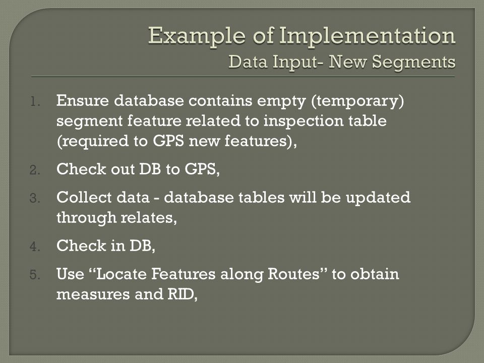
1. Ensure database contains empty (temporary) segment feature related to inspection table (required to GPS new features), 2. Check out DB to GPS, 3. Collect data - database tables will be updated through relates, 4. Check in DB, 5. Use “Locate Features along Routes” to obtain measures and RID,
 segment feature related to inspection table (required to GPS new features), 2. Check out DB to GPS, 3. Collect data - database tables will be updated through relates, 4. Check in DB, 5. Use Locate Features along Routes to obtain measures and RID,.")
46
6. Rename Segment ID with measure info., 7. Append this attribute table to event table, 8. Recreate “permanent” feature class, 9. Empty contents of the “temporary” feature class for future use with GPS.

Similar presentations


![GIS Definition & Key Elements 1 Geographic Information System [GIS] Continuum E. Atlas--------Thematic Mapper--CAC----------GIS.](/17/5294993/big_thumb.jpg "GIS Definition & Key Elements 1 Geographic Information System [GIS] Continuum E. Atlas--------Thematic Mapper--CAC----------GIS.>")


