Download presentation
Presentation is loading. Please wait.

1
Chapter 7

2
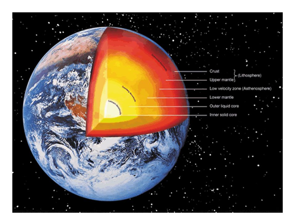
What are the 3 Major Zones of the Earth?

4
What is the CRUST? Outer layer of Earth Thickness: 5-70 km Thin, rocky Divided into OCEANIC and CONTINENTAL crust

5
What are the types of Earth’s Crust? Oceanic Crust – Made up of material on the ocean floor Continental Crust – Made up of continental landmasses.

6
What is the MANTLE? Layer of Earth between crust and core Thickness: 2,900 km Solid, rocky, Magma, capable of flowing Plastic

7
What is the CORE? Center of Earth Thickness: 3,500 km Solid and liquid Divided into 2 layers: –OUTER core Liquid 2,260 km thick –INNER core Solid…WHY? 1,220 km thick

8
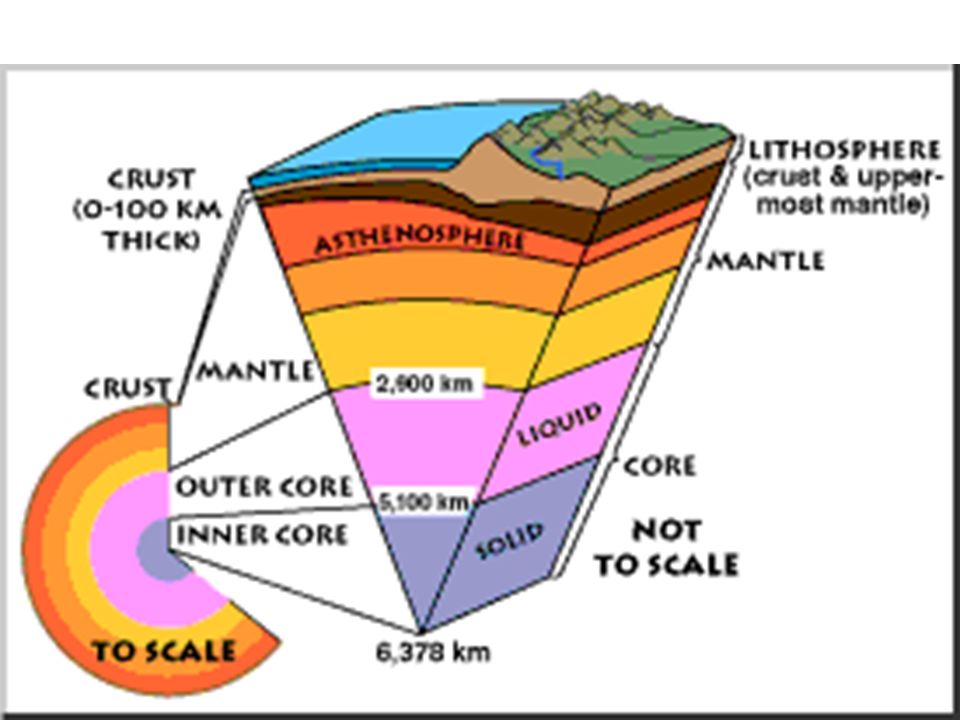
What are the physical layers of the Earth? The Earth is divided into 5 physical layers. –Lithosphere –Asthenosphere –Mesosphere –Outer core –Inner core

9
What is the Lithosphere? The outermost, rigid layer of the Earth Composed of the crust and upper part of the mantle. (15-300km) Divided into parts called the tectonic plates that move in respect to each other.
 Divided into parts called the tectonic plates that move in respect to each other..")
10
What is the asthenosphere? Plastic layer of the mantle on which the tectonic plates move. (250km thick)
.")
12
What is the mesosphere? The lower part of the mantle…it is extremely strong. It extends all the way to the core…(2550km thick).
..")
13
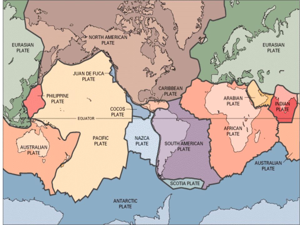
What are tectonic plates? Pieces of the lithosphere that move around on top of the asthenosphere. It is like a big jigsaw puzzle. There are 10 major tectonic plates…we live on the North American Plate

14
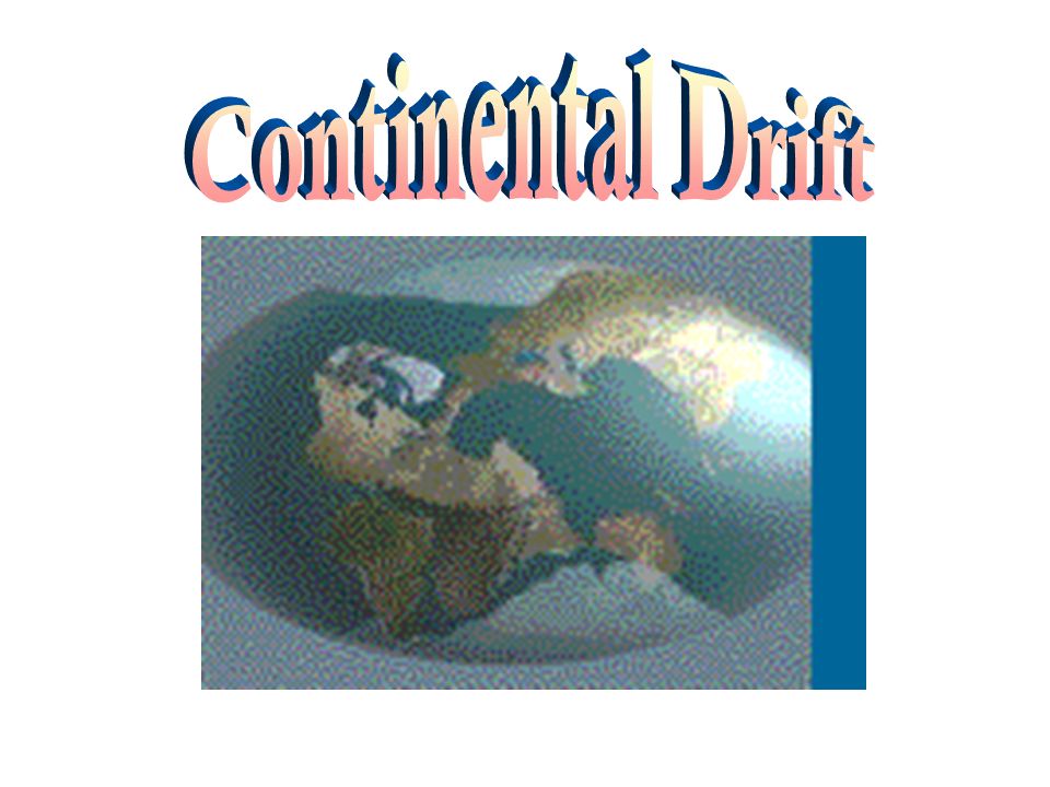
What is Wegener’s Continental Drift Hypothesis? states that the continents had once been joined to form a single supercontinent- Pangaea, began to break apart 200 million years ago and form the present landmasses. There was one sea called Panthalassa “all seas”…Pangaea existed during the end of the Paleozoic era and end of Mesozoic era.

15
What are the evidences of Continental Drift? Continental Puzzle Fossil Geological Climatic

16
Breakup of Pangaea

18
Figure 1 A Curious Fit This map shows the best fit of South America and Africa at a depth of about 900 meters. The areas where continents overlap appear in brown. Inferring Why are there areas of overlap? Continental Puzzle

19
Fossil

20
Identical fossil remains of Mesosaurus, a small, extinct land reptile that lived 270 million years ago, has been found in both eastern South America and western Africa. These reptiles could not have swum across the Atlantic Ocean.

21
Geological Matching Mountain Ranges

22
Geological

23
Ancient Glaciers grooves (shown by arrows) in present day structures) Climatic
 in present day structures) Climatic")
24
Gondwana Reconstruction of Southern hemisphere super continent. Notice how ring of glaciers match the patterns of a polar ice

25
Glacier Evidence

26
"Pangea Ultima" will form 250 million years in the Future

27
What is the theory of plate tectonics? Earth’s surface consists of a number of rigid, but moving pieces called plates Theory of Plate Tectonics: Theory that helps explain the formation and movements of these plates

29
What happens when convection currents move away from one another? New material moves to Earth’s surface Pushes older material aside Lithospheric plates move apart

30
Where cooler, denser currents are sinking Lithospheric plates are pulled together!

32
What happens at Plate Boundaries? Place where one plate is moving relative to another plate Belts where earthquakes and volcanoes are located – stress builds up along boundary

33
What are the Kinds of Plate Boundaries?

34
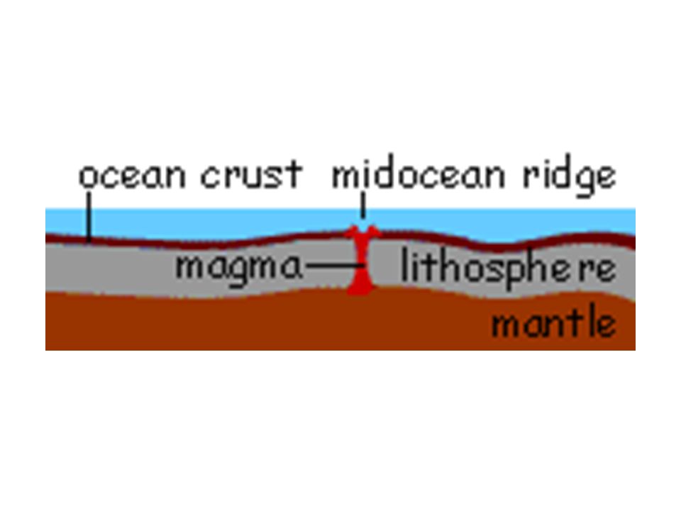
1. Divergent boundaries Places where two lithospheric plates are moving apart Contain mid-ocean ridges which have deep valleys along entire length called rift valleys As plates move apart, molten rock rises and fills space between plates – cools and hardens (seafloor spreading)
.")
37
When spreading centers develop within a continent, the landmass may split into two or more smaller segments, forming a continental rift. Continental rift near Krafla, Iceland

38
East African Rift Valley

39
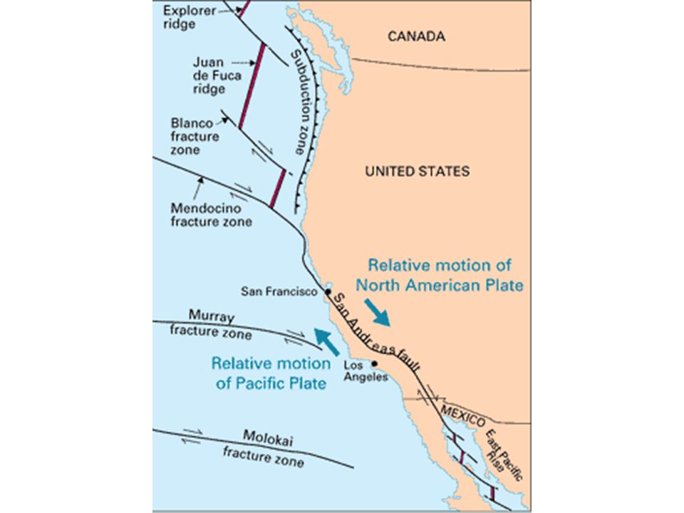
2. Transform Fault Boundaries Lithospheric plates are sliding past one another Transform fault – break or crack in the Earth’s crust along which movements have occurred

41
Example: San Andreas Fault

43
3. Converging Boundaries Places where two plates come together There are 3 types….

44
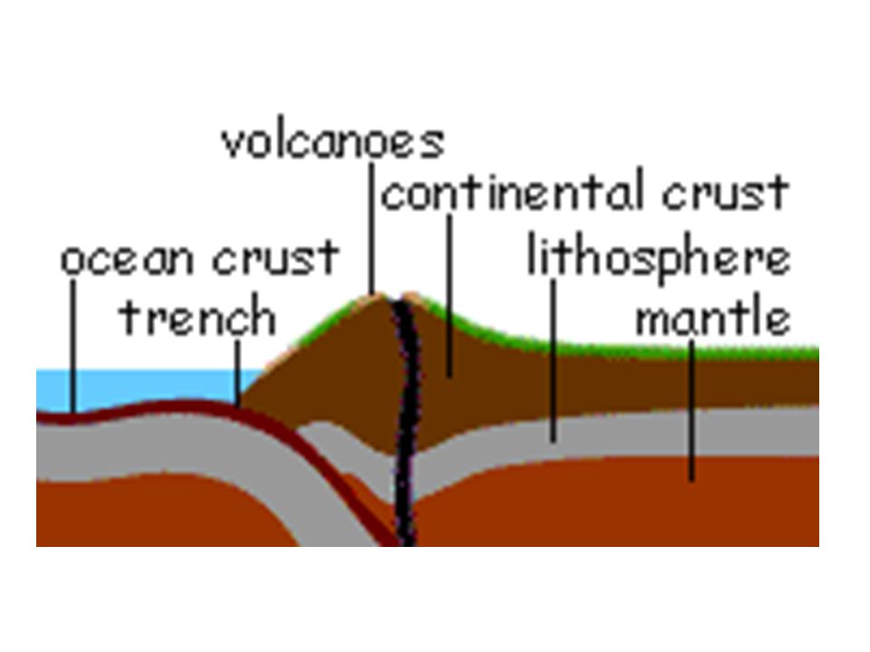
I.SUBDUCTION Zone When an ocean plate and continental plate collide Ocean plate slides under continental plate Forms deep-ocean trench and continental volcanic arc

47
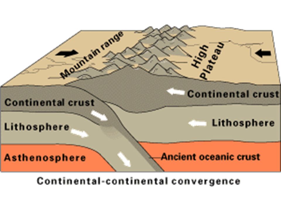
II. CONT. to CONT. Convergence Two continental plates collide Become crumpled and uplifted Form mountain ranges

51
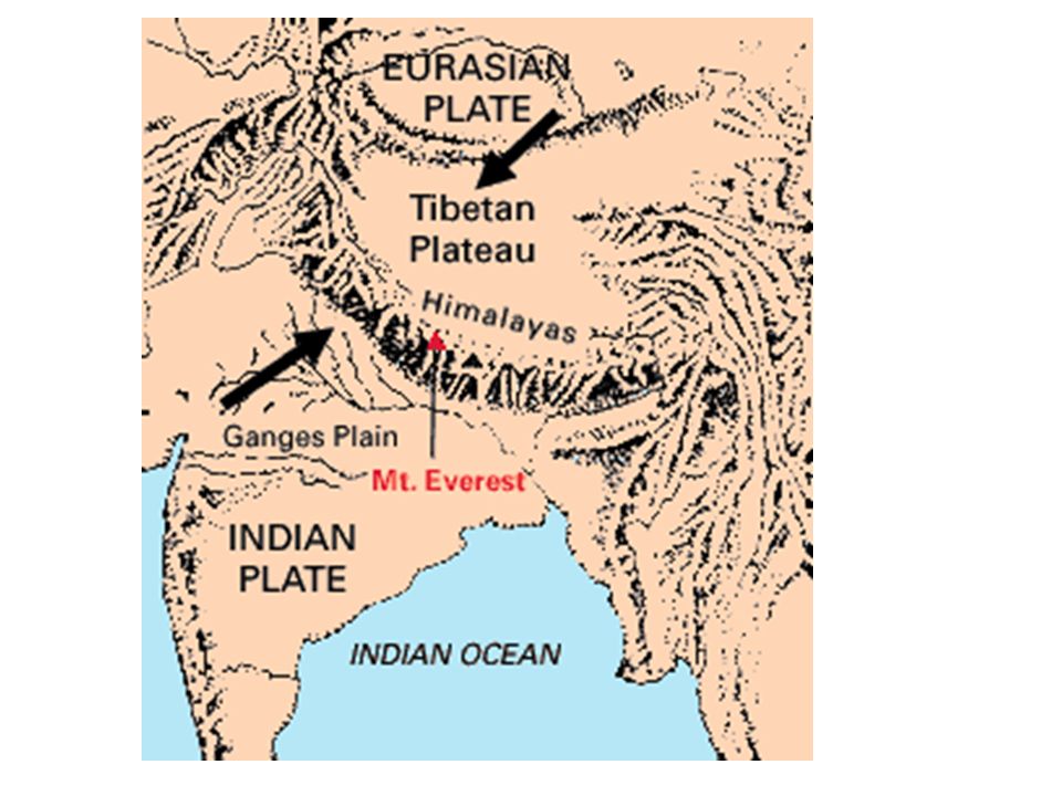
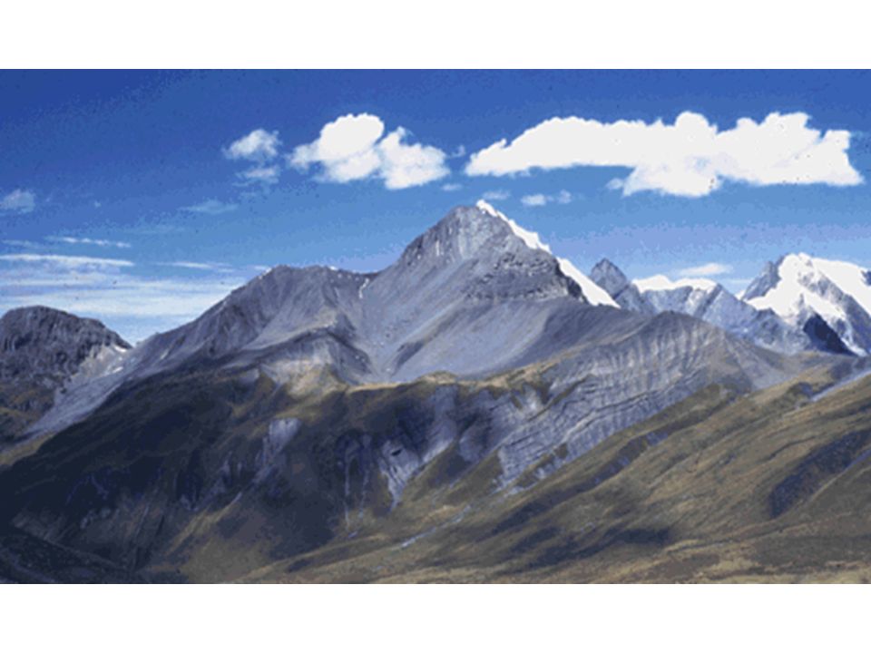
Collision of India and Asia

53
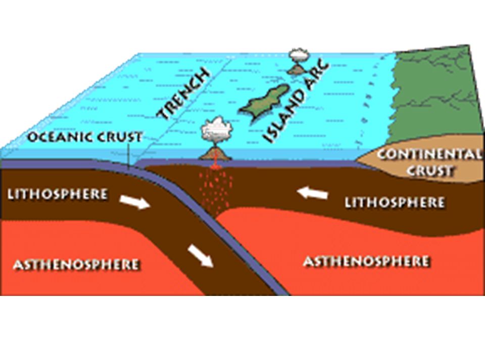
III. OCEANIC TO OCEANIC Crust Convergence One plate is subducted, forms trench Subducted plate melts Molten rock rises to surface along trench Forms island chain called an ISLAND ARC

55
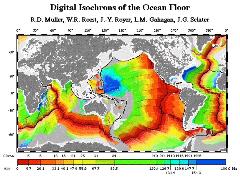
Evidence of Plate Tectonics Paleomagnetic Seafloor Spreading Earthquake Patterns Ocean Drilling Hot Spots

56
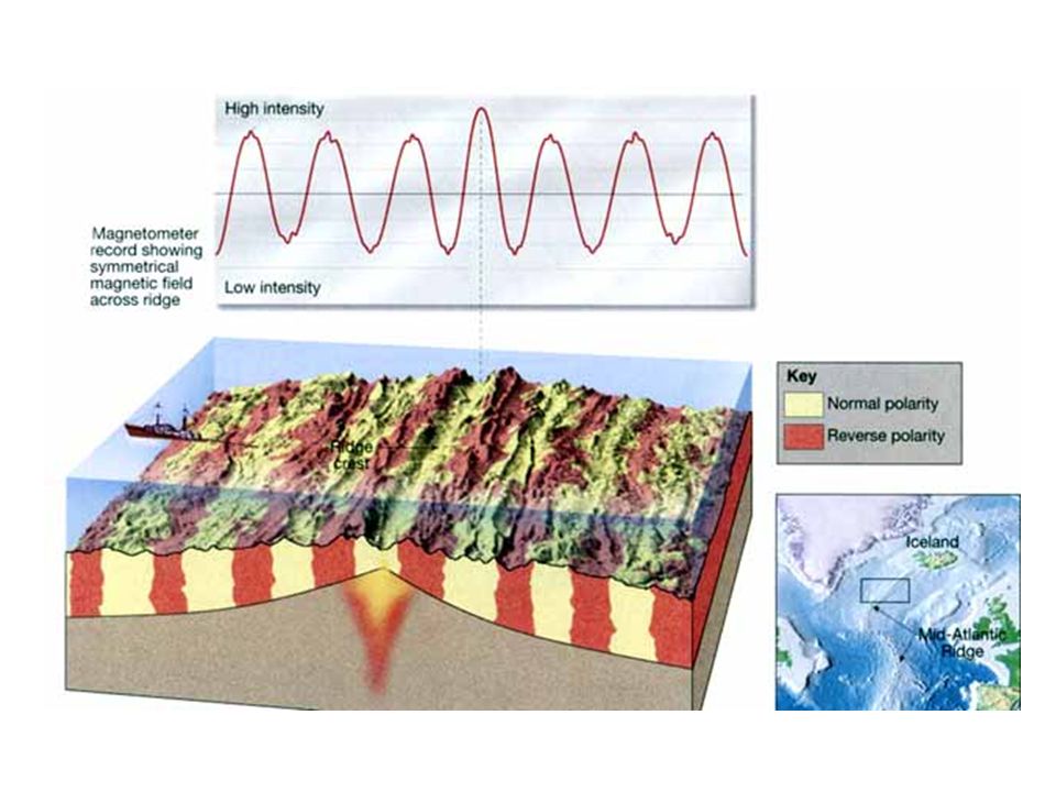
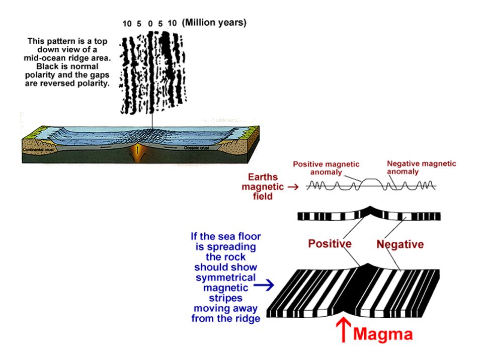
What is Paleomagnetism? Paleomagnetism: rocks formed millions of years ago show the location of the magnetic poles at the time of their formation. Normal polarity—when rocks show the same magnetism as the present magnetism field Reverse polarity—when rocks show the opposite magnetism as the present magnetism field

58
Paleomagnetism Preserved in Lava Flows

59
Polarity of the Ocean Crust

62
http://www.pbs.org/wgbh/aso/tryit/tectonics /# Let’s go to this website and review! Click on Plate Tectonics Activity (with a yellow arrow) when you get there! CLICK HERE>>>
 when you get there. CLICK HERE>>>.")
63
Here it is – all in one big picture… Can you pick out the types of Plate Boundaries?

64
Were you right?

Similar presentations


>")


 - thick low density rock (granite). –>")