Download presentation
Presentation is loading. Please wait.

3
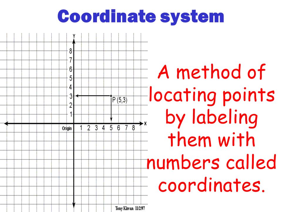
Coordinate system A method of locating points by labeling them with numbers called coordinates.

4
How are points determined on the Earth? Latitude-longitude coordinate system. Latitude lines are listed first (x- line) and longitude is listed second (y-line).
 and longitude is listed second (y-line)..")
5
Latitude Latitude lines run in an east-west direction (horizontal). Latitude lines NEVER cross, they run parallel to one another and may also be called parallels. The main reference line of latitude is known as the equator (0°) this line divides the world in 2 = halves (northern hemisphere and the southern hemisphere).
 this line divides the world in 2 = halves (northern hemisphere and the southern hemisphere)..")
6
W E

7
Since there are 2 = hemispheres a given latitude must be identified as north or south of the equator. Example: We live along the 41°N line.

8
How is latitude calculated? Angular measurement from the equator to any point along the surface. Therefore 0° (equator) is the smallest value of latitude and 90° (the poles) is the highest value of latitude.
 is the smallest value of latitude and 90° (the poles) is the highest value of latitude..")
9
Degreesof latitude Degrees of latitude Each degree of latitude is 111km apart. Degrees of latitude can be broken down into smaller units called minutes. denoted by the symbols ( °, ' ).. There are 60 minutes in 1° of latitude. Ex. Between 40°N and 41°N is 40°30 ‘N
.. There are 60 minutes in 1° of latitude. Ex. Between 40°N and 41°N is 40°30 ‘N.")
10
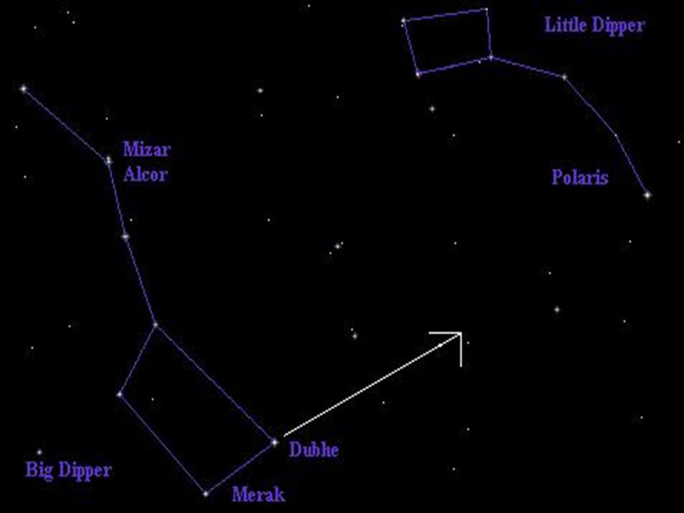
Polaris and latitude The angle between the horizon and Polaris is = to the latitude of the observer. Polaris (the North Star) is in line with our north pole. To find Polaris here you would look straight up, 90° above the horizon and your latitude is also 90°N. At the equator Polaris would appear right on the horizon or 0° above the horizon and your latitude is = 0°.
 is in line with our north pole. To find Polaris here you would look straight up, 90° above the horizon and your latitude is also 90°N. At the equator Polaris would appear right on the horizon or 0° above the horizon and your latitude is = 0°..")
13
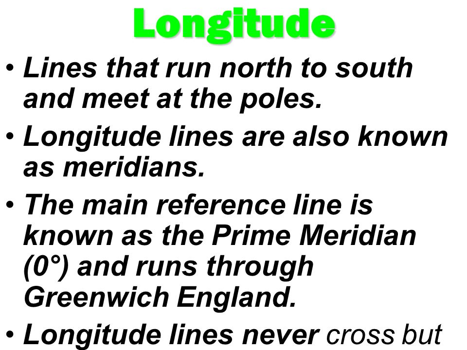
Longitude Lines that run north to south and meet at the poles. Longitude lines are also known as meridians. The main reference line is known as the Prime Meridian (0°) and runs through Greenwich England. Longitude lines never cross but they do all meet at the poles.
 and runs through Greenwich England. Longitude lines never cross but they do all meet at the poles..")
15
How is longitude determined? Longitude is an angular measurement of how far east or west one is of the Prime Meridian. The lowest angle for longitude is (0° Prime Meridian) and the highest angle is 180° (international date line). Longitude lines are indicated east or west of the prime meridian.
 and the highest angle is 180° (international date line). Longitude lines are indicated east or west of the prime meridian..")
16
How do we read a point on a map or a globe? 1 st you determine the latitude position. 2 nd you determine the longitude position. EXAMPLE: New York City: 41°N/74°W

Similar presentations


 Splits Earth into Northern/Southern.>")