Download presentation
Presentation is loading. Please wait.

1
Guten tag! September 10, 2014 What is Geography?

2
Write down the date Write down the opening question Write down your answers The study of the earth and its features, including human life and the effects of human activity. Put your syllabus (with signatures in your folder) Keep notes in your folder Put folders away before you leave
 Keep notes in your folder Put folders away before you leave.")
3
For Notes Label on the front: Name and Period Social Studies

4
September 12, 2012 Fantastisch! How is the Earth organized?

5
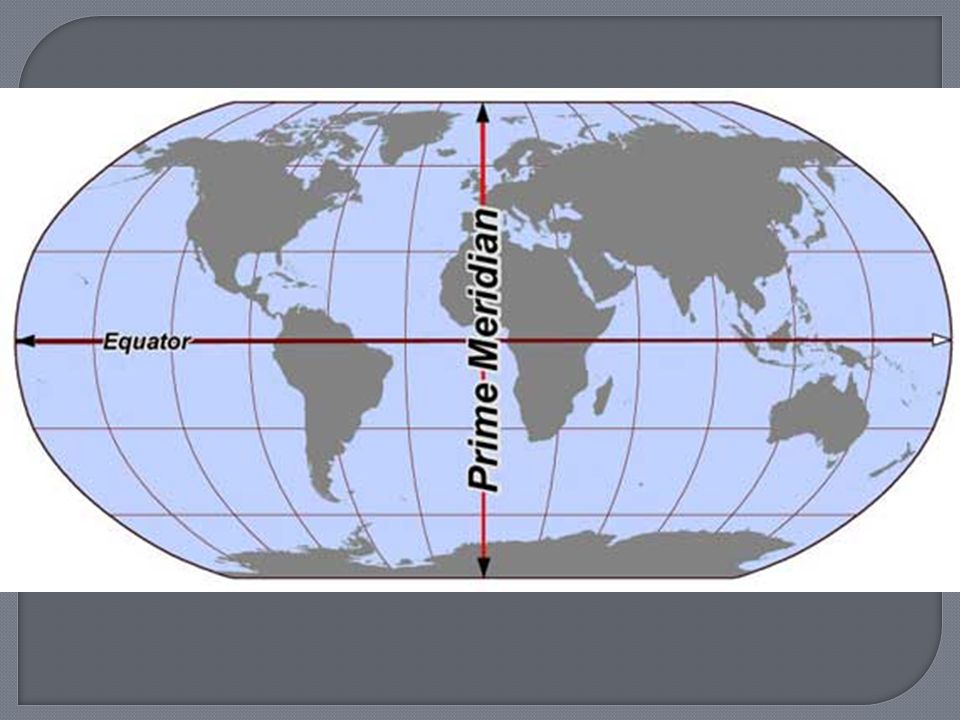
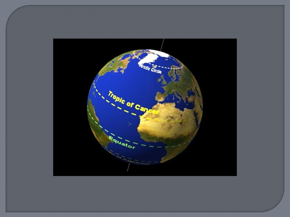
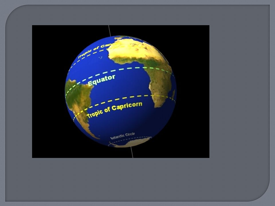
CUESNOTES Continents Oceans Equator Prime Meridian Hemisphere Tropics

6
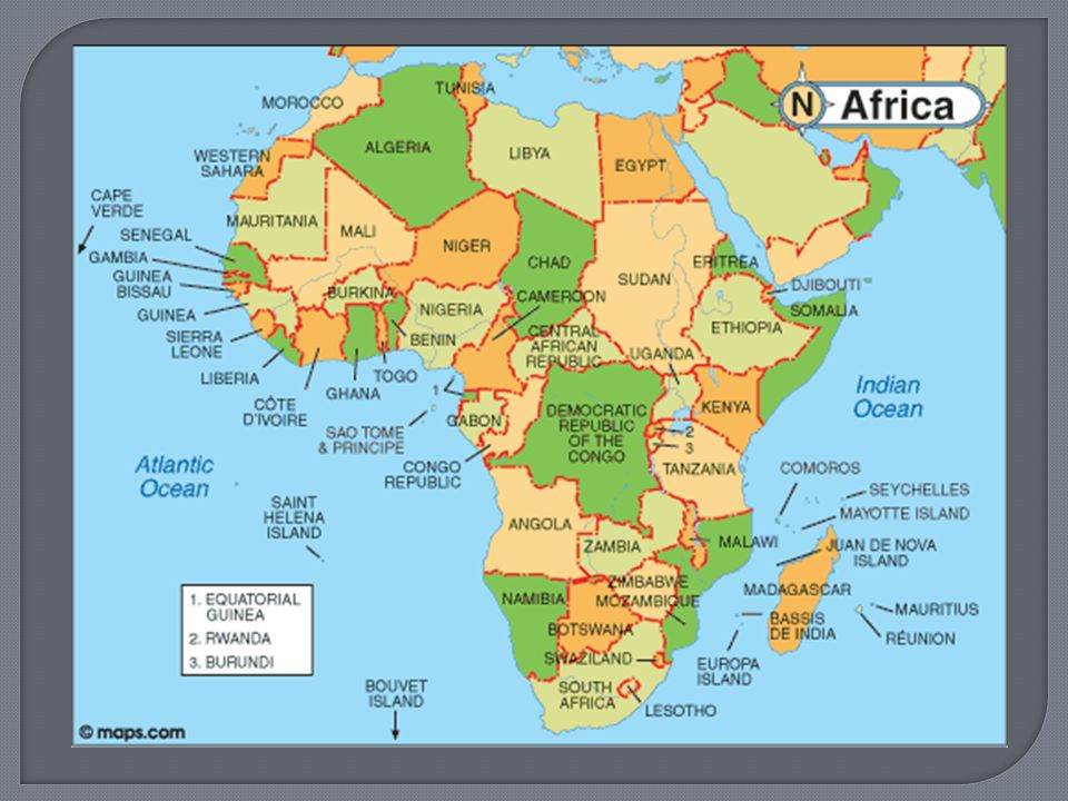
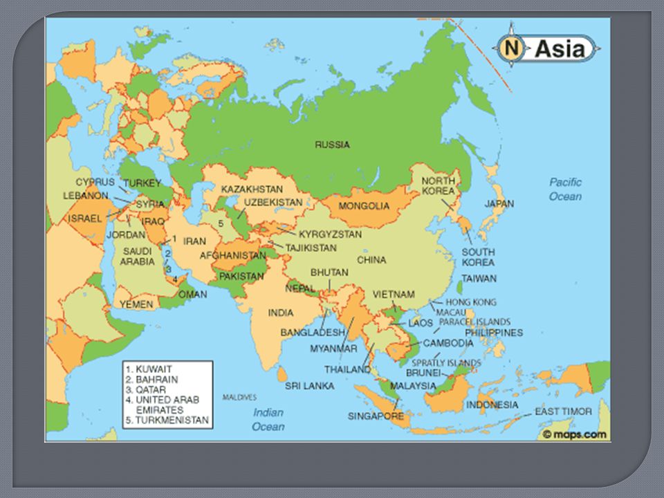
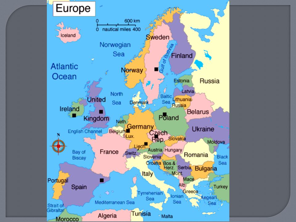
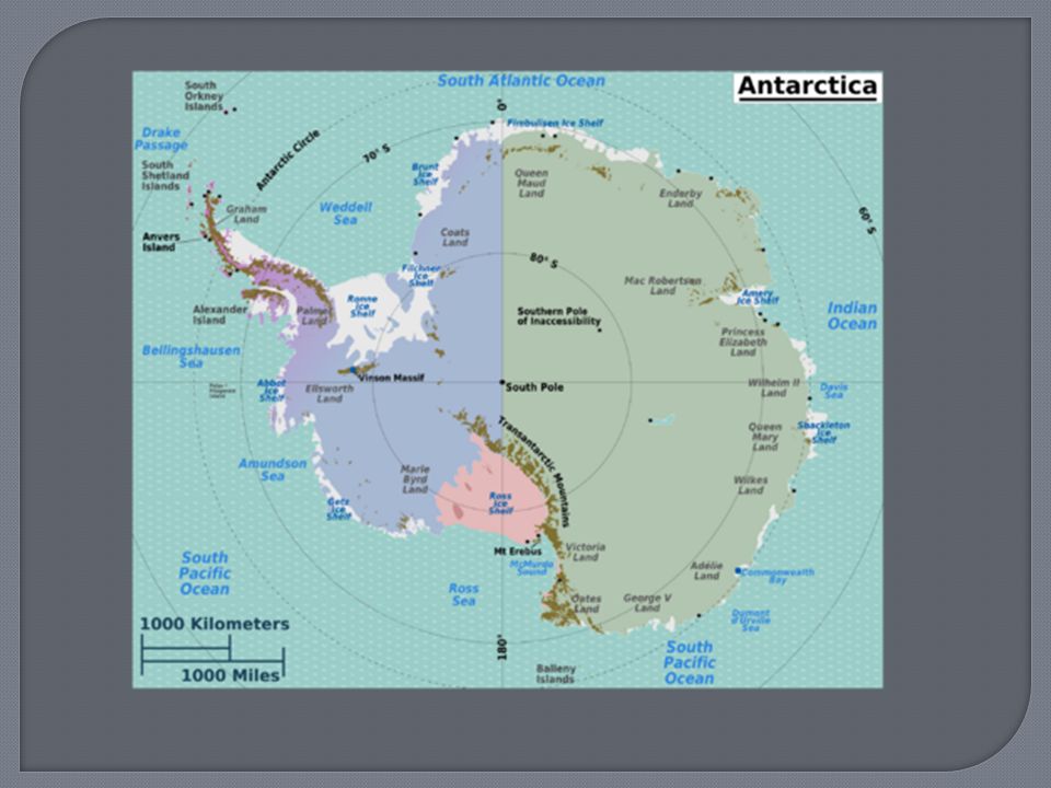
Total of 7 North America; 3 rd South America; 4 th Africa; 2 nd Europe; 6 th Asia; 1 st largest Australia; 7 th smallest Antarctica; 5 th

15
Total of 4 Arctic Ocean Pacific Ocean Atlantic Ocean Indian Ocean

17
Guten morgen! September 13, 2011 Name two ways the Earth is organized and the seven continents.

18
With your group Work together to build the Earth! No maps allowed! From your memory Create the 7 continents Label each and the 4 Oceans Take your time! North America; 3 rd South America; 4 th Africa; 2 nd Europe; 6 th Asia; 1 st largest Australia; 7 th smallest Antarctica; 5 th Pacific Ocean Atlantic Ocean Arctic Ocean Indian Ocean

19
Equator (left & right) (east & west)
 (east & west)")
21
(up & down) (north & south)
 (north & south)")
23
Northern Southern Eastern Western

25
Tropic of Cancer (above equator) Tropic of Capricorn (below equator)
 Tropic of Capricorn (below equator)")
28
September 15, 2011 Fantastisch! What features create the Northern/Southern/Eastern/Western hemispheres?

29
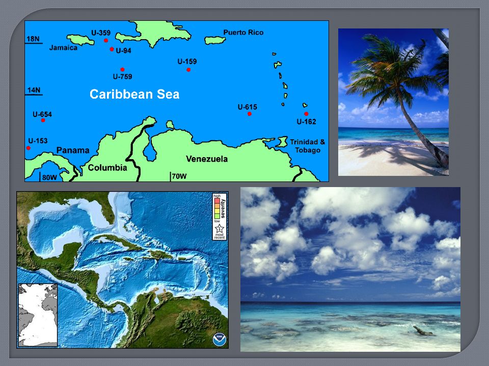
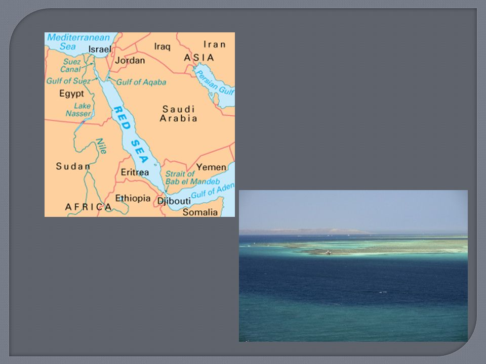
salt water that covers most of the earth's surface and surrounds its landmasses Caribbean Sea Separates North & South America Mediterranean Sea Separates Europe and Africa Red Sea Separates Africa and Asia

33
Ich bin schlau! September 16, 2011 If you were in North America and wanted to travel to Europe, then to Australia, what two directions would you go?

34
N. America to Europe = East Europe to Australia = South East Ich bin schlau= I‘m Smart!

35
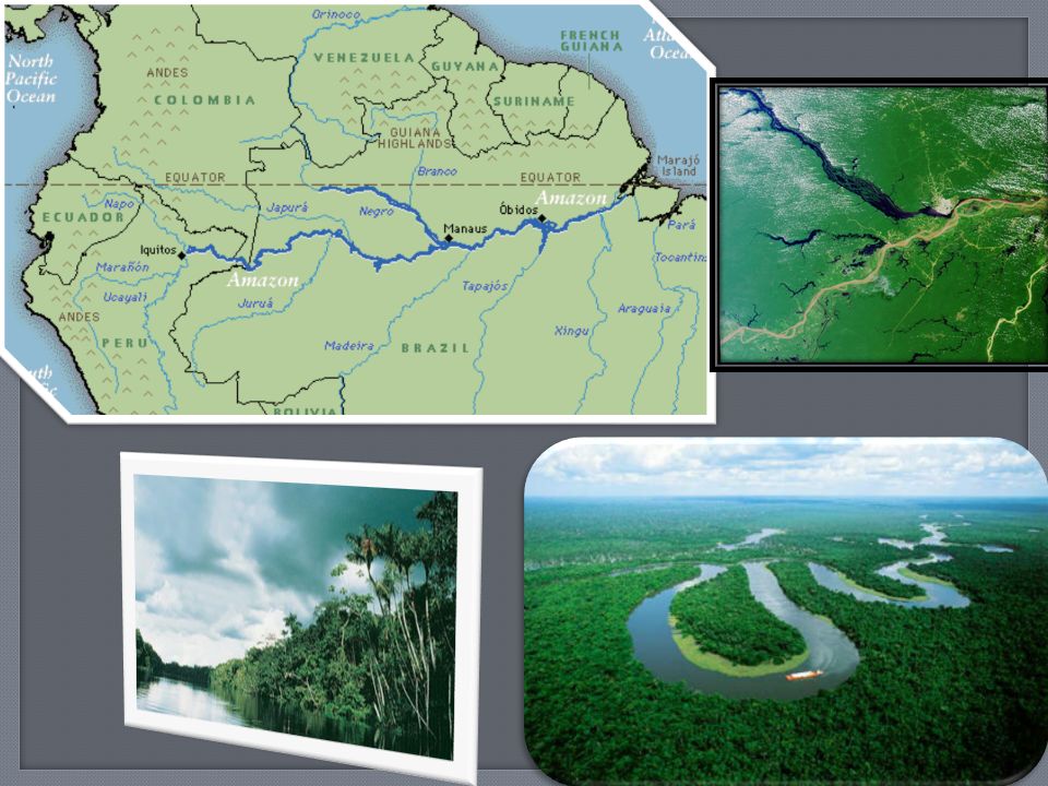
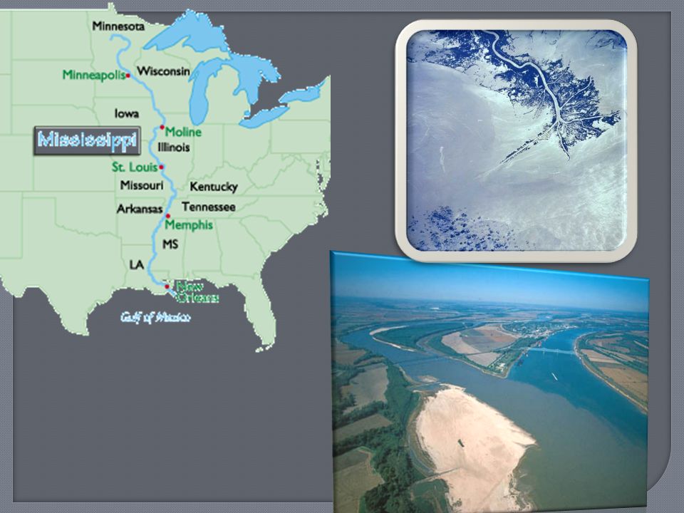
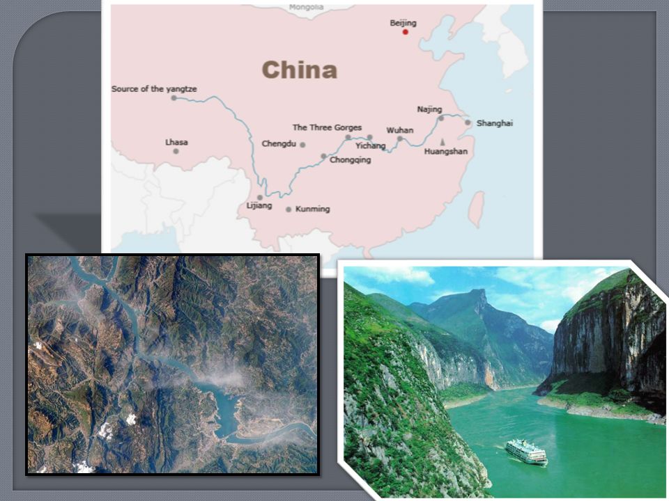
large natural stream of water flowing in a channel to the sea, a lake, or another stream Largest Rivers are: Amazon (S. America) Nile (N. Africa) Mississippi (N. America) Yangtze (China)
 Nile (N. Africa) Mississippi (N. America) Yangtze (China).")
40
Geographie! September 19, 2011 Look on page 58 in your atlas (Map Key D4), what do you find?
, what do you find")
41
(Gee-oh-coffee) Geography!
 Geography!")
42
(Must be present to win!)
")
43
Every map has a key Choose TWO symbols and draw them on your key box now Brainstorm ancient civilizations Look on page #2

44
First Label the Amazon, Nile, Mississippi, and Yangtze Rivers (HINT: look in your INDEX for page # and map key) Second (Home Work) Color (crayons or colored pencils only) N. America (Red), S. America (Blue), Europe (Yellow), Africa (Green), Asia (orange), Australia (purple), Antarctica (brown) MAPS DUE TOMORROW Colored, labeled (in marker)
, S. America (Blue), Europe (Yellow), Africa (Green), Asia (orange), Australia (purple), Antarctica (brown) MAPS DUE TOMORROW Colored, labeled (in marker).")
Similar presentations


>")


>")


