Download presentation
Presentation is loading. Please wait.

1
Geographic Information Systems GIS as a support to consultants interested to manage and solve environmental and territorial problems. How use GIS to individuate what type of renewable energies are more territory compatible/sustainable Emanuela Caiaffa caiaffa@casaccia.enea.it UNESCO Casaccia, 2007 15 th January

2
Font: EUROPEAN COMMISSION: green paper on a European strategy for sustainable, competitive & secure energy. What is at stake–background document (2006_03_08_gp_slide_presentation.pdf)
.")
3
From: COMMISSION STAFF WORKING DOCUMENT. Annex to the Green Paper A European Strategy for Sustainable, Competitive and Secure Energy What is at stake – Background document [COM(2006) 105 final]
 105 final].")
4
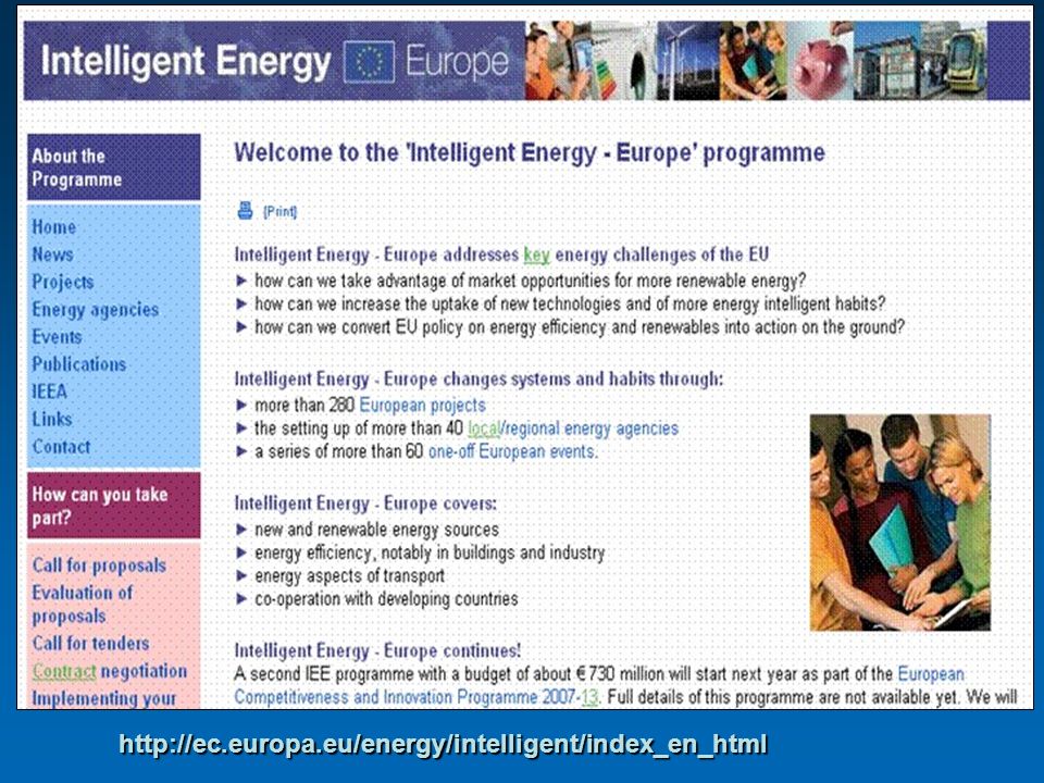
http://ec.europa.eu/energy/intelligent/index_en_html
5
http://www.eusew.eu/

6
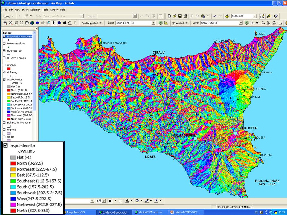
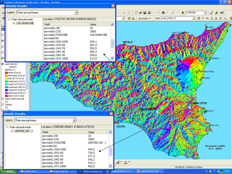
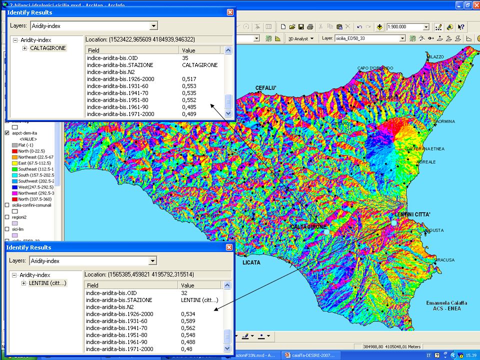
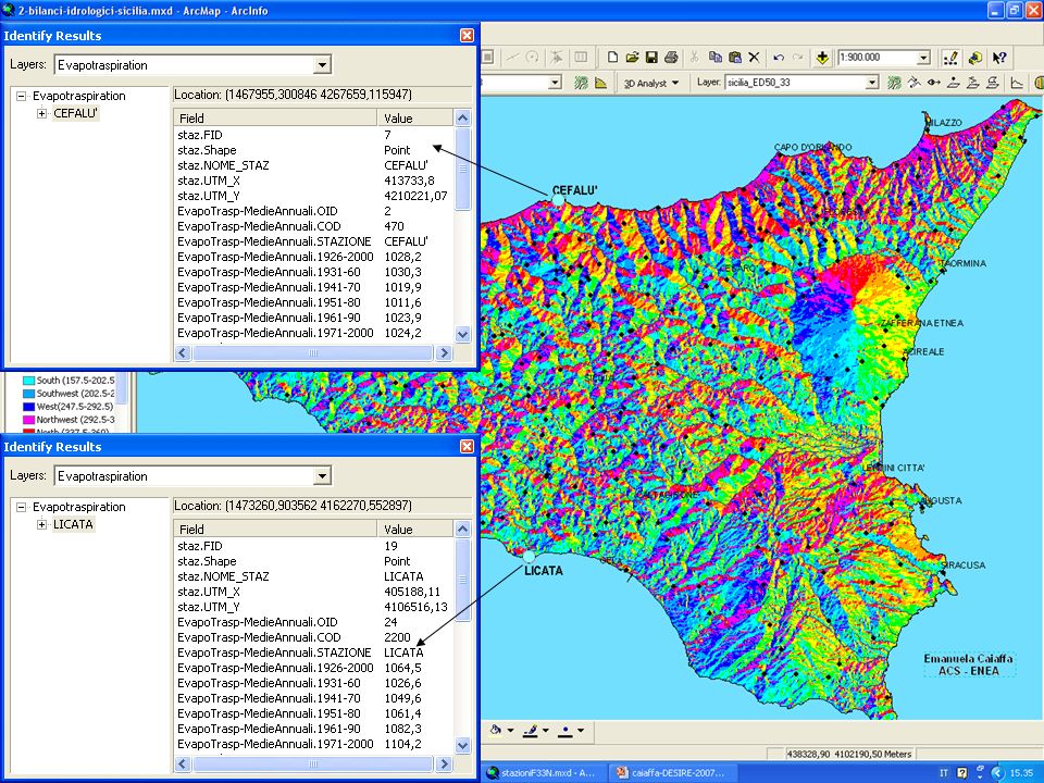
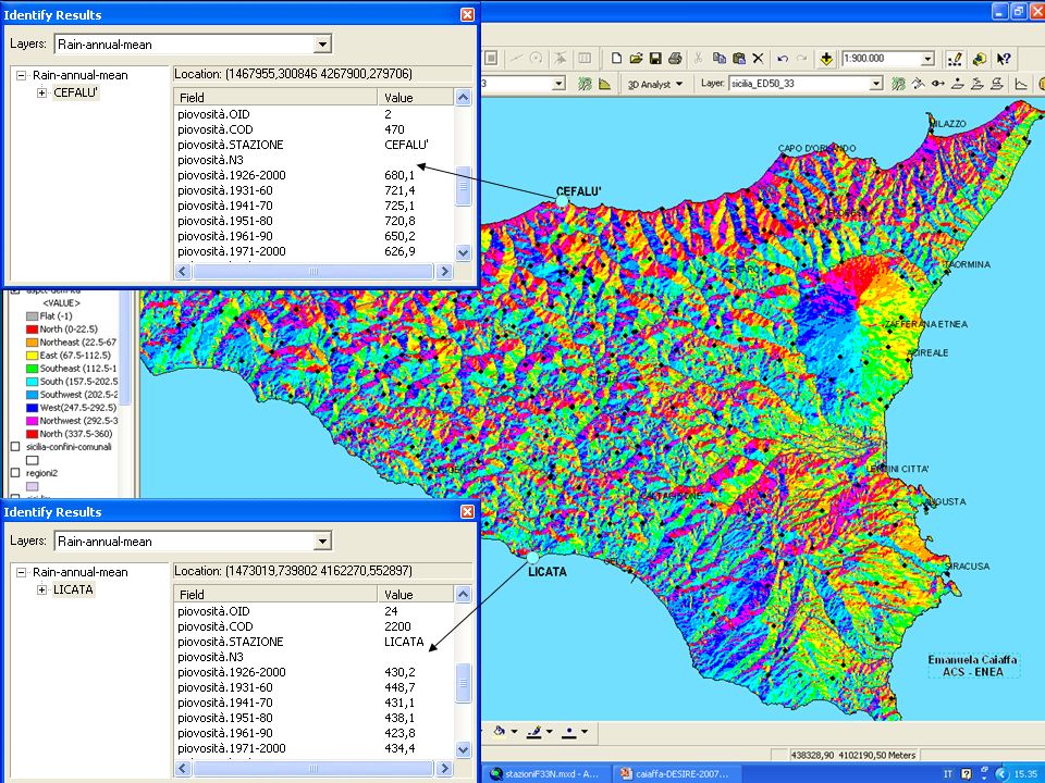
Emanuela Caiaffa ENEA - ACS

7
Emanuela Caiaffa ENEA - ACS

8
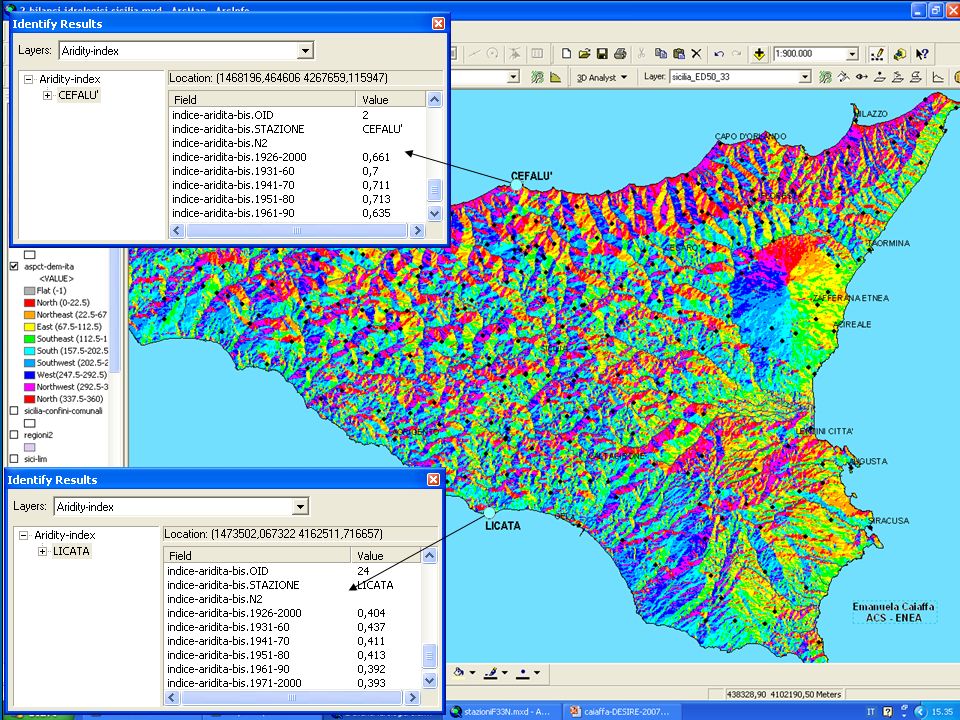
Emanuela Caiaffa ENEA - ACS

9
Emanuela Caiaffa ENEA - ACS

10
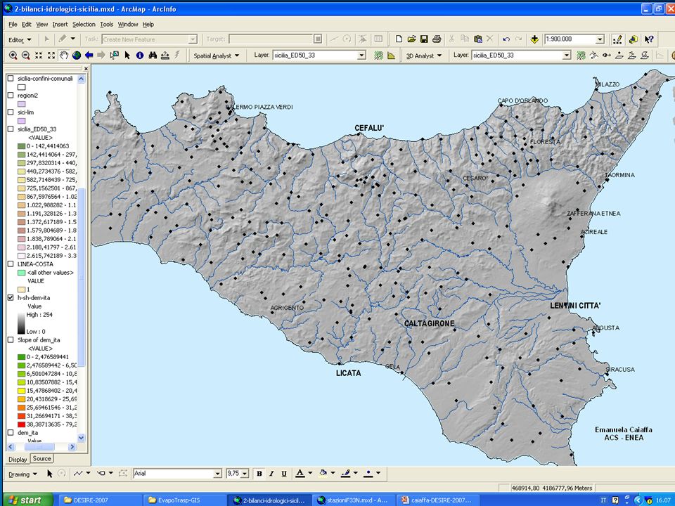
Emanuela Caiaffa ENEA - ACS

11
From: COMMISSION STAFF WORKING DOCUMENT. Annex to the Green Paper A European Strategy for Sustainable, Competitive and Secure Energy What is at stake – Background document [COM(2006) 105 final]
 105 final].")
13
MULTIPLE SOURCES, MULTIPLE PIPELINE ROUTES

14
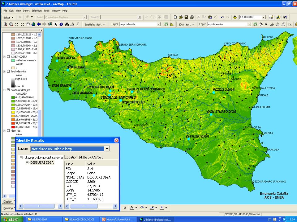
Emanuela Caiaffa ENEA - ACS

15
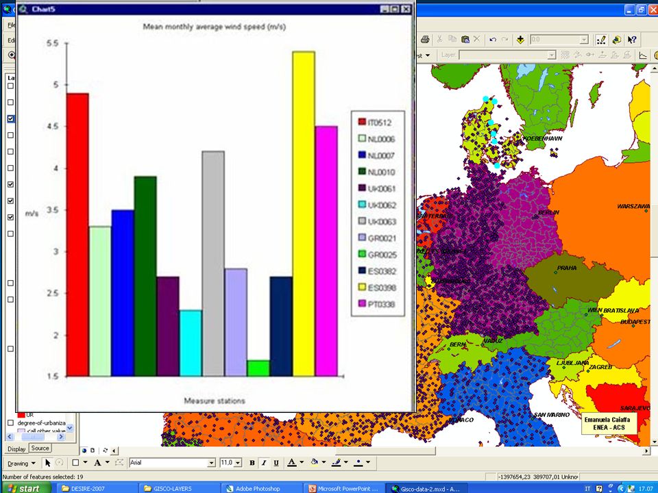
Mean monthly average wind speed data elaborations at the European level. (GISCO Data Update 11th May 1998 produced by European Environment Agency, Copenhagen)
.")
18
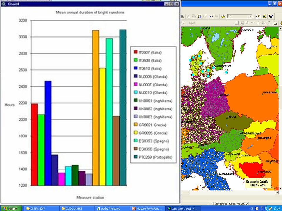
Mean annual duration of bright sunshine data elaborations at the European level. (GISCO Data Update 11th May 1998 produced by European Environment Agency, Copenhagen)
.")
31
CONCLUSIONS Before concluding my lecture let me express some conclusions The aim of the today lecture was to give you some starting points to approach the territorial aspect of the renewable energy plans realization. Energy supply is become a critical environmental problem as well as social and economic. By GIS using we stated a new way to face it through thematic maps analysis in order to find possible solutions at least for the problems territory linked.

32
Thank you for your attention! caiaffa@casaccia.enea.it

Similar presentations


 International Competition Law Dushanka Dovichinska 24 Nov 2010.>")


