Download presentation
Presentation is loading. Please wait.

1
Latin America Chapter 9 Physical Geography

2
Latin American Regions Middle America – includes Mexico and the Central American countries The Caribbean Islands South America

3
Landforms Mexico –Sierra Madre Oriental & Occidental Mountains –Anáhuac – densely populated plateau Oaxaca Plateau, Mexico

4
Sierra Madre Ranges

5
Andes Mountains Longest mountain range in the world Stretches 4,500 miles from north to south, along the west coast of South America Highest peak, Aconcagua, rises 23,000 feet Aconcagua

6
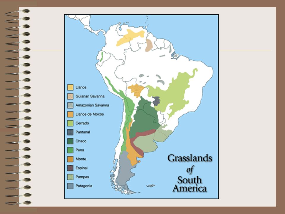
Landforms PLAINS Llanos - vast tropical grassland plain situated at the east of the Andes in Colombia & Venezuela (cattle ranching) Pampas - fertile plains in Argentina, Uruguay, & Brazil (grain, cattle, & sheep) PLATEAUS Patagonia – cold, windswept plateau in Argentina & Chile Altiplano – high plateau in Chile, Argentina, Bolivia & Peru
 Pampas - fertile plains in Argentina, Uruguay, & Brazil (grain, cattle, & sheep) PLATEAUS Patagonia – cold, windswept plateau in Argentina & Chile Altiplano – high plateau in Chile, Argentina, Bolivia & Peru")
7
Atacama Desert Located in Chile and Peru Driest desert on Earth Rich deposits of copper and other minerals

8
Amazon Rainforest South America Covers 1.2 billion acres More than 1/5 of the rainforest has already been destroyed One square kilometer of the Amazon rainforest can contain about 90,000 tons of living plants.

9
Amazon Rainforest The region is home to 2.5 million insect species, tens of thousands of plants, and some 2,000 birds and mammals. Tapir Orchid

10
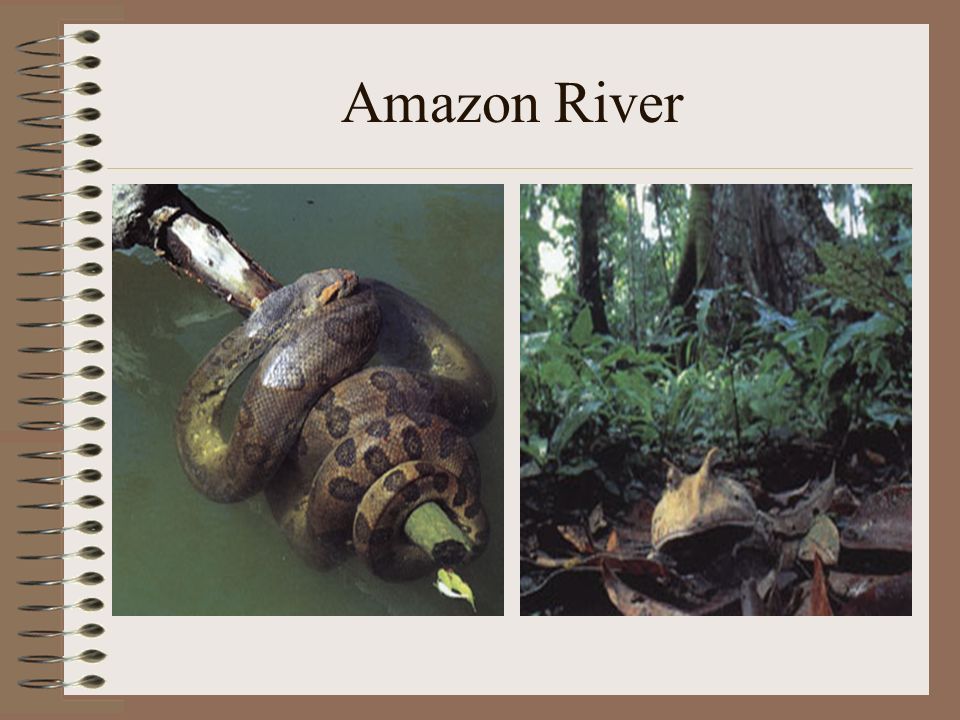
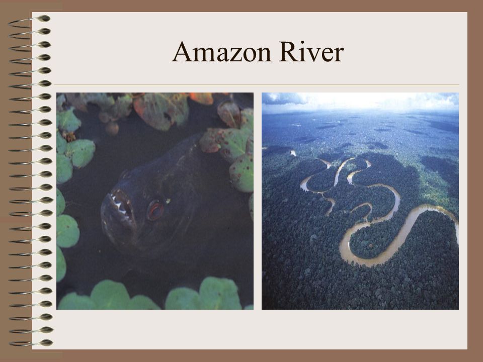
Amazon River Longest River in the Western Hemisphere Greatest total water flow of any river, carrying more than the Mississippi, Nile, and Yangtze rivers combined Drainage area, called the Amazon Basin, is the largest of any river system Amazon River near Manaus

11
Amazon River

14
Paraná, Paraguay, & Uruguay River System 2 nd longest river system in South America Most important commercial highway Rio Parana from Encarnacion, Paraguay, looking to Posadas, Argentina

15
Orinoco River Mainly in Venezuela More that 1,500 miles long into the Atlantic Some of the areas drained by the Orinoco are home to the few remaining Native American peoples, such as the Yanomamo

16
Amazon River Dolphin Found in the Amazon and Orinoco Rivers 1 of 5 freshwater dolphin species in the world Unique pink coloring Also known as “Boto”

17
Lake Titicaca Highest commercially navigable lake in the world (12,536 ft. above sea level) South America’s largest freshwater lake Located in the Altiplano high in the Andes on the border of Peru and Bolivia
 South America’s largest freshwater lake Located in the Altiplano high in the Andes on the border of Peru and Bolivia.")
18
Lake Maracaibo Located in Venezuela Contains large reserves of crude oil Connected to the Gulf of Venezuela by a narrow strait in the north, making it slightly saline

19
Lake Nicaragua Largest lake in Central America Located in Nicaragua Called “The Sweet Sea” Has sizeable waves and archipelagos of islands Lake Nicaragua has the only species of freshwater sharks in the whole world.

20
Angel Falls World’s highest uninterrupted waterfall at 3,230 feet Located in Venezuela The waterfall was not known to the world until its official discovery in 1933 by the American aviator, James Crawford Angel, on a flight while searching for gold. 16 times the height of Niagara Falls

21
Angel Falls

22
Major Islands Greater Antilles –Large islands in the Caribbean –Cuba, Jamaica, Hispaniola (Haiti & Dominican Republic), Puerto Rico Lesser Antilles –Smaller islands in the region SE of Puerto Rico –Divided into the Windward (winds that blow across them) and Leeward (sheltered) Islands
, Puerto Rico Lesser Antilles –Smaller islands in the region SE of Puerto Rico –Divided into the Windward (winds that blow across them) and Leeward (sheltered) Islands")
23
Greater Antilles

24
Lesser Antilles

25
Mineral Resources Bauxite (used to make aluminum) Copper Tin Iron Lead Nickel Silver Gold Bauxite
 Copper Tin Iron Lead Nickel Silver Gold Bauxite")
26
Energy Resources Oil – Venezuela & Mexico Coal Natural gas - Trinidad Uranium Hydroelectric power - Brazil

27
Hydroelectric power plant in Brazil

28
Varied Climate & Vegetation Varied climate and vegetation due to several factors: –Spans a great distance on each side of the equator –Big changes in elevation because of massive mountains –Warms currents of the Atlantic Ocean & the cold currents of the Pacific Ocean affect the climate

29
Tropical Climate Zones Tropical Wet –Rain forests –Hot and rainy year round –Most of Brazil Tropical Wet & Dry –Savannas –Hot climates with seasonal rains –Found of Brazil, Colombia, & Argentina

31
Dry Climate Zones Desert –Less than 10 inches of precipitation a year –Northern Mexico, coast of Peru, Atacama Desert in Chile, part of Patagonia Semiarid –Generally dry, with some rain –Parts of Mexico, Brazil, Uruguay, & Argentina

32
Mid-Latitude Climate Zones Humid Subtropical –Rainy winters and hot, humid summers –Varied vegetation –Parts of Paraguay, Uruguay, southern Brazil, southern Bolivia, and northern Argentina Mediterranean –Hot, dry summers and cool, moist winters –Chapparal vegetation –Located in part of Chile Marine West Coast –Cool, rainy winters and mild, rainy summers –Forests –Southern Chile & Argentina Highlands –Moderate to cold, depending on elevation –Mountains of Mexico & South America

33
Human/Environment Interaction Slash-and-Burn farming Terraced farming Urbanization Tourism

34
Slash-and-Burn Farming -Used by native peoples to clear fields -Cut trees, brush, grasses and burned the debris to clear the field Today, farmers practice this method to clear land for farming in the Amazon River basin Sometimes use destructive farming practices Soil is exhausted after a few years and all nutrients have been drained from the soil Then they move on and clear another spot This is one of the reasons for the shrinking of the rainforest

35
Before & After

36
The aftermath of slash and burn farming in the Amazon.

37
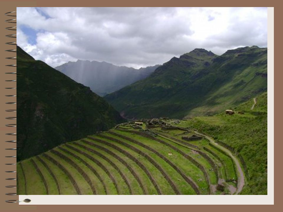
Terraced Farming Ancient technique for growing crops on hillsides or mountain slopes Cut step-like horizontal fields into hillsides and slopes Allow steep land to be cultivated for crops Reduces soil erosion

39
Tourism Advantages of Tourism –Create jobs Disadvantages of Tourism –Congestion –Pollution –Income gap between tourists and local residents –Public debt due to borrowing money to build tourist facilities –Often, the owners of the hotels and airlines do not live in the country and the profits go elsewhere

Similar presentations