Download presentation
Presentation is loading. Please wait.

1
Torrey Pines High School Canyon Field Study
An Inquiry Lesson in the Ecology of the Coastal Sage & Chaparral Communities Of San Diego County

2
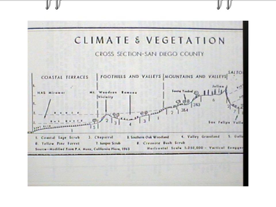
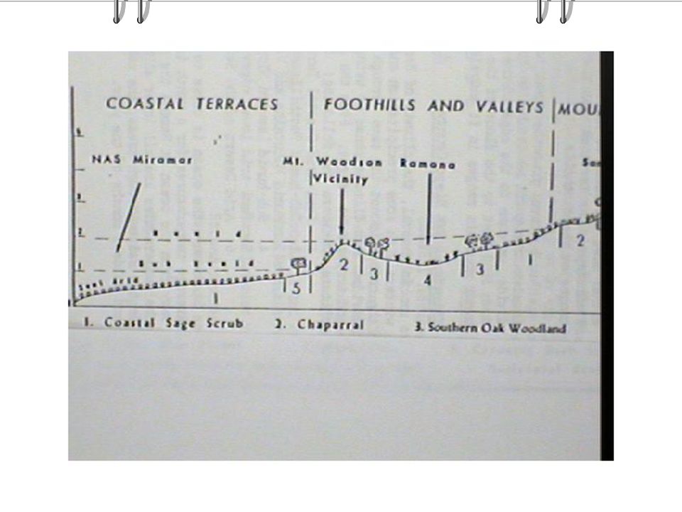
PURPOSE of STUDY: San Diego County has a unique range of ecological communities that begin at the coast line and progress westward across the coastal plain, into foothills, mountains, and a desert region. The rain shadow effect created by this geographical transect provides a unique set of micro climates that define these communities.

6
Purpose cont. East and West Facing canyons along the coastal belt show similar plant transitions and microclimates Students analyze these slopes and then compare and contrast their findings to the larger geographic distributions

7
Class Objectives: To collect data to demonstrate plant
distribution by microclimate using Temperature, Soil Conditions, Moisture & Animal or human interference) To document seasonal changes from Fall to Spring
 To document seasonal changes from Fall to. Spring.")
8
Procedure Students collect field data on biotic and abiotic factors of the canyon. And then match the microclimate features to the key index plants

9
Key Terms Coastal Sage and Chaparral- a scrub land biome
of dense shrubs found along the coast characterized by mild, rainy winters and long, hot, dry summers

10
Key Terms Humus-The product of decaying matter from plants, animals, and decomposers Index Plant-A main plant found in abundance in a particular community

11
Key Terms Transect Line-A line of vegetation selected for charting plants. Microclimate-A climate of an area with important factors such as precipitation and temperature.

13
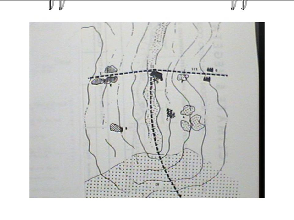
Canyon Overview Climax Areas have stable plant Communities:
West Facing Slope(III) East Facing Slope(I) Riparian Area (Stream bed-I)
 East Facing Slope(I) Riparian Area (Stream bed-I)")
15
Plant Adaptations . . . . . In order to survive harsh
conditions plants must have special features to utilize the available: moisture sunlight nutrients and protect them from animals

16
Highly Adapted Plants . . . . . . Prickly Pear Cactus Leaves are ?
Needles for ? Stem is green for? Thick & Soft to store?

20
Key Difference between:
Adaptations that help a plant to survive a hot, dry climate by preventing water loss versus allowing for water storage

22
Adaptations . . . . . . . . Too much light or heat
can be as damaging as too little & require: long narrow or tiny leaves thick hard stems thick waxy cuticle on leaves to reduce water loss.

23
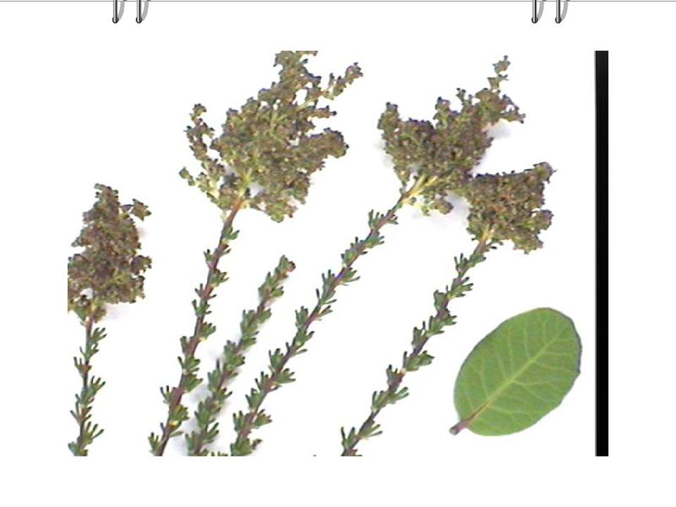
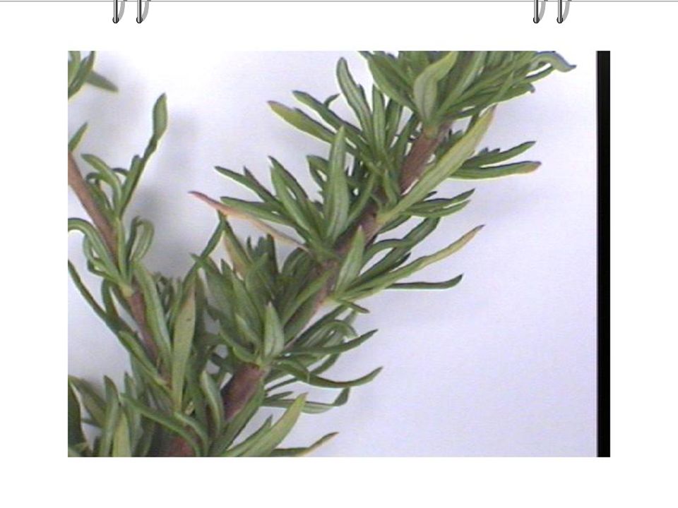
Plant Adaptations of the West Facing Slope Top areas . . . .
Chamise hard woody stem small leaves to prevent water loss. most highly adapted of the shrubs for a hot, dry climate.

27
Mid slope regions . . . . . . Lemonade Berry
Thick waxy cuticle on leaves Thick stems to prevent water loss BUT broad leaf is not as able to survive extreme conditions, so it is a mid slope belt

31
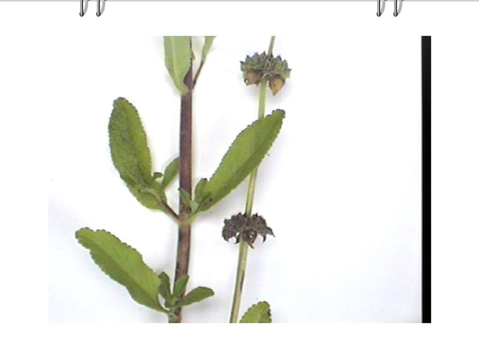
Plants in the lower slope regions
Black Sage Strong aroma Moderately large leaves Turned upward to catch moisture Silver backing to reflect the hot light

34
Mid Slope Plants cont. . . . . . . Baccharis or Chaparral Broom
Small light green leaves Green top stems Hard woody bottom stems Stiff & bushy…broom!

37
Questions to ponder? Flattop Buckwheat How does it get its name?
Why so many leaves? What function does the swirl & clustering of these leaves provide?

39
Mid Slope Plants……. What shape is the leaf?
Ceanotheus What shape is the leaf? What advantage in a hot, dry climate What type of stem adaptation

41
Riparian Plants . . . . . . Rushes are round Sedges have edges
Riparian =Stream Bed Undergoes succession because of stream erosion Rushes are round Sedges have edges Cattails Large deep rooted trees

43
Plant Adaptations of the Riparian
Laurel Sumac- long, broad leaves are NOT well adapted curled leaves help gather water & reduce the amount of surface area exposed to the hot sun thick woody stem to prevent water loss

45
The Succession Study Area IV
Succession Area South slope adjacent to the football field Cleared & filled for the stadium Grasses, small shrubs, and opportunistic species first colonize these areas. This secondary succession area once had living organism but was destroyed & is now recovering.

46
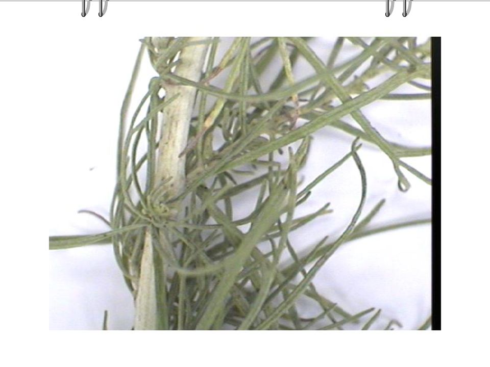
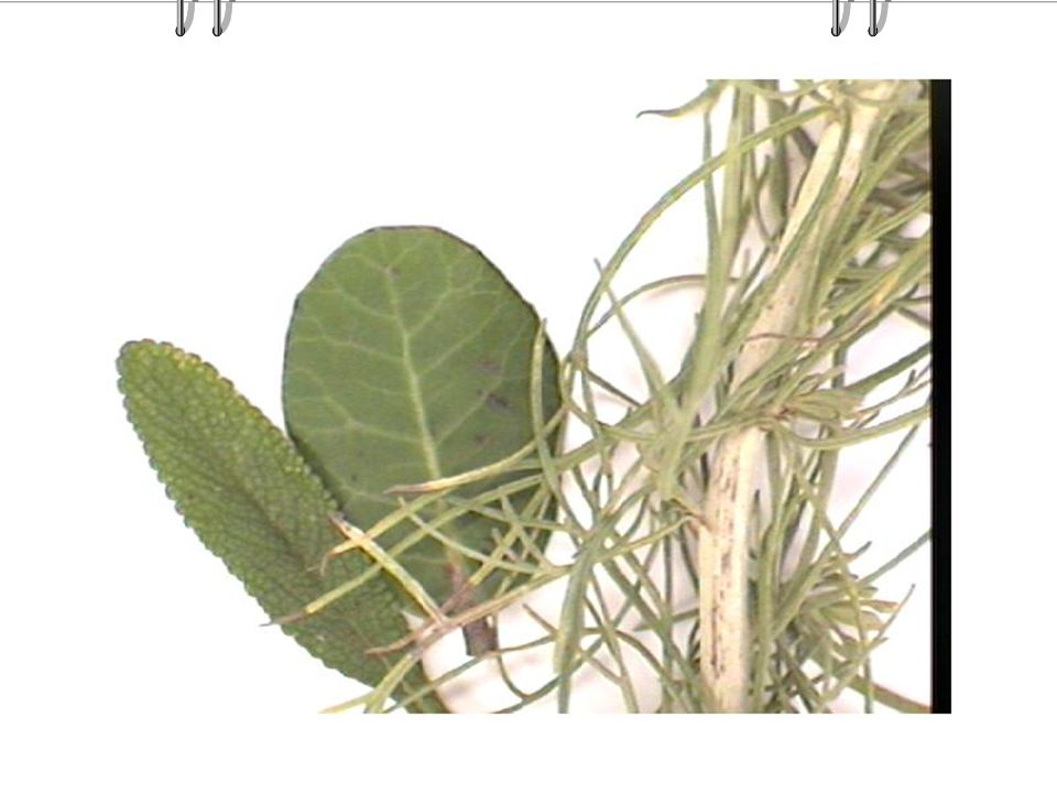
Plants in the Succession area . . .
California Sage Strong aroma Very narrow, long leaves Light gray coloration Reflects hot intense sun light Green stem Increases photosynthesis area

50
Plant Adaptations of the East Facing Slope
Scrub Oak- relatively large tree-like structure dark, cupped oval leaves for gathering water with prickles for protection This plant is an index plant of the foothills community at higher, cooler, elevations.

52
East Facing Slope….. Mazanita- large tree long broad leaves
large surface, but are curled downward red, woody stem prevents water loss.

54
References Http://bio.lmu.edu/socal_nat_hist/nathist.htm
Ancinec, G. et al Natural History of Southern California, A laboratory guide, Peek Publications, Palo Alto, CA.

Similar presentations