Download presentation
Presentation is loading. Please wait.

1
Presented by Joël Morin to Space Weather Workshop 2008

2
Outline Edmonton Area Control Centre Airspace Arctic Air Traffic Flow Patterns Intro to ATC Polar Flight Challenges How Space Weather affects ATC How scientists can help us.

3
Edmonton Area Control Centre Largest domestic Flight Information region in the World – 3,600,000 mi 2

4
Edmonton ACC Airspace above FL290 3.6 Million mi 2

5
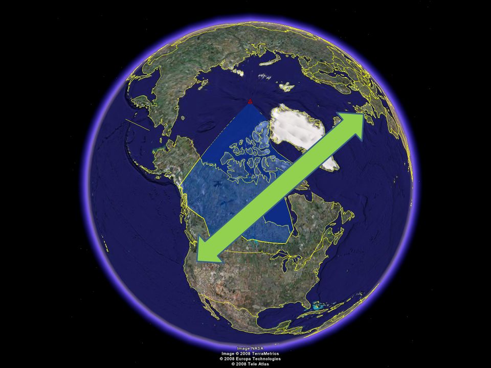
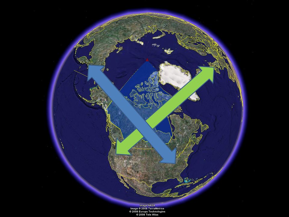
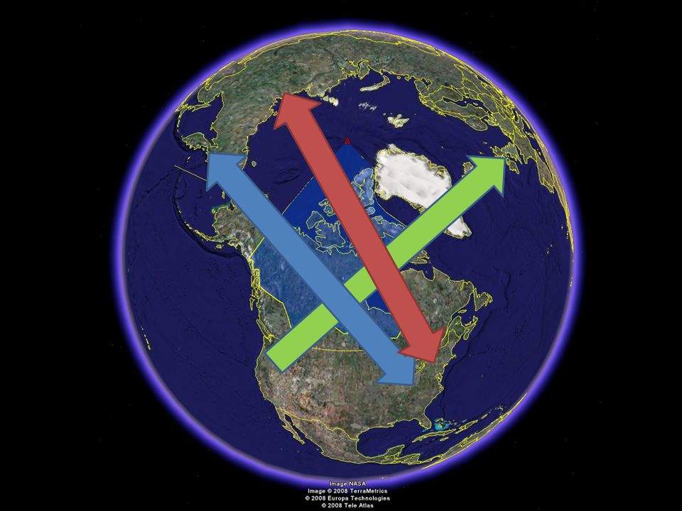
Edmonton Area Control Centre Largest domestic Flight Information region in the World – 3,600,000 mi 2 Major crossroad – Western North America Europe

7
Edmonton Area Control Centre Largest domestic Flight Information region in the World – 3,600,000 mi 2 Major crossroad – Western North America Europe – Eastern North America Asia via Alaska

9
Edmonton Area Control Centre Largest domestic Flight Information region in the World – 3,600,000 mi 2 Major crossroad – Western North America Europe – Eastern North America Asia via Alaska – Eastern North America Asia via Polar gateways

11
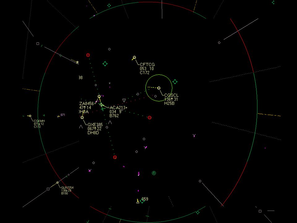
Air Traffic Control’s Function Safe, Orderly, Expeditious flow of air traffic In the IFR domain (aircraft flying on instruments), ATC provides the separation between aircraft.
, ATC provides the separation between aircraft.")
12
Vertical Separation – 1000 feet (in most cases)
")
14
Non-radar Lateral Separation - In the arctic, 60 nautical miles

15
Non-radar Longitudinal Separation 15 minutes (CMNPS airspace)
")
16
Under certain conditions 10 minutes

18
Polar Flights Most Challenging Fuel-critical Payload-limited Beyond Direct Controller – Pilot Communications (VHF) Rely on relayed High Frequency (HF) Family D in arctic (2.9 – 13.3 KHz) Satellite communications emerging
 Rely on relayed High Frequency (HF) Family D in arctic (2.9 – 13.3 KHz) Satellite communications emerging")
19
Polar Flights Most Challenging Fuel-critical Payload-limited Beyond Direct Controller – Pilot Communications (VHF) Rely on relayed High Frequency (HF) Family D in arctic (2.9 – 13.3 KHz) Satellite communications emerging.
 Rely on relayed High Frequency (HF) Family D in arctic (2.9 – 13.3 KHz) Satellite communications emerging.")
20
North American Airports Anchoring Polar Flights

21
Asian Airports served by Polar Flights

22
Sample Polar Great Circle Routes

23
Sample Polar Great Circle Routes with Comms

24
Communications

25
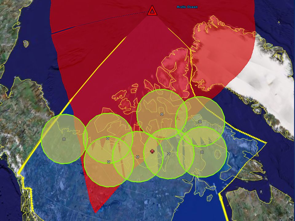
Polar Gateways

26
One day’s trajectories over a fix Red Lines: GCRs Yellow Lines: actual trajectories

30
April 15, 2008 - Colour Coded

31
Polar Caravan

32
Situation Critical flights Large amounts of spacing – 60 miles laterally – 15 minutes longitudinally ( ~120 nautical miles) Limited flight levels – 320 – 340 – 380
 Limited flight levels – 320 – 340 – 380")
33
Situation Critical flights Large amounts of spacing – 60 miles laterally – 15 minutes longitudinally ( ~120 nautical miles) Limited flight levels – 320 – 340 – 380.
 Limited flight levels – 320 – 340 – 380.")
34
Requested Altitude Change Pilot passes request to Gander Radio Gander transmits message to controller Controller issues clearance to Gander Radio Gander Radio relays clearance to pilot

35
Then – Just as things are going well…. Credit: SOHO Consortium, ESA, NASASOHO ConsortiumESANASA

36
Geomagnetic Storm HF Blackout – Varying geographic area – Err on the side of safety Satellite Feeds may be lost Satellite relay of VHF frequencies may be lost GPS accuracy may be compromized

37
Mitigation

38
How Space Weather Science can help Give us as much notice as possible Graphical & geographical products Easily & rapidly understandable by non- scientists Categorize: – HF blackout? – Satellite blackout? loss? Duration of effects

39
Questions?

41
Edmonton Area Control Centre April 2008

42
CZEG With NAM airports

43
April 15 zoomed

Similar presentations


 and Radio Navigation (R/N) services R/T Communications English is the standard language for all commercial flights,>")


