Download presentation
Presentation is loading. Please wait.

2
Spatial Data Infrastructure (SDI)
")
3
“[Spatial Data Infrastructure] provides a basis for spatial data discovery, evaluation, and application for users and providers within all levels of government, the commercial sector, the non-profit sector, academia and by citizens in general.” – SDI Cookbook Spatial Data Infrastructure (SDI)
![[Spatial Data Infrastructure] provides a basis for spatial data discovery, evaluation, and application for users and providers within all levels of government, the commercial sector, the non-profit sector, academia and by citizens in general. – SDI Cookbook Spatial Data Infrastructure (SDI)](http://images.slideplayer.com/16/5169043/slides/slide_3.jpg "[Spatial Data Infrastructure] provides a basis for spatial data discovery, evaluation, and application for users and providers within all levels of government, the commercial sector, the non-profit sector, academia and by citizens in general. – SDI Cookbook Spatial Data Infrastructure (SDI)")
4
The theory of SDI developed before we learned what was possible with the Internet

5
...what an ideal SDI would be like Imagine...

6
uploading, sharing, and working with spatial data as easily as blogging Imagine...

7
Publishing data Anthony has some spatial data and wants to display it as part of a blog post.

8
Publishing data Anthony uploads it to a public SDI, styles it, provides a background, and then puts a map widget on his blog.

9
Publishing data Meanwhile, the data, style, and map remain available on the public SDI for others to use.

10
Metadata and reputation The World Organization tells Cameron, their consultant, to put data she has gathered on their SDI.

11
Metadata and reputation Other users notice mistakes in the metadata. They notify Cameron and give it a low rating.

12
Metadata and reputation Cameron fixes the mistakes, and the other users rate the data more highly. Her reputation on the SDI improves.

13
Federated search A regional Health agency and a regional Transit agency have separate SDI systems.

14
Federated search Tom, a GIS analyst doing research, seeks out correlations between health and bicycle routes

15
Federated search Tom searches for data in a single federated index and downloads the data as a batch.

16
Vision

17
An easy, collaborative web environment for geospatial content

18
Theory

19
How do you make an SDI that's as compelling as modern, widely-used web services?

20
Make an SDI using the best practices of these web services and projects

21
General Principles Grow Bottom Up Align Incentives through Openness Build it for Casual Users Features, not Policies

22
04/26/10 Grow Bottom-Up Start with data. Let users work with it. Generate metadata as needed.

23
Align Incentives... Reward data providers for good contributions Encourage users to contribute back Make value of service transparent to system providers

24
... through Openness Provide a reason to participate Reward collaboration Make it as transparent as possible

25
Build it for Casual Users Reading documentation is too much work. The burden is on the system developers to make it intuitive to use.

26
Features, not Policies If SDI technology requires No overhead or compromises there will be No organizational resistance

27
Features, not Policies Look for and implement smart technical solutions to legitimate organizational concerns.

28
Vision Theory

29
Context

30
is a new software project to build this SDI

31
Founders Global Facility for Disaster Reduction and Recovery (GFDRR) and World Bank UN International Strategy for Disaster Reduction (UNISDR)
 and World Bank UN International Strategy for Disaster Reduction (UNISDR)")
32
Founders Global Facility for Disaster Reduction and Recovery (GFDRR) and World Bank UN International Strategy for Disaster Reduction (UNISDR)
 and World Bank UN International Strategy for Disaster Reduction (UNISDR)")
33
Builders Not-for-profit social enterprise Builds and supports open source geospatial software Aims to build the Open Geospatial Web

34
GeoNode is open source.

35
Install it for free. Contact the developers directly. Collaborate with us and each other. Users can be independent of any vendor.

36
Partners Australia-Indonesia Facility for Disaster Reduction (AIFDR) Global Earthquake Model (GEM) Secretariat of the Pacific Community (SPC)...and others
 Global Earthquake Model (GEM) Secretariat of the Pacific Community (SPC)...and others")
37
We will soon release GeoNode 1.1-beta

38
Vision Theory Context

39
What does GeoNode actually do ?

40
GIS SDI

41
GIS SDI

42
Embed SDI in the real work of GIS practitioners, and it will have more impact.

43
Provides styling and cartography tools Users can use the tools on data they upload GeoNode provides a reason to participate

45
Map composer makes Maps Maps are an important content type They bind together ecosystem of geospatial content

48
Maps, Data and Users form an web to be browsed

49
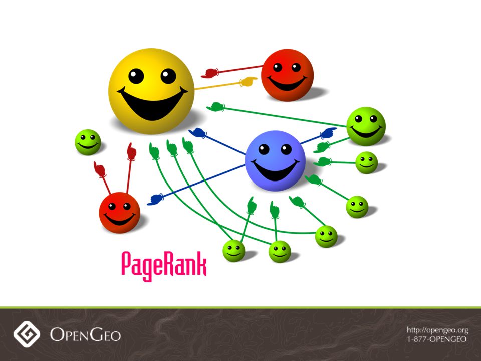
Generic search engines (like Google, Bing) can crawl and rank these pages.
 can crawl and rank these pages.")
50
Users Have Identity People fill out user profiles to establish identity on the web Profiles are also useful data

51
Meanwhile, Metadata Pain Good metadata for geospatial data is important but hard to produce.

52
GeoNode has user profiles and features them prominently Those profiles have ISO metadata fields within them

53
Metadata Made Easy

54
Metadata Published Metadata is published with open standard CSW using GeoNetwork

55
Open standards and API's

56
Data published by GeoServer in OGC Services: WMS, WFS, WCS Metadata published by GeoNetwork in CSW

57
KML for Google

58
We use open standards for data access. GeoNode also has open APIs

59
HTTP

60
GeoNode's components interact through clean API's Others can build apps around GeoNode Or swap out components (Drupal...?)
")
61
Let Users Control Content

64
Content owners control access with easy user interface Deep data security extends to OGC services

65
We are building GeoNode to accommodate any institution's access policy

66
All these features are included in the current 1.0 release.

67
Extensions

70
Vision Theory Context Reality

71
Future

72
We have even more ambitious plans for GeoNode moving forward

73
Use the Social Network

74
The Social for Search

77
04/26/10

79
Record statistics on usage Let users comment on and rate content Use that information to improve search results

80
The Social for Quality

81
Ratings affect user reputation Will encourage quality content on SDI

82
04/26/10 Groups Matter

83
04/26/10

84
Organizations will have a presence Allows organizational endorsement of data

85
Open Data Skepticism Isn't GeoNode an open data platform? Doesn't open data raise concerns about data quality and data security?

86
Open Data Optimism Yes, GeoNode is designed to promote open data.

87
Open Data Optimism Features like User reputation Organizational endorsement Flexible security address data quality concerns

88
Open Data Optimism GeoNode supports the continuum of openness with a common platform for institutional GIS and neogeography

89
Editing

90
04/26/10 Federation

91
04/26/10

92
The partnership investing in GeoNode is growing The roadmap expands with the vision and needs of its partners

93
First ever GeoNode Roadmapping Summit is May 19-20

94
Summit Attendees World Bank AIFDR SOPAC Mapstory/NGA NASA GEM Harvard CGA

95
GeoNode Action

96
How to Try It Play with the live public demo at http://demo.geonode.org (Warning: Unstable)
")
97
How to Build It Follow the documentation http://docs.geonode.org Email questions to mailing list geonode@librelist.com geonode@librelist.com Talk to developers in #geonode IRC channel

98
How to Learn More http://geonode.org

99
Thanks!

Similar presentations