Download presentation
Presentation is loading. Please wait.

1
Oceanography from Space

6
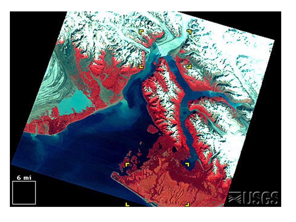
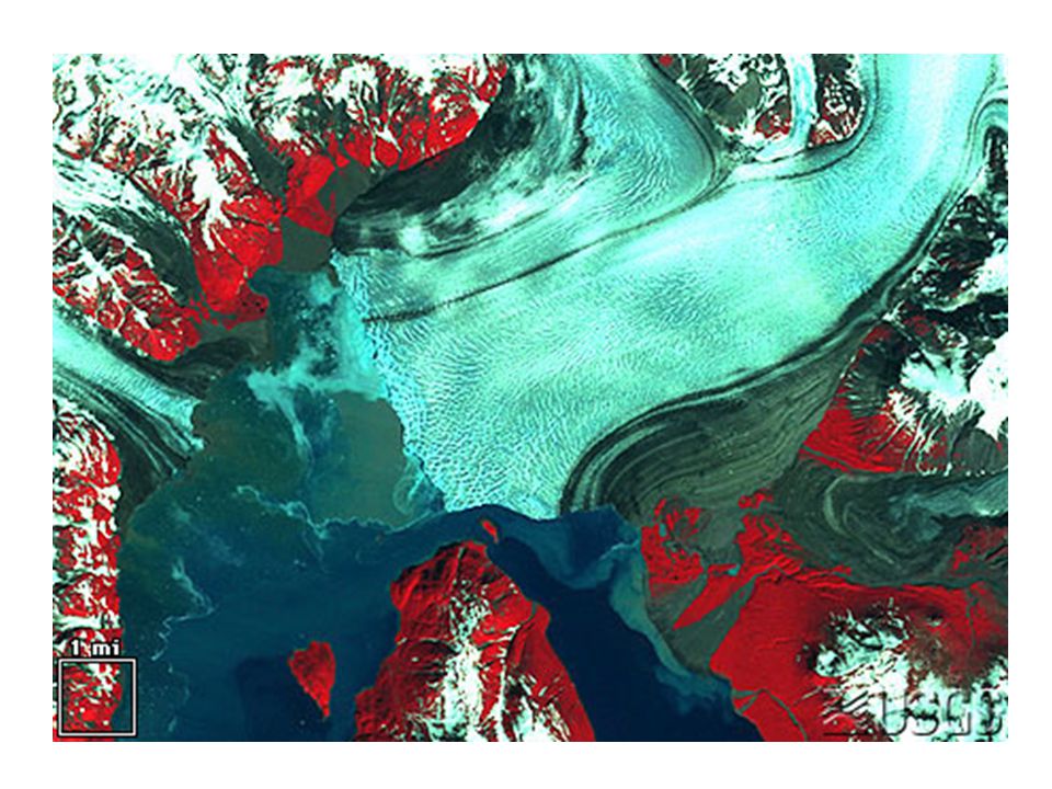
Landsat images show how much energy from the sun (electromagnetic radiation) was reflecting off the Earth's surface when the image was taken. Clear water reflects little radiation, so it looks black. Pavement and bare ground reflect a lot of radiation, so they look bright. Urban areas usually look light blue-gray. Vegetation absorbs visible light but reflects infrared, so it looks red. This is a customary way to show satellite images. (Some images have black "zero fill" at the corners, because the Landsats do not fly straight north-south. Most images are color-adjusted and reduced-resolution.) Reading Landsat Images
 Reading Landsat Images.")
Similar presentations


 Our atmosphere receives most of its energy from the sun. This energy travels in waves from the sun called electromagnetic.>")

 Weather Satellite Interpretation 1. Visible satellite images are coded from black to white according to the amount of reflected.>")


 1>")


