Download presentation
Presentation is loading. Please wait.

1
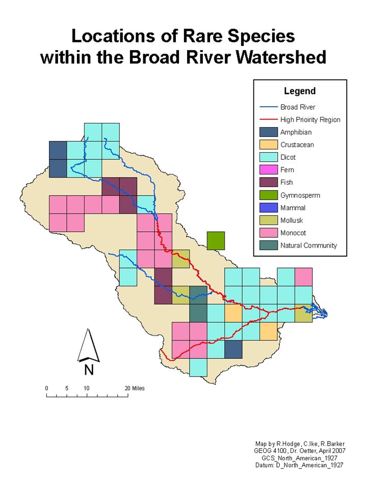
Broad River Watershed Assessment
Rachel Hodge Claire Ike Robin Barker

2
Problem Statement: No comprehensive studies have been conducted regarding the ecological, hydrological, historical, economic, political, and social features within the Broad River watershed. A wide-ranging water basin characterization will allow the Broad River Watershed Alliance to identify important water monitoring sites.

3
Broad River Watershed Alliance
Founded in 1991 Work with landowners to ensure protection of lands from harmful development Act to conserve Education and outreach through public forums Adopt-A-Stream monitoring River clean-ups

4
Broad River Background
Approximately 944,000 acres and includes parts of thirteen Georgia counties. One of the last free-flowing rivers in Georgia. Flowing south from its headwaters in Banks and Stephens Counties through Madison and Elbert Counties to its confluence with the Savannah River at the Clarks Hill/Strom Thurmond Reservoir. Provides drinking water for the cities of Royston and Franklin Springs and it is an industrial and agricultural water supply for the region. Recreational uses throughout Canoeing, camping, kayaking, etc. Provides habitat for deer, turkeys, bobcats, foxes, beavers, otters, muskrats, quail, dove, mallards, wood ducks, turtles, crayfish and many others.

5
Threats to Watershed Agricultural non-point source pollution
Septic systems Landfill leachate Litter Construction in the floodplain Riverbank erosion Destruction of the vegetative buffer Lack of tributary protection Poorly planned development

6
Heading North: What we Found on the South Fork
Sandy Creek Shallow, can see the bottom from the top of bridge, turtles, brown water, shoal areas, exposed rocks, birds. Watson Mill Bridge St. Park Exposed rock, bridge that separates flowing water form reservoir (dam), water is clear with minimal trash, hydroponic vegetation. Hwy 72 slow water flow, shallow, sandbars, fallen trees, 80% canopy cover, stream not very wide. South Fork Hwy 72 minimal water flow, cut bank on one side, fallen trees blocking flow, turbid waters, sandy brown sediment. *Study points also taken from EPA
, water is clear with minimal trash, hydroponic vegetation. Hwy 72. slow water flow, shallow, sandbars, fallen trees, 80% canopy cover, stream not very wide. South Fork Hwy 72. minimal water flow, cut bank on one side, fallen trees blocking flow, turbid waters, sandy brown sediment. *Study points also taken from EPA.")
7
Field methods used GPS- NAD 1983 Zone 17 N. Photos Visual observations

9
Watson Mill Bridge State Park

17
Analysis: Geoprocessing

18
Area: Ha

19
Area: Ha

20
Area: Ha

21
Analysis: Statistical

25
Resources www.gis.state.ga.us

Similar presentations