Download presentation
Presentation is loading. Please wait.

1
Good Morning 12/13/11 Take a handout out of the purple tray and begin working on it. On the back, answer or define: –How is the country organized? –Where is it located? –What kind of geographic features does it have? –What language do they speak? –What kind of natural resources do they have?

2
Physical FeatureNotes

3
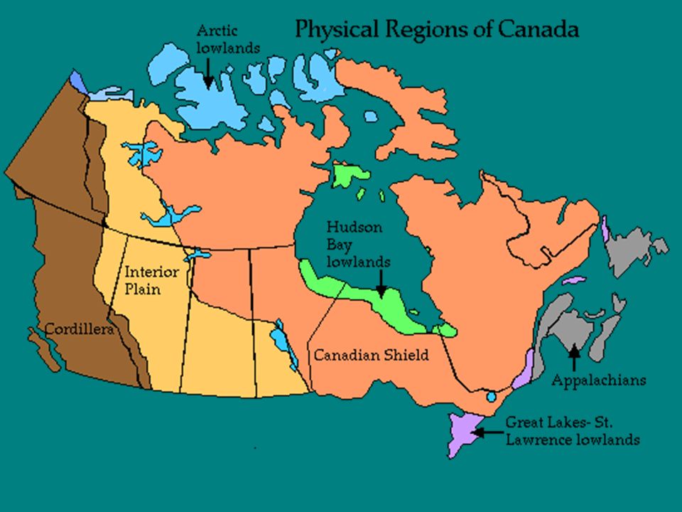
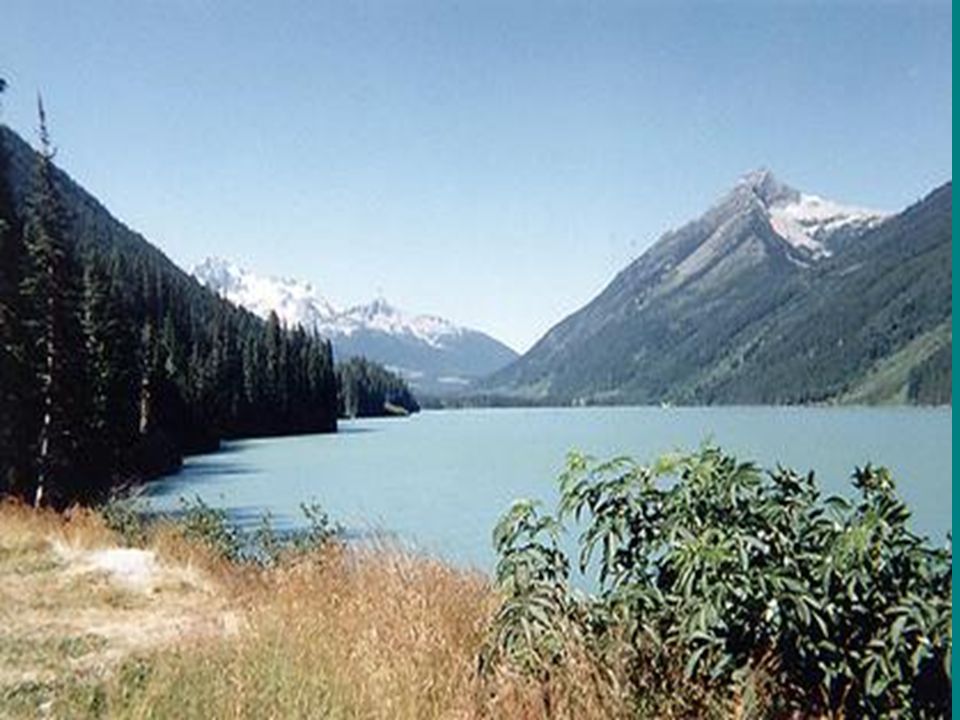
Physical Features of Canada

5
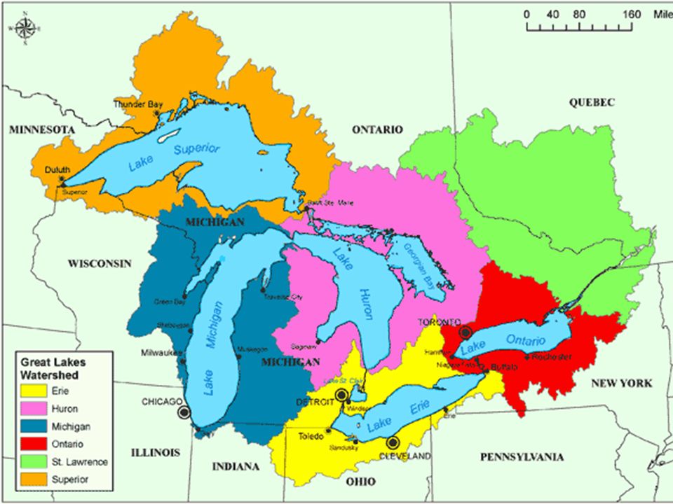
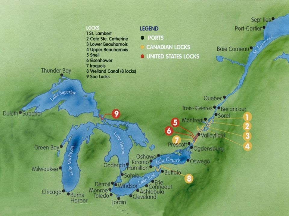
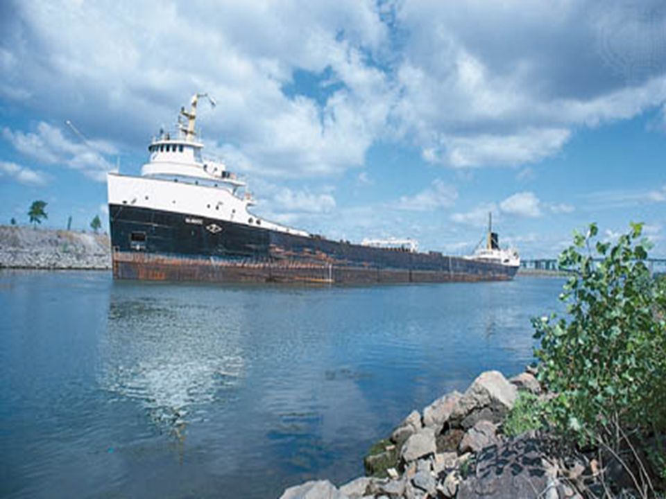
Great Lakes 5 large freshwater lakes in central North America – HOMES (Huron, Ontario, Michigan, Erie, Superior) Serve as the “industrial heartland” of the continent because of all of the factories One of the world’s busiest shipping areas –Most of Canada’s population lives in this region
 Serve as the industrial heartland of the continent because of all of the factories One of the world’s busiest shipping areas –Most of Canada’s population lives in this region")
8
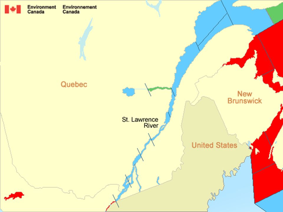
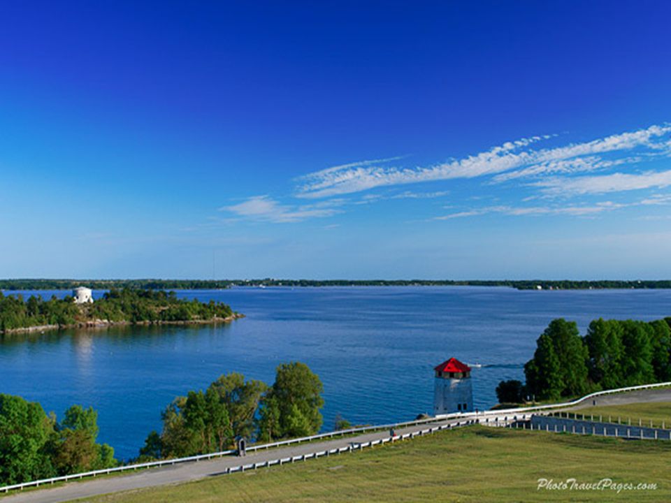
St. Lawrence River Major source of overseas and US/Canada shipping & trade –Shortcut that connects the Great Lakes to the Atlantic Ocean Huge producer of hydroelectricity

11
St. Lawrence Seaway A canal completed in 1959 at the eastern end of the Great Lakes –Connects the Great Lakes with the St. Lawrence River (which flows to the Atlantic Ocean) Major source of overseas and US/Canada shipping & trade –Closed from November to April (frozen) –Seaway has made cities in Eastern Canada home to many successful manufacturing companies
 Major source of overseas and US/Canada shipping & trade –Closed from November to April (frozen) –Seaway has made cities in Eastern Canada home to many successful manufacturing companies.")
14
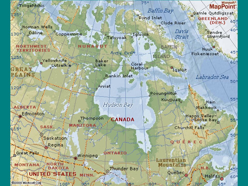
Hudson Bay HUGE inland sea in east central Canada “an arm” of the Atlantic Ocean –Grain from Alberta & Saskatchewan is shipped from Hudson Bay out to the Atlantic and on to other countries –Only navigable from July to October

18
Atlantic Ocean 2 nd largest of the earth’s 5 oceans Most heavily traveled ocean Forms the eastern border of Canada –Major shipping route to Europe & Africa

19
Pacific Ocean Largest & deepest of the world’s 5 oceans Covers 1/3 of the earth’s surface! Western border of Canada –Major shipping route to Asia

20
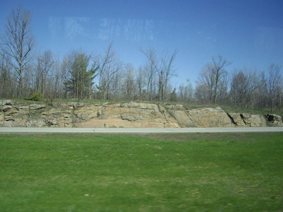
Canadian Shield Stretches from Great Lakes to Arctic Ocean; covers half of Canada! –Horseshoe region around Hudson Bay Region of mostly thin soil lying on top of rock, with many bare outcrops of rock & thousands of lakes Major source of natural resources: timber, minerals, & water Region is sparsely populated

23
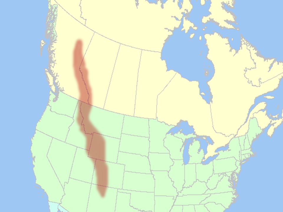
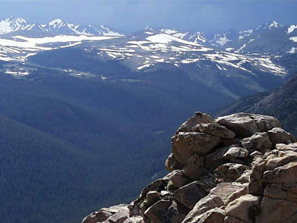
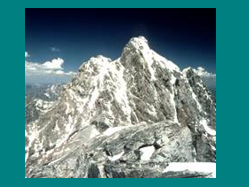
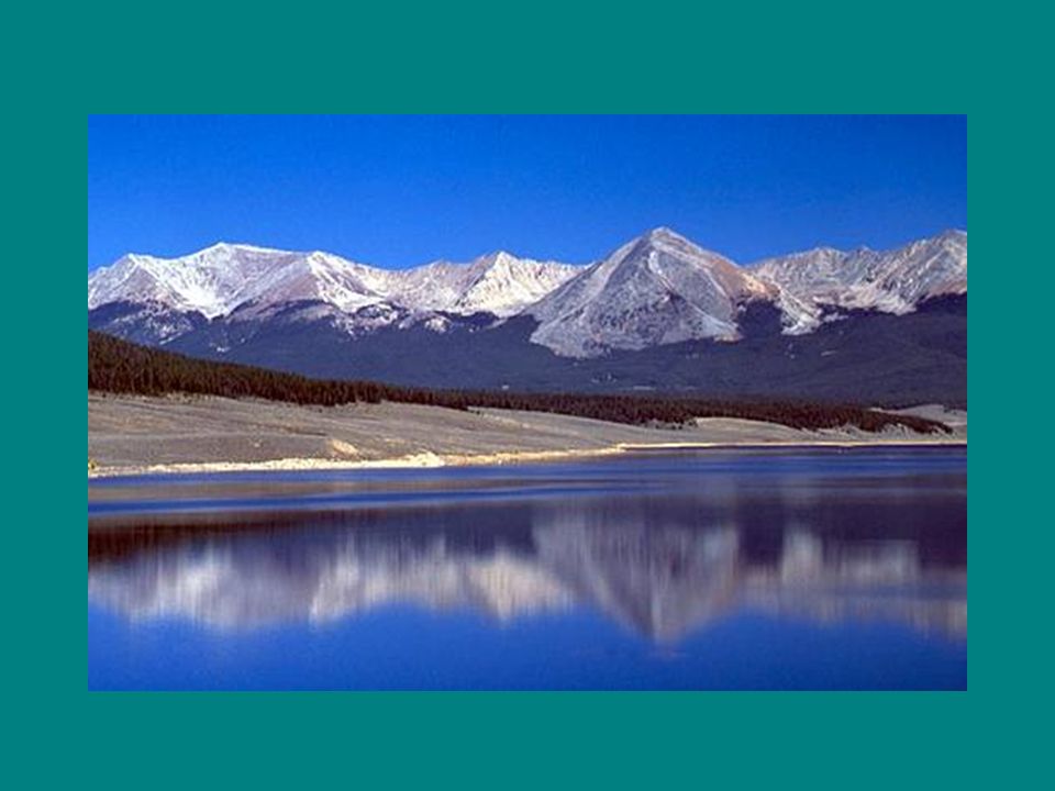
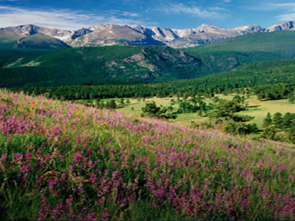
Rocky Mountains Mountains located in Western Canada –Includes western Alberta and eastern British Columbia Stretch a distance of 2,000 miles! Mining is the biggest industry in the region, followed closely by logging –Major minerals include: iron ore, copper, coal, gold Sparsely populated & contain few cities

29
Be the Thing… Your Task: –Choose 1 of the physical features –Fold your paper “hamburger style” to make a desk tent On the front : Imagine that you are one of the features. Write 5 facts about yourself. On the back: draw an illustration of the feature –We will walk around and try to guess the features!

30
Who Am I? Brrrrr! I am always so cold!! It’s chilly up here in northern Canada. I am so tired of everybody always picking on me. Dig, dig, dig all day long. I wish I had some pretty trees to look at…All that I can see is scraggly trees and flat, rocky land. It’s so lonely. No one lives near me. My Example…

31
The Canadian Shield!

Similar presentations


>")


