Download presentation
Presentation is loading. Please wait.

1
GRADE 10 GEOGRAPHY SKILLS UNIT MAP TYPES

2
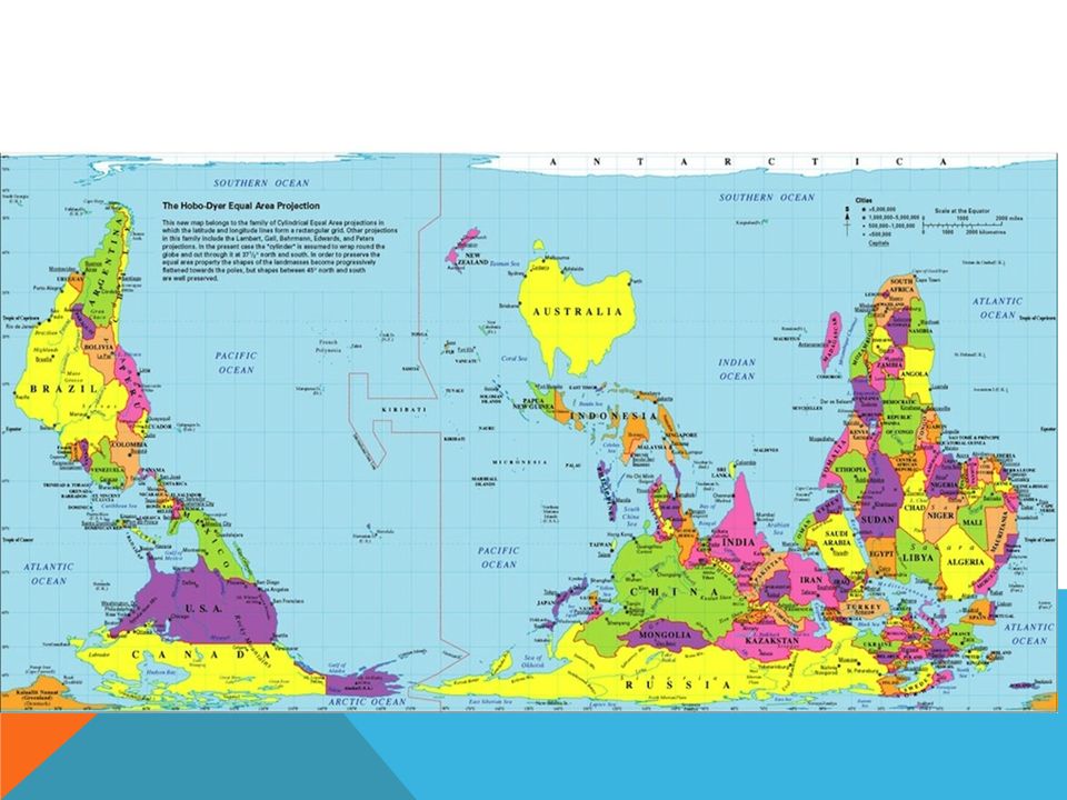
PROJECTION METHODS OF MAPS 1) MAP PROJECTIONS are used to transfer images from the globe to a FLAT surface. It is used for making SMALL scale maps, allowing a whole COUNTRY or CONTINENT, or even the world to fit onto one page. (plus its easier to carry a map in your pocket rather than a globe ;) The 3 most common types of projection methods are: PLANE CONICAL CYLINDRICAL
 The 3 most common types of projection methods are: PLANE CONICAL CYLINDRICAL.")
3
1) THE PLANE PROJECTION -is restricted to mapping SMALL areas such as the NORTH or SOUTH POLE. It is accurate in the CENTER, clearly shows the MERIDIANS (of Longitude), but is inaccurate around the EDGES.
, but is inaccurate around the EDGES..")
4
2) THE CONICAL PROJECTION - is used for COUNTRIES, CONTINENTS, or regions with an EAST-WEST alignment. They are accurate along the ‘STANDARD PARALLEL’ which occurs approximately half way up the map, but are quite distorted near the TOP and BOTTOM.

5
3) THE CYLINDRICAL PROJECTION -aka MERCATOR projection is useful for mapping EQUATORIAL regions, and is also used for producing WORLD maps. It is the only projection that can gather most areas of the globe onto one map. It is accurate along the EQUATOR but is almost useless beyond 60 degrees latitude. **In 1998 the National Geographic Society cartographers created a new type called the WINKLE TRIPEL map projection to correct some of the Mercator's imperfections.

6
4) THE OVAL PROJECTION -Shows areas correctly around the ‘standard line’ or EQUATOR, however it too often DISTORTS shapes towards the POLES.
 THE OVAL PROJECTION -Shows areas correctly around the ‘standard line’ or EQUATOR, however it too often DISTORTS shapes towards the POLES.")
7
There are many other projections methods, each with its advantages and disadvantages. Generally speaking, there is no one, overall best map projection method. Each method has value depending on what is being mapped, and the purpose for which the map is being created.

8
A few more map types to know…. Topographic A.K.A. Relief Maps Maps used to illustrate varying ELEVATIONS of an area are called TOPOGRAPHIC maps. These maps use CONTOUR lines or color to indicate differences in elevation. (height above or below sea level)
.")
9
POLITICAL MAPS Maps that show the names of cities, PROVINCES, states and country names.

10
THEMATIC MAPS A map that only shows ONE SPECIFIC theme or subject. For example: population distribution, Ppt amounts, TEMPERATURE, forest types….

11
NOW, FOR A FEW FUN VIDEOS! http://www.youtube.com/watch?v=zUfUNW7z3Fw Global Concepts in Maps (Highlights) - 1947 Longitude and Latitude Funny Geo Teacher Rap International Date Line Explained Map projections West Wing Why are we changing maps? World Map without distortion Maps that show you that you really don't know the world http://www.youtube.com/watch?v=fQPYhELR tWI&feature=related ---doesn’t work?
 Longitude and Latitude Funny Geo Teacher Rap International Date Line Explained Map projections West Wing Why are we changing maps. World Map without distortion Maps that show you that you really don t know the world v=fQPYhELR tWI&feature=related ---doesn’t work .")
13
EXIT SLIP/RESPONSE- HAND IN BY THE END OF CLASS- S2-KP-040 Describe ways in which various globes, maps and/or map projections may influence perceptions. For example: relative size and position, power, sovereignty

Similar presentations