Download presentation
Presentation is loading. Please wait.

1
Chapter 7 6 th Grade

2
Section 1 Weather is the condition of the atmosphere at a certain time and place. This condition is affected by the amount of water in the air. Water cycle: states are liquid, solid, and gas. It is continuous. Know condensation, evaporation, precipitation, runoff, transpiration. Humidity: The amount of water vapor in the air. It is invisible. It enters the air because of evaporation. The higher the temperature the more water the air can hold.

3
Section 1 Relative humidity: the ratio of the amount of water vapor in the air to the maximum amount of water vapor the air can hold at a set temperature. It is given as a percentage. When air is holding all it can at a temperature it is said to be saturated. So its relative humidity is 100%. To determine relative humidity you simply: Actual water vapor content (g/m3) ___________________________ x 100 = relative humidity saturation water vapor content (g/m3)
 ___________________________ x 100 = relative humidity saturation water vapor content (g/m3).")
4
Section 1 Two factors affect relative humidity. Amount of water vapor and temperature. More water vapor = higher relative humidity. However, if the temperature changes then the relative humidity will change. Relative Humidity will decrease as temperature rises and increase as it decreases. Why does this occur?

5
Section 1 Psychrometer: an instrument that is used to measure relative humidity. It is basically two thermometers, one is a wet bulb (just covered with a wet cloth) while the other is dry. The differences in temperature readings indicates how much water is in the air. The larger the difference between the two readings the less amount of water vapor that is present in the air. Therefore, the lower the humidity.
 while the other is dry. The differences in temperature readings indicates how much water is in the air. The larger the difference between the two readings the less amount of water vapor that is present in the air. Therefore, the lower the humidity..")
6
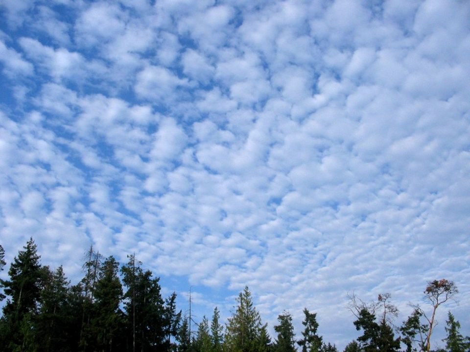
Section 1 Condensation: someone explain it to me. Dew point: the temperature at which a gas condenses into a liquid. Air is saturated at its dew point. Clouds: a collection of millions of tiny water droplets or ice crystals. They form as warm air rises and cools. As the air rises it becomes saturated. The water vapor changes to a liquid or a solid. Temperatures above freezing water vapor forms a liquid. Below freezing it forms a solid. Clouds are classified by form and altitude.

7
Clouds Cumulus clouds: puffy white clouds that tend to have flat bottoms. Form when warm air rises. Tend to indicate fair weather. When they get large they can produce thunder storms. The thunderstorm cloud is called a cumulonimbus cloud. Clouds that have nimbus or nimbo likely produce precipitation. Stratus clouds: clouds that form in layers. Often cover larger areas of the sky and block the sun. Caused by a gentle lifting of a large body of air. Nimbostratus clouds are dark clouds that produce light to heavy continuous rain. Fog is a stratus cloud that formed near the ground.

13
Clouds Cirrus clouds: are thin, feathery, white clouds at high altitudes. They form when the wind is strong. They tend to indicate a change in the weather. Altitudes of clouds: cirro indicates clouds at high altitudes. Alto: clouds that form at middle altitudes. Low altitude clouds do not have prefixes. Be familiar with the altitudes.

15
Precipitation Rain: when water reaches a certain size. Water in a cloud begins very small, like a dot or smaller. Before it can fall it needs to be 100X bigger. Sleet-when rain falls through a layer of freezing air. Snow: temperatures are so cold that water vapor changes directly into a solid. Hail: balls or lumps of ice that form in a cloud. Forms in cumulonimbus clouds. Updrafts keep sending the hail up in the air where it collects more water or layers of ice. Eventually to heavy to collect more ice and falls.

16
Section 2 Air mass: a large body of air where temperature and moisture content are similar throughout. Causes changes in weather. The moisture content and temperature of an air mass are determined by the area over which the air mass forms. These areas are called source regions. Ex. gulf of Mexico: warm and wet. Pg. 192 details the types of air masses.

17
Section 2 Cold air mass: three polar air masses influence most of the cold winter in the U.S. Continental polar (cP) forms over northern Canada and brings really cold weather. In summer it tends to bring cool, dry weather. Maritime Polar (mP) forms over the North Pacific Ocean and brings cool, wet weather. Cool, foggy weather in the summer. (mP) over the North Atlantic brings cool, cloudy weather and precipitation to New England in the winter and in the summer cool, foggy weather.
 forms over northern Canada and brings really cold weather. In summer it tends to bring cool, dry weather. Maritime Polar (mP) forms over the North Pacific Ocean and brings cool, wet weather. Cool, foggy weather in the summer. (mP) over the North Atlantic brings cool, cloudy weather and precipitation to New England in the winter and in the summer cool, foggy weather..")
18
Section 2 Warm air masses: Four warm masses. Maritime Tropical (mT)—develops over warm areas in the pacific Ocean. (mT) Form in the gulf of Mexico and in the Atlantic Ocean. They bring a lot of hot and humid weather in the summer, as well as hurricanes and thunderstorms. In the winter they bring mild, cloudy weather. Continental Tropic (cT) forms over the deserts of northern Mexico and southwestern U.S. It brings clear, dry, and hot weather in the summer
—develops over warm areas in the pacific Ocean. (mT) Form in the gulf of Mexico and in the Atlantic Ocean. They bring a lot of hot and humid weather in the summer, as well as hurricanes and thunderstorms. In the winter they bring mild, cloudy weather. Continental Tropic (cT) forms over the deserts of northern Mexico and southwestern U.S. It brings clear, dry, and hot weather in the summer.")
20
Section 2 Fronts: Air masses that form from different areas that do not mix. They have different densities. Warm air is less dense than cold air. A front is basically the boundary between air masses of different densities and usually different temperatures. Four types of fronts. Pg. 194! Cold front: Forms when cold air moves under warm air, which is less dense, and pushes the warm air up. These often bring thunderstorms, heavy rain, or snow. Warm front: when warm air moves over cold air. The warm air eventually replaces the cold air. They can bring drizzly rain and clear, warm weather.

21
Section 2 Occluded Front: When a warm air mass is caught between two colder air masses. The coldest air mass moves under and pushes the warm air mass up. It continues to move forward until it meets the other cold air mass. This can produce large amounts of rain/snow. Stationary Front: when a cold air mass meets a warm air mass. Neither air mass moves the other and the two remain separated---likely because there is not enough wind. Can bring cloudy, wet weather.

23
Section 3 Severe Weather: Thunderstorms: small, intense weather systems that produce strong winds, heavy rains, lightning and thunder. Two atmospheric conditions required to produce a thunderstorm: warm and moist air near Earth’s surface. Atmosphere is unstable when the surrounding air is colder than the rising air mass. Remember cold air is denser. When warm air reaches its dew point, the water vapor condenses and forms a cumulus cloud(s). The warm air can continue to rise and the cloud will grow dark— cumulonimbus cloud.
. The warm air can continue to rise and the cloud will grow dark— cumulonimbus cloud..")
24
Section 3 Lightning: is an electric discharge that takes place between a positively charged area and a negatively charged area. It can occur between clouds, earth and cloud, or even in the same cloud. Same as static electricity—rubbing your feet on carpet and touching someone. The lightning strike releases energy. The energy is transferred to the air and sends out sound waves called thunder.

25
Section 3 Tornadoes: happen in only 1% of all thunderstorms. Starts out as a funnel cloud and protrudes though the bottom of a cumulonimbus cloud. It becomes a tornado when it touches the ground. 75% of the worlds tornadoes occur in the U.S. Most happen in the spring and early summer when cold, dry air from Canada meets warm moist air from the tropics. Most only last a few minutes. Tornadoes can uproot trees---wind between 120 to 500 km/h.

26
Section 3 Hurricanes: wind speeds of at least 120km/h. They are the most powerful storms on Earth. Also called typhoons or cyclones. Most form in areas between 5 degrees and 20 degrees north latitude and 5-20 degrees south latitude. It begins as a group of thunderstorms over tropical water. Wind that was traveling in different directions meet and causes a spinning effect. Because of the Coriolis effect the storm turns counterclockwise in the Northern Hemisphere and clockwise in the Southern Hemisphere. It gets its energy from water condensation. Fueled by going over warm water. As the warm, moist air rises the water vapor condenses and releases large amounts of energy. When it moves over colder areas it begins to lose energy.

27
Section 3 Hurricanes can have wind speeds up to 300 km/h. Often cause storm surges----high walls of water that crash onto the shore. Know the parts of a hurricane on page 202. Storm safety!!!!!

28
Section 4 Meteorologist: predicts weather. To predict weather a meteorologist needs to measure various atmospheric conditions, such as air pressure, humidity, precipitation, temperature, wind speed, and wind direction. Weather balloons carry electronic equipment that measures conditions up to 30 km above the earth’s surface. Can measure temperature, air pressure, and relative humidity.

29
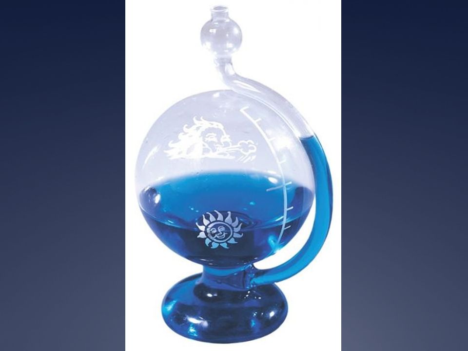
Section 4 Thermometer: what does it do? Barometer: measures air pressure. It is a glass tube that is sealed at one end and placed in a container full of mercury. As pressure increases the mercury moves up the glass tube. The more the air pressure the higher the mercury will rise. Windsock or wind vane: measures wind direction. Anemometer: is three or four cups connected to a pole. It measures wind speed.

32
Section 4 Radar is used to find the location, movement, and amount of precipitation---Doppler radar. Weather maps: isobars = air pressure.

Similar presentations