Download presentation
Presentation is loading. Please wait.

1
Introduction to Network Analyst (adapted from ESRI Lessons) GEOG 4650/5650 2009 Spring Week 2
 GEOG 4650/ Spring Week 2")
2
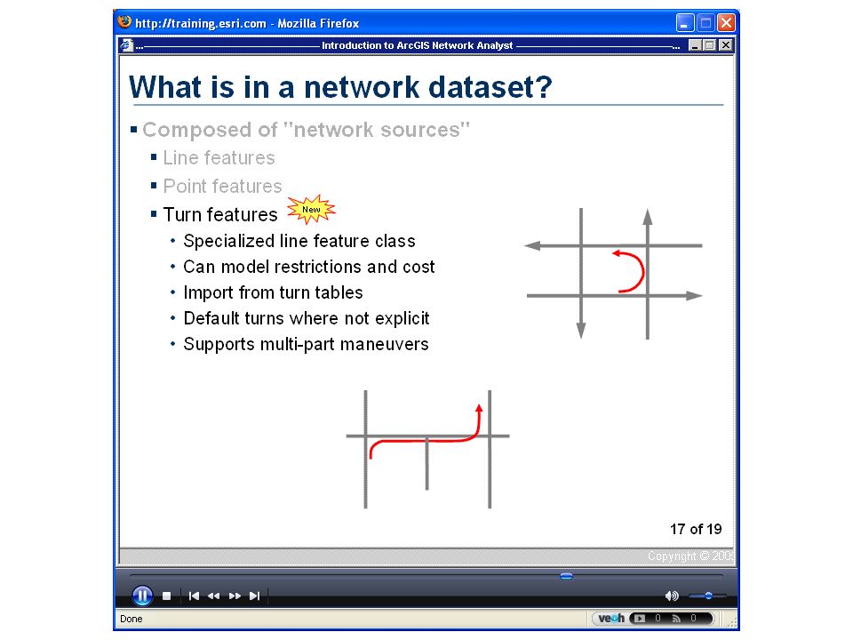
Goal : to model real-world networks Solving transportatio n problme Road – interstates, Streets Railroad Busline Turns

3
What does it solve? Best route – find best route Closet facility – find closet pizza store Service area – find streets/zone from distance Origin-destination cost matrix

4
Network Analyst in ArcMap

5
Toolbar

6
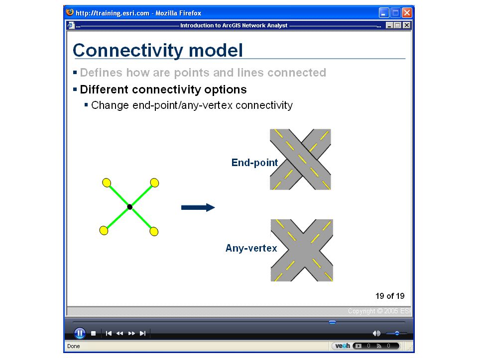
Designing the Network Dataset Network dataset can be shapefile,geodatabase or SDC dataset Shapefile supports one edge source Geodatabase supports multiple edge and junction sources SDC – highly compressed countrywide street network (purchased from vendor) Build Network Dataset : From ArcCatalog or ArcToolBox | Network Analyst | Network Dataset | Build Network
 Build Network Dataset : From ArcCatalog or ArcToolBox | Network Analyst | Network Dataset | Build Network")
7
Attributes of street files distance, travel time, etc. For best results, name these fields the units of your impedances, as these fields will automatically be detected by the New Network Dataset wizard -- for example, you may want to name your travel time field "Minutes". For edge sources, if the impedance values differ based on direction of travel, provide a separate field for each direction of travel -- for example, "FT_Minutes" and "TF_Minutes". If you are modeling one-way streets, be sure that your edge sources have a field specifying one-way street information. The New Network Dataset wizard will recognize a string field named "One_Way" or "Oneway", creating evaluators that interpret its values as follows: –"FT" or "F" indicates a one-way street only permitting travel in the digitized direction of the edge. –"TF" or "T" indicates a one-way street only permitting travel against the digitized direction of the edge. –"N" indicates a street that does not permit travel in either direction. –Any other value indicates a street that permits travel in either direction.

8
Traveling Salesman Problem…..

23
Barrier

33
Creating Network Dataset Start ArcCatalog Right-click Street layer Select New Network Dataset

Similar presentations


 and connecting junctions (points),>")


. Contents overview More about tablesMore about tables New layer enhancementNew layer enhancement Cartographic representationCartographic.>")


 By Alma Vargas. Levels of Desktop ArcGIS Arc View Version that most clients will use The version that this session will.>")
