Download presentation
Presentation is loading. Please wait.

1
Basic Forecast Guidelines

2
Penn State Weather Camps Sat I Sat I - Sat II - NWS - Radar - RadarSat II NWSRadar sfc. map 1 sfc. map 1 - sfc. map 2 – sfc map 3sfc. map 2sfc map 3 -> IR emission PROP to ? -> Temp and Height ?

3
Know what to expect! = Climo. JUNE 22

4
Basic Forecast Guidelines Climatology Forecast = averages for today Persistence Forecast = yesterday’s valuesyesterday’s values Modified Persistence -> Yesterday = First Guess -> Modify based on changes Conceptual Models

5
Basic Forecast Guidelines Modifying Persistence ◦What causes temperature to change? Cloud cover: ◦ Day Vs. Night Precipitation: ◦ When it rains T’s tend to be higher/lower? Why? Wind and Fronts: ◦ Direction N vs. S ◦ Speed Day Vs. Night

6
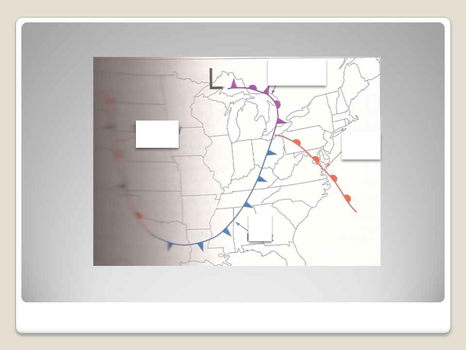
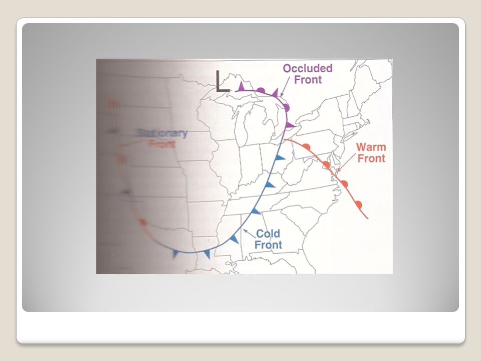
Basic Forecast Guidelines L L

7
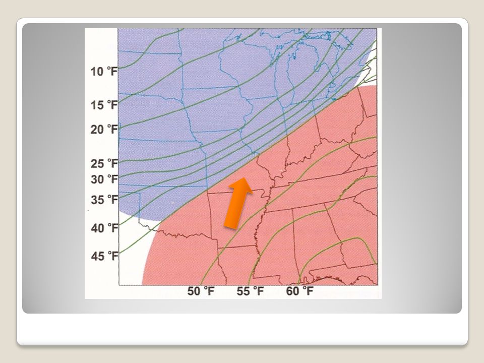
11z TUES -> 70,65,60 Isodrosotherms -> Low, Cold & Warm Fronts L

8
Basic Forecast Guidelines

20
What causes rain? ◦Need clouds! Will any ole cloud do? ◦Moisture supply Bodies of water – Moisture content of air ◦Upward motion: How does this affect clouds/precip.? Mechanisms for “lift” ◦ Fronts – Topography – Low Pressure – Jet stream dist. ◦(In) stability: Warm down low … cold up high!
 stability: Warm down low … cold up high!.")
Similar presentations


 Warm (-31 C)>")
>")


 Dewpoint Depression (°C) Height Wind direction and speed (knots)>")


