Download presentation
Presentation is loading. Please wait.

2
A Satellite View

3
Africa’s Size # Second largest continent 11,700,000 sq. mi. # 10% of the world’s population. # 2 ½ times the size of the U. S. 5000MILES5000MILES 4 6 0 0 M I L E S

4
What do you notice about this map?

5
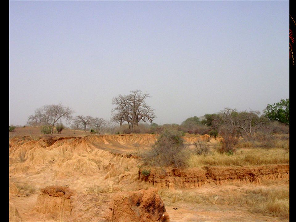
Deserts Sahara Desert Sahel Kalahari Desert Namib Desert Libyan Desert

6
The Sahara Desert

7
Sahara The world’s largest hot desert “Sahara” is Arabic word for desert. The Sahara can experience temperatur e differences of up to 100 degrees Much of the Sahara is not sand. There also are vast areas of gravel, rocky plateaus, and volcanic mountains.

8
The Sahel Desert

10
The Sahel is in these countries. Senegal Mauritania Mali Niger Burkina Faso Nigeria Chad Eritrea Sudan The Sahel is semiarid area just south of the Sahara. The Sahel suffers from desertification, and great famines have resulted.

11
Drajensburg Mts. Ruwenzori Mts. Δ Mt. Kenya Δ Mt. Kilimanjaro Mountains & Peaks Atlas Mts.

12
Atlas Mountains

13
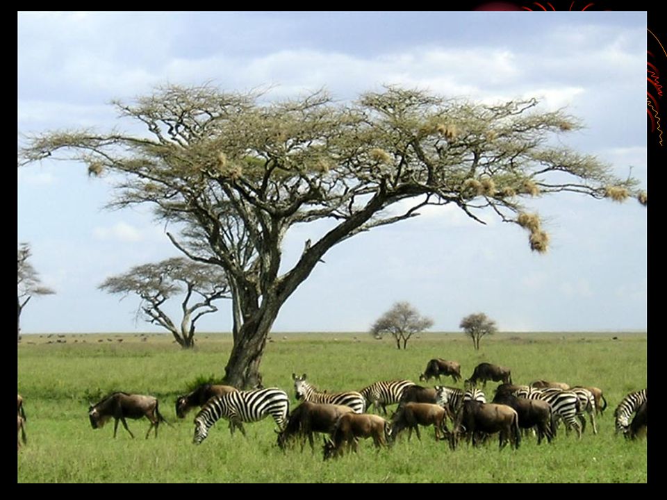
African Savannas, Botswana, and South Africa. It covers 40 % of Africa! It covers Guinea, Sierra Leone, Liberia, Cote D‘ Ivore, Ghana, Togo, Benin, Nigeria, Cameroon, Central African Republic, Chad, Sudan, Ethiopia, Somalia, and the Democratic Republic of the Congo, Angola, Uganda, Rwanda, Burundi, Kenya, Tanzania, Malawi, Zambia, Zimbabwe, Mozambique

14
The African Savannah: 13 million sq. mi.

16
Bodies Of Water Nile River Congo River Zambezi River Niger River Orange River Limpopo River Mediterranean Sea Atlantic Ocean Pacific Ocean Indian Ocean Red Sea L. Victoria L. Albert--> L. Chad--> L. Tanganyika-> <--Gulf of Aden

17
The Mighty Nile River: “Longest River in the World”

18
Nile River Runs North instead of South.Runs North instead of South. Longest river in the world.Longest river in the world.

19
The Congo River Basin # Covers 12% of the continent. # Extends over 9 countries. # 2,720 miles long. # 99% of the country of Zaire is in the Congo River basin.

20
The Congo River

22
The Niger River Basin # Covers 7.5% of the continent. # Extends over 10 countries. # 2,600 miles long.

23
Niger River Third Largest river in AfricaThird Largest river in Africa Why do you thinkWhy do you think Bodies of water are Important to Africa?

24
Lake Victoria Largest lake in AfricaLargest lake in Africa Second widest fresh water lake in the worldSecond widest fresh water lake in the world

25
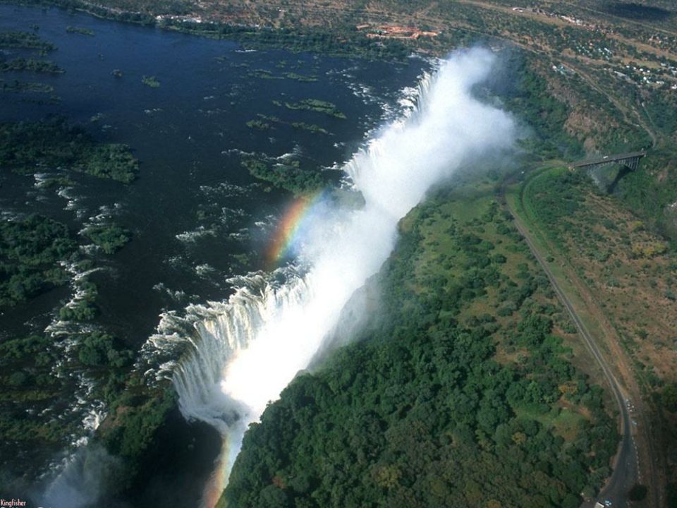
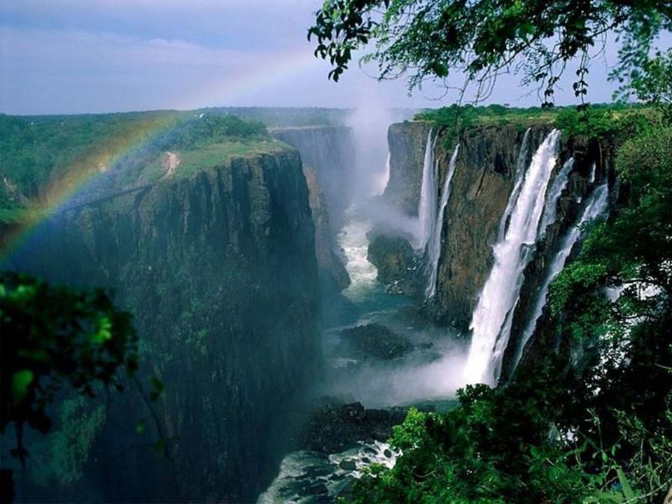
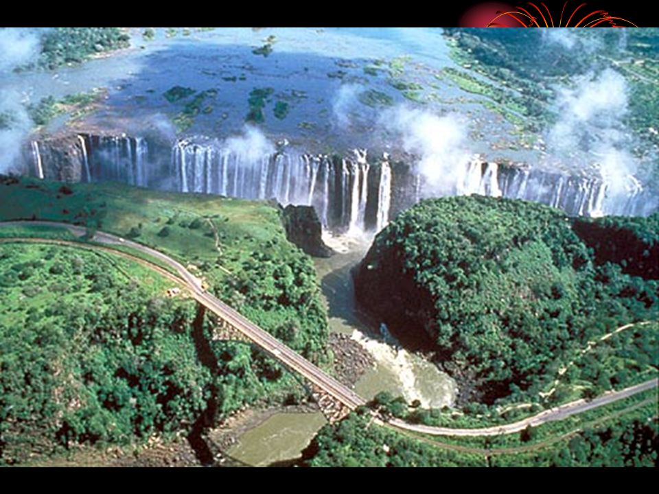
Victoria Falls 350 Ft High

29
Lake Tanganyika Third Largest Lake in the world.Third Largest Lake in the world. Longest Lake in Africa.Longest Lake in Africa. Second Deepest Lake in the world.Second Deepest Lake in the world.

30
Vegetation Zones

31
African Rain Forest # Annual rainfall of up to 17 ft. # Rapid decomposition (very humid). # Covers 37 countries. # 15% of the land surface of Africa.
. # Covers 37 countries. # 15% of the land surface of Africa..")
33
Africa: The “Tropical” Continent Tropic of Cancer 20° N Tropic of Capricorn 20° S Equator 0°

Similar presentations


>")


