Download presentation
Presentation is loading. Please wait.

1
Unit 1, Ch. 1 Looking at the Earth

2
Ch. 1 Section 1 Key Terms Geography Absolute Location Relative Location Hemisphere Equator Prime Meridian Latitude Longitude

3
5 Themes of Geography These 5 Themes help Geographers look at the use of space on earth and the interactions that take place there.

4
Theme 1: Location Location asks the question Where is it?

5
Location Location is identified in two different ways. Absolute Location Relative Location

6
Absolute Location Shows us the “Exact” location of a place by using lines of Latitude and lines of Longitude.

7
Absolute Location An example of Absolute Location is: You are in room 315 at Garland High School. You are in the 3 rd row, 4 th seat in room 315 at Garland High School

8
Relative Location Tells us where a place is “relative” to something else. Ex: You are in a class room at Garland High School.

9
Understanding Location In order to understand “Absolute Location” you must understand the use of Latitude and Longitude Lines.

10
Lines of Latitude Lines of Latitude run East & West or horizontal on a map. These lines are also known as “Parallels”. “Lat”itude / “Flat”itude

11
Lines of Longitude Lines of Longitude run North & South or up and down on a map. These lines are also known as “Meridians”.

12
Degrees of Lines Lines of Latitude only go up to 90 degrees. Equator = 0 degrees Lines of Longitude only go up to 180 degrees. Prime Meridian = 0 degrees

13
Hemispheres The earth is divided into 4 different “Hemispheres”. North, South, East & West

14
Skill Builder

15
Ch. 1 Sect. 2 The Geographer’s Tools

16
Key Terms; Sect. 2 Globe Map Cartographer Map Projection Topographic Map Landsat Geographic Information Systems (GIS)
.")
17
Globe A Globe is a 3 dimensional representation of the earth. It provides a way to view the earth as it travels through space.

18
Map A two dimensional representation of the earth’s surface. A disadvantage of a map is that distortion occurs as the earth’s surface is flattened to create the map

19
Cartographer A map maker, reduces some types of distortion by using different types of map projections.

20
Map Projections Is a way of drawing the earth’s surface that reduces the distortions caused by presenting a round earth on flat paper.

21
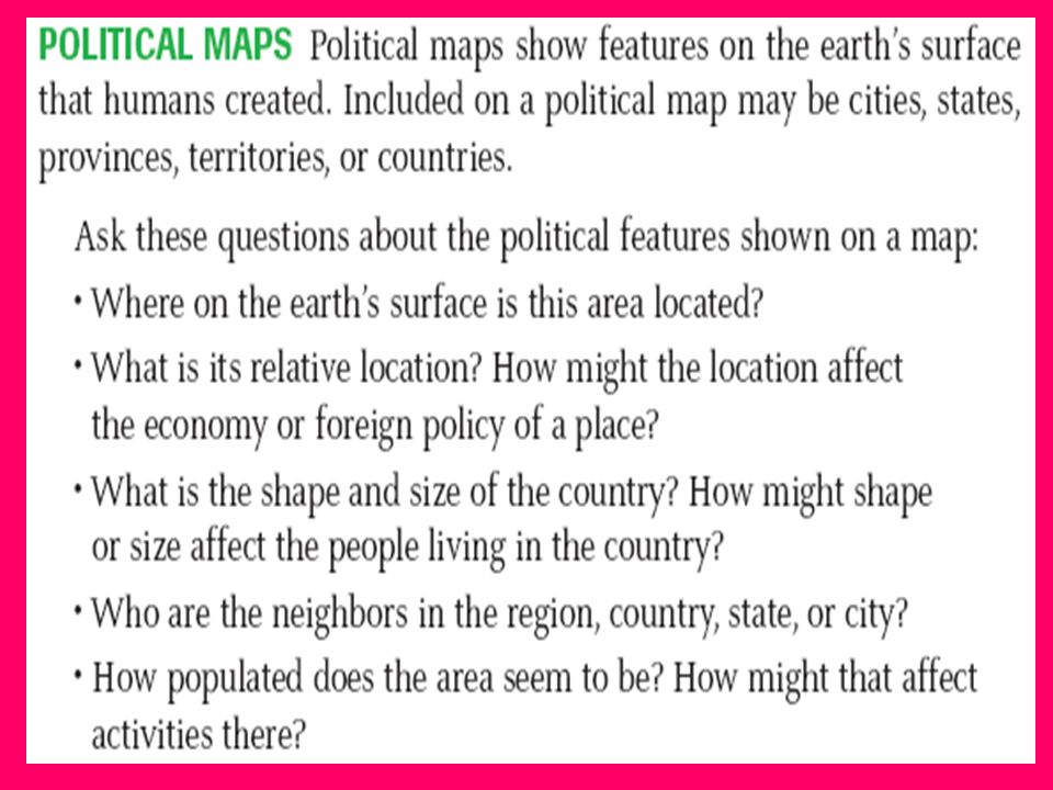
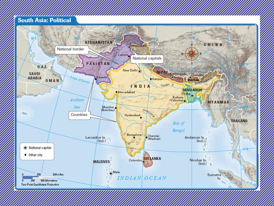
3 Types of Maps General reference: Show’s natural and man-made features on the earth. Thematic: Emphasize specific kinds of information; ex: climate or population density. Navigational: Sailors and pilots use this type to help find exact location.

22
Reading a Map What does all this stuff mean???

23
Map Key

24
Read and understand a map!!

25
Map Projections Planar Projection Conical Projection Cylindrical Projection

26
Planar Projections

27
Conical Projections

28
Cylindrical Projections

29
More Cylindrical Projections

30
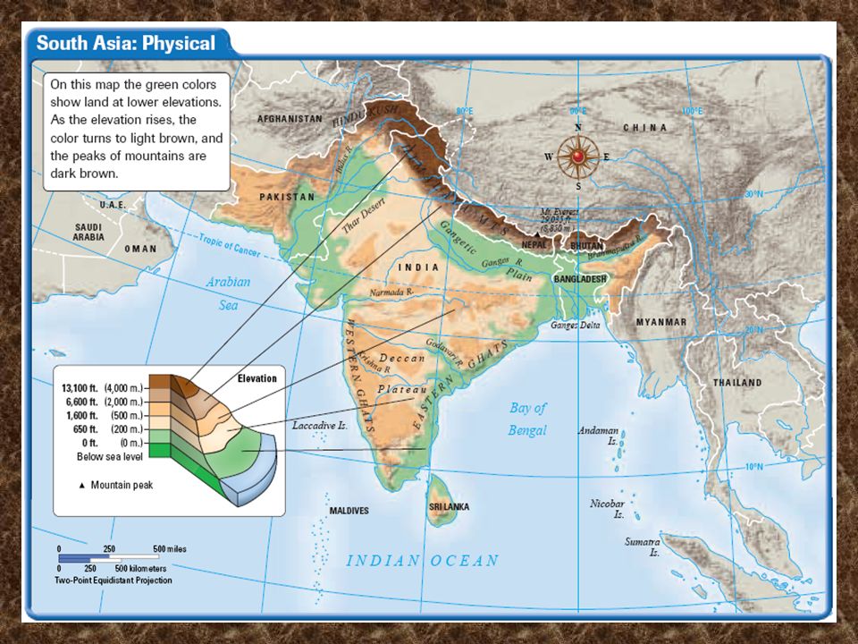
Using Different Types of Maps (Pg 20-23)
")
34
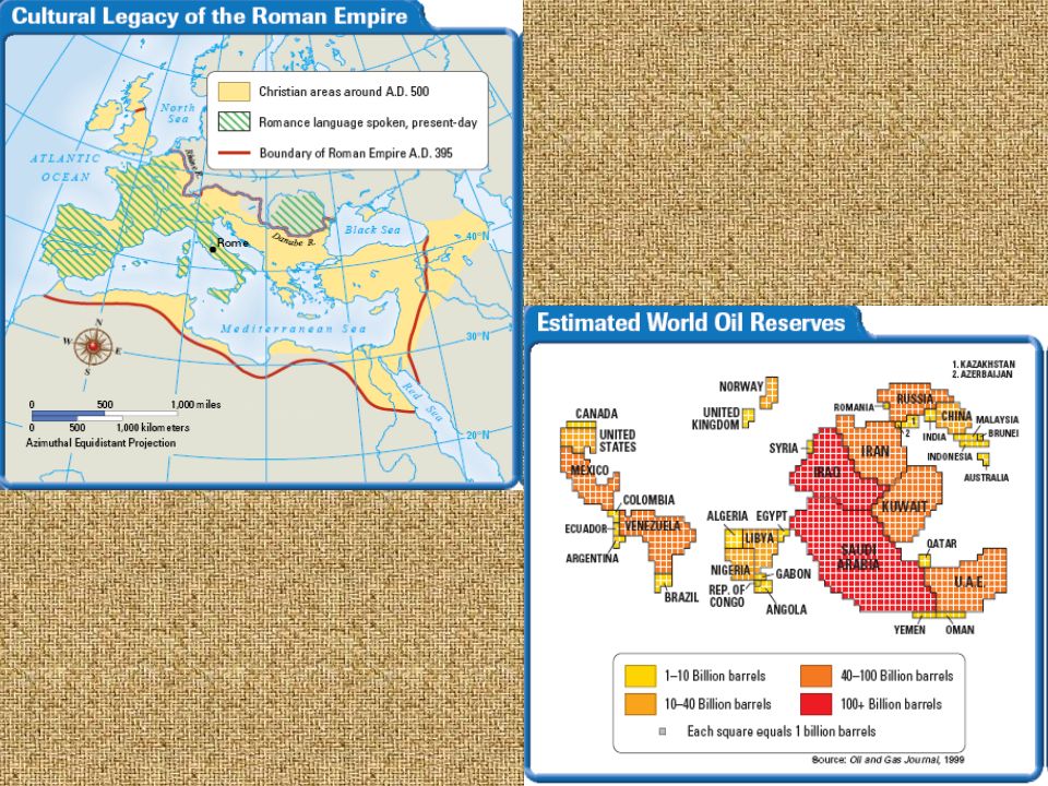
Thematic Maps

36
Flow Line Maps

37
Map Practice

Similar presentations