Download presentation
Presentation is loading. Please wait.

1
Presented at West Virginia GIS 2004: GIS In The Appalachians May 10, 2004 By Michael Anderson Spatial Information Technologies, Inc. Presentation available at: http://www.spatialit.com/wvgis2004 Contact: mike@spatialit.com MapConnector™ Integrating GIS with your Application

2
MapConnector™ What is it? MapConnector™ is software that connects applications to GIS software. Why use it? Incorporate the capability of any GIS software into any application, including existing ones that would benefit from GIS capabilities. These applications can be built using commercial desktop GIS, web browsers, and common desktop software like Word, Access, Excel, etc. Provide GIS capabilities to users with no GIS training. Provide flexible, inexpensive access to expensive resources

3
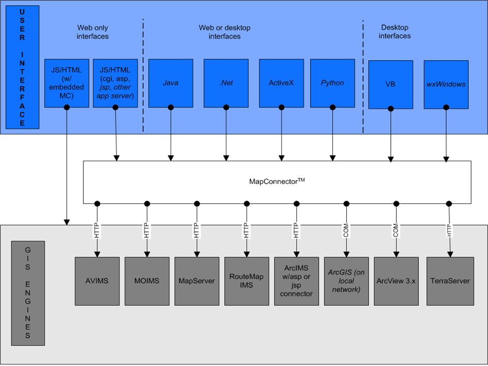
Where MapConnector™ Fits in the Application

6
Custom Service - Report Writer ArcView 3.x Report Generator GIS Engine ArcGis 8.x MapConnector ™ AccessWord Pdf GeneratorWord Database Browser Asp page

Similar presentations


 Zeng January 19, 2011.>")


