Download presentation
Presentation is loading. Please wait.

1
Map Projections

2
Globes and Maps A globe is a scale model of the Earth that presents the most accurate depiction of geographic information such as area, distance, and direction. A printed map is a symbolic representation of all or part of the planet.

3
A globe that has been put onto a piece of paper is called a map projection. Projections This is will always have some distortions A distortion is a change in the size, shape, or distance on a map. (Please add distance to your paper)
.")
4
Common Map Projections The Mercator projection increasingly distorts size and distance as it moves away from the Equator. However, Mercator projections do accurately show true directions and the shapes of landmasses, making these maps useful for sea travel.

5
Projections (cont.) Conic Projection A conic projection comes from placing a cone over part of a globe. Conic projections are best suited for showing limited east-west areas that are not too far from the Equator. For these uses, a conic projection can indicate distances and directions fairly accurately.

6
Common Map Projections (cont.) An interrupted projection resembles a globe that has been cut apart and laid flat. Goode’s Interrupted Equal-Area projection shows the true size and shape of Earth’s landmasses, but distances are generally distorted.

7
The Equal Area Projection shows accurate sizes and distance for land areas, but the land shapes are distorted. Especially near the edges. Equal Area Projection Common Map Projections (cont.)
.")
8
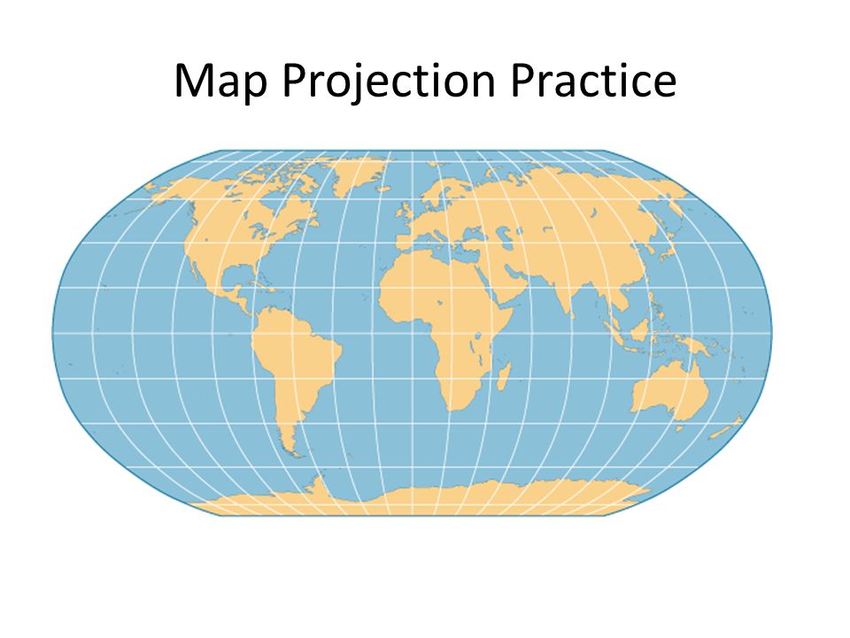
Section 1 Common Map Projections (cont.) The Robinson projection has minor distortions. The sizes and shapes near the eastern and western edges of the map are accurate, and outlines of the continents appear much as they do on the globe. However, the polar areas are flattened.

9
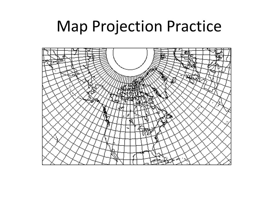
Map Projection Practice

13
Test and Binder Check Test over Geography Skills is Next TUESDAY SEPTEMBER 20 th. We will review Friday and also discuss your 9/11 papers. However, those are due on Thursday. Binder Check – On the next slide will be a list of all the items you need for this class. Remember to ask me for anything missing or grab from the wikipage at: www.mrmazonwikipage.wikispaces.com www.mrmazonwikipage.wikispaces.com cmazon@cdeducation.org

14
Binder Check Items

Similar presentations


>")


