Download presentation
Presentation is loading. Please wait.

1
Map Elements Write On

2
Earth Earth is shaped like a sphere. A Globe is a model of the Earth.
A map projection is a flattened globe. It is not completely accurate. It is distorted. An atlas is a book of maps.

3
Latitude and Longitude
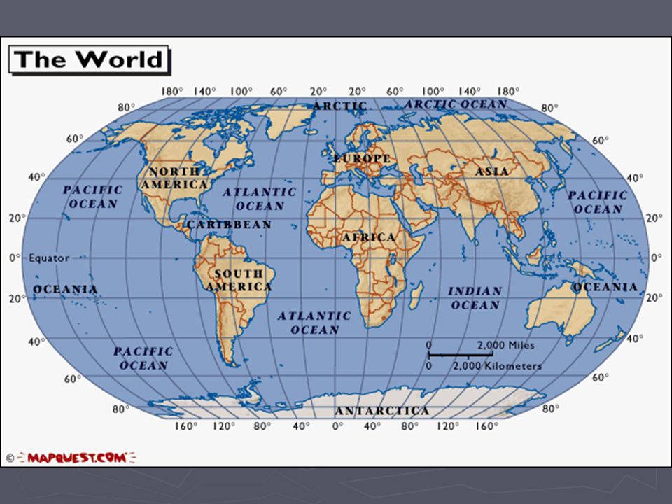
The earth is divided into lots of lines called latitude and longitude.

4
Lines Longitude lines (also called meridians) run north and south.
Latitude lines (also called parallels) run east and west. The lines measure distances in degrees. Latitude Longitude
 run east and west. The lines measure distances in degrees. Latitude. Longitude.")
5
Where is 0 degree? Equator The equator is 0 degrees latitude.
It is an imaginary belt that runs halfway point between the North Pole and the South Pole. Equator

6
Where is 0 degrees? P R I M E D A N The prime meridian is 0 degrees longitude. This imaginary line runs through the United Kingdom, France, Spain, western Africa, and Antarctica.

8
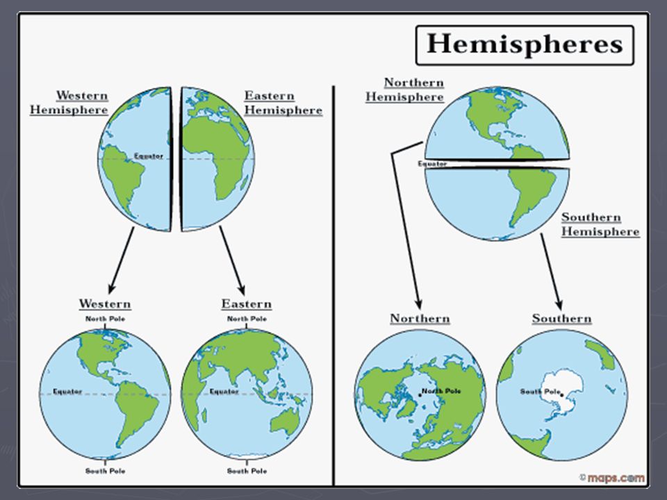
Hemispheres By using the equator and prime meridian, we can divide the world into four hemispheres, north, south, east, and west.

10
Compass Rose A compass is a tool that helps the user know what direction one is headed. On a map, a compass rose helps the user locate these directions.

11
Directions The cardinal directions are north, south, east, and west.

12
Scale Maps are made to scale; that is, there is a direct ratio between a unit of measurement on the map and the actual distance. For example, each inch on the map represents one mile on Earth. So, a map of a town would show a mile-long strip of fast food places and auto dealerships in one inch.

13
Scale

14
Time Zones The Earth is divided into 24 time zones, corresponding to 24 hours in a day. As the earth rotates, the sun shines in different areas, moving from east to west during the course of a day. Places that have the same longitude will be in the same time zone.

16
Map Legends The legend is the key to unlocking the secrets of a map. Objects or colors in the legend represent something on the map. Religions Legend

17
Can you understand this legend?

18
Age Expectancy Legend

19
New Vocabulary Terms continents, latitude, longitude, prime meridian, compass rose, equator, hemisphere, scale, legend, time zone, map projection, globe, atlas, parallels, meridians

20
Legend Reading Activities
What You Can Learn From A Map What do Maps Show Activity Road Map Road Map Legend Road Map of Salt Lake City Region Map Worksheet

21
Sites to visit Look up Latitude and Longitude for US Cities
Maps and Map Skills Degrees, Latitude, & Longitude Worksheet Latitude and Longitude Map (lesson plan) Scale Time Zones Anchors Aweigh (a map adventure) Map Quiz Make Your Own Map Topography Maps U. S. Map Collection GeoSpy Game Globe Projector GeoGame
 Scale. Time Zones. Anchors Aweigh (a map adventure) Map Quiz. Make Your Own Map. Topography Maps. U. S. Map Collection. GeoSpy Game. Globe Projector. GeoGame.")
22
Additional Sources Atlas - World (Holt, Rinehart and Winston)
Outline Map of US Map Packet Download Maps.com National Geographic Xpeditions Maps & Globes

23
Latitude and Longitude Resources
Latitude & Longitude Activity A Printable Latitude & Longitude Map of the World Latitude & Longitude Map Making Latitude and Longitude Quiz

Similar presentations