Download presentation
Presentation is loading. Please wait.

1
9-4-15 Answer on an index card. State which region these images would be part of and cite textual evidence to support your answer. State which region these images would be part of and cite textual evidence to support your answer.

2
Section 3 Louisiana’s Natural Regions

3
General ► Studying of physical geography includes: Identifying, classifying, and analyzing (1) ► Natural regions are defined and classified by: Relief, soil, vegetation, and climate (2)
 ► Natural regions are defined and classified by: Relief, soil, vegetation, and climate (2)")
4
http://www.turbosquid.com/FullPreview/Index.cfm/ID/544144

7
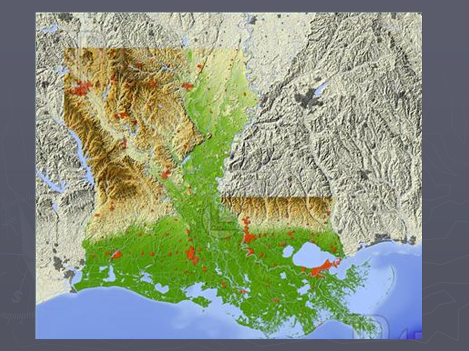
► Louisiana is a part of the Gulf Coast Plain

8
► LA’s elevation ranges from 4 feet below sea level (New Orleans) to 535 feet above (Mt. Driskill) (5/6)
 (5/6).")
9
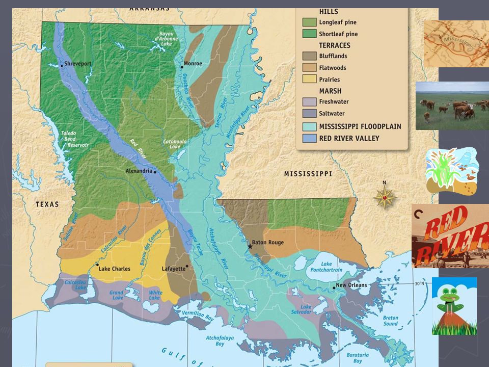
General ► Samuel Lockett – mapped LA’s elevation and relief (7) ► 5 major natural regions: Mississippi Floodplain, the Terraces, the Marshes, the Red River Valley, the Hills (8)
 ► 5 major natural regions: Mississippi Floodplain, the Terraces, the Marshes, the Red River Valley, the Hills (8)")
10
Mississippi Floodplain Region ► Floodplain – level land along a river likely to flood (9) ► Soil is alluvial, deposited by the river (very fertile) (10) ► Has 3 parts: Natural Levee, Swamp, Passes (11)
 ► Soil is alluvial, deposited by the river (very fertile) (10) ► Has 3 parts: Natural Levee, Swamp, Passes (11)")
11
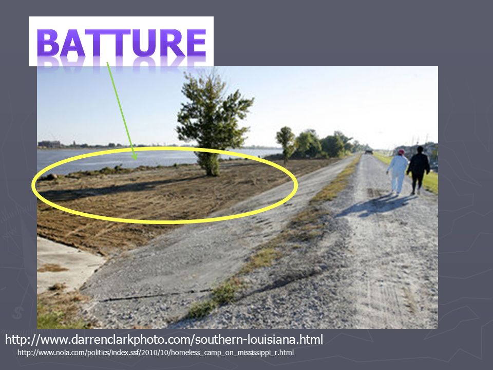
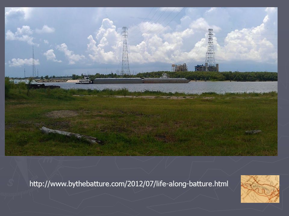
The Natural Levee ► Natural riverbanks built over time by silt deposited from flooding (usually 3 to 6 feet) ► Manmade levees were built to keep the river within its’ banks (12) ► Batture – slope between top of the levee and the river Batture
 ► Manmade levees were built to keep the river within its’ banks (12) ► Batture – slope between top of the levee and the river Batture")
13
The Swamp ► Seasonally flooded forest (14)
")
14
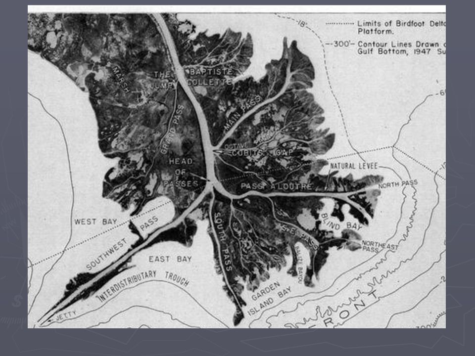
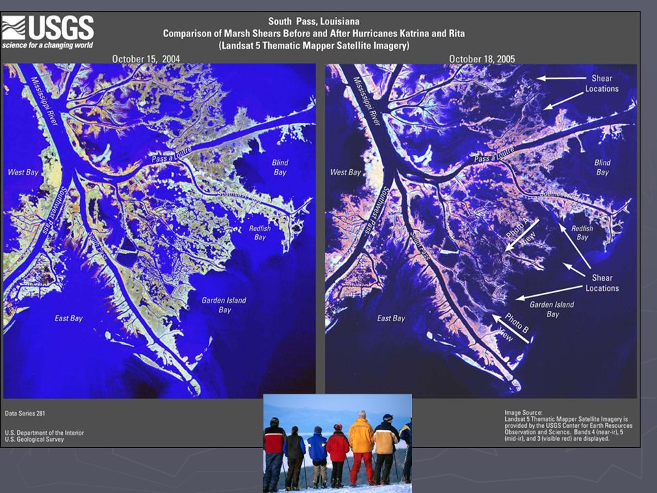
The Passes ► Routes the MS River takes to merge with the Gulf of Mexico ► Called a delta because the triangle shape of the mouth of the river looks like the Greek letter Delta (16) ► At the estuary the water changes from fresh to salt ► Vegetation: mostly marsh grasses (17)
 ► At the estuary the water changes from fresh to salt ► Vegetation: mostly marsh grasses (17)")
15
Terraces Region ► Contains the old Mississippi floodplains ► 3 parts: Blufflands, Prairies, Flatwoods(18) The Blufflands ► These are the old natural levees ► Loess soil – wind-deposited soil, built up the old levees (19)
 The Blufflands ► These are the old natural levees ► Loess soil – wind-deposited soil, built up the old levees (19)")
16
Loess cliff on edge of former gravel pit, Sicily Island Hills, Catahoula Parish, Louisiana. Estimated height of cliff is approximately 45 feet high. (Photograph courtesy of Mr. Richard P. McCulloh)
.")
17
The Prairies ► Old river channels ► Flat The Flatwoods ► Prairies covered with forests ► Called the “piney woods”: covered with mixed pine and hardwood forests (25)
")
18
Marsh Region ► Marsh – wet, treeless prairie covered with water and grasses ► Difference between marsh and swamp: Marsh along the coast and no trees, swamps have trees (27)
")
19
Marsh Region ► Migratory birds return annually to feed on the bounty of the marsh (31) ► A transition zone between the land and the ocean (32)
 ► A transition zone between the land and the ocean (32)")
20
Salt Domes ► found in the salt marsh ► Main domes called the Five Islands and are found between New Iberia and Morgan City: Avery Island (Tabasco) (34) Weeks Island (emergency reserve supply of petroleum) Jefferson Island (site of major accident)
 (34) Weeks Island (emergency reserve supply of petroleum) Jefferson Island (site of major accident)")
21
Red River Valley Region ► Borders the Red River as it flows from the NW corner to Central LA ► Elevation and relief are low compared to the surrounding region ► Fertile red soil {from Oklahoma and Texas} (36) ► Vegetation includes trees that can survive flooding (37)
 ► Vegetation includes trees that can survive flooding (37)")
22
Hills Region ► It is the highest region with the toughest terrain (39) ► Soil is old and NOT fertile (usually red) (42) ► Some parts have forests of JUST longleaf pine (43)
 ► Soil is old and NOT fertile (usually red) (42) ► Some parts have forests of JUST longleaf pine (43)")
24
http://www.darrenclarkphoto.com/southern-louisiana.html http://www.nola.com/politics/index.ssf/2010/10/homeless_camp_on_mississippi_r.html
26
http://www.bythebatture.com/2012/07/life-along-batture.html
29
Jeff Roberson, Associated Press A farm is surrounded by Mississippi River floodwaters near New Madrid, Mo., after the Army Corps of Engineers intentionally broke a clay levee holding back the rising river.

30
http://www.tulane.edu/~bfleury/envirobio/enviroweb/FloodControl.htm
Similar presentations